Country:
 City:
City:


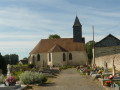
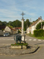
The route starts at the car park on Rue du Prieuré in Bréval.
(S/E) Head right towards the end of the cul-de-sac and take the path that continues northwards. At a Fork in the road, continue right along a path. At the end, carry on along Rue de la Bourdonnière.
(1) Take Chemin de la Guidonnerie on the left. Ignore the side paths to reach the D114.
(2) Cross the road carefully, first turning right then left for a few metres.
(3) At the crossroads of footpaths, turn left. Carry on straight ahead to Saint-Illiers-le-Bois, ignoring any side paths.
(4) Take Rue Coger and cross Place des Tilleuls. Then turn right onto Rue d’En Bas. At the junction, turn left along the street towards the church.
(5) Turn left to cross the cemetery and walk past the foot of the church. Exit to the right through a small gate and continue along Chemin de l’Église. You’ll come out onto Rue Gaillard; follow it to the left.
(6) At a bend, take the Sente des Écoliers opposite, which runs alongside the school. At Rue Dauphine, turn right and then immediately left into Rue du Vieux Puits. Then take thefirst right, Rue de la Mairie. Cross the D114 with care and continue along Rue des Graviers for about 400 m.
(7) Take thefirst path on the right towards a wood. Walk alongside the wood on your right-hand side until you reach a road (marked D58 on the right, in the Eure department, and D11 on the left, in the Yvelines department).
(8) Cross the road carefully and continue straight ahead into the woods. At each junction, go straight on (south-west).
(9) You’ll come out onto the D301.6; follow it to the left until you reach the hamlet of La Bâte.
(10) Turn left into Rue de l’Enclos. You’ll cross Rue du Vieux Puits on your right.
(11) At the triangular junction, turn left onto Rue du Pavillon. Walk alongside the woodland and then enter it. Continue straight ahead (north) until you reach the D58 (D11). N.B. Towards the end of this section, the path does not appear on the map but it does exist and is passable.
(8) Cross the road again with care. On the other side, take the path on the right (north-east), walk alongside a woodland on your right and continue between the fields.
(12) After carefully crossing a small road, take theGRP® path opposite. Turn right along the path and you’ll come to a Fork in the road (signpost with yellow and red markings).
(13) Continue to the left along the GRP®. At the next junction, turn right to quickly reach the car park. (S/E).



 Visorando Member


 Easy
Easy