Marmande Castle, starting from Mondion

A short walk through fields and woods to reach a medieval castle, currently undergoing restoration, situated on a hilltop.

Details

1331971
Creation:
Last update:
Last review:
  • Walking
    Activity: Walking
  • ↔
    Distance: 5.30 mi
  • ◔
    Average duration: 2h 40 
  • ▲
    Difficulty: Moderate

  • ⚐
    Back to start: Yes
  • ↗
    Ascent: + 262 ft
  • ↘
    Descent: - 279 ft

  • ▲
    Highest point: 410 ft
  • ▼
    Lowest point: 269 ft
  • ⚐ Country: France
  • ⚐ City: Mondion (86230)
  • ⚑
    Start/End: N 46.938239° / E 0.485621°
  • ❏
    IGN map(s): Ref. 1825SB
  • Hour-by-hour weather

Photos

Description of the walk

Start from the large car park at the Mondion village hall, situated behind the town hall on Rue du Frêne.

No signposting

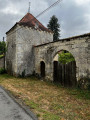
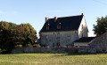
(S/E) Leave the car park, keeping the war memorial on your left, and note the beautiful church opposite. Follow Rue du Frêne to the left, passing the town hall on your left. At the Fork in the road, take the left-hand road towards La Jofrinerie and head downhill (note the beautiful square turret on the right-hand side).

(1) At the ‘give way’ sign, carry on straight ahead along the road. After a left-hand bend, cross a stream and head uphill.

(2) At the top, at thefirst junction, turn left towards La Barre. After about 200m, before a right-hand bend in the road, turn right onto a wide grassy track. Head slightly downhill and then uphill towards a wood. Cross the wood briefly, then follow the edge of the meadows.

(3) At the junction (with a clearing opposite), turn right. Immediately ignore a faint path on the left and walk along the edge of the woodland on your left and the meadow on your right. Then enter the woodland, go straight on and cross a path running perpendicular to the track.

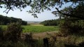
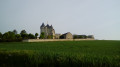
(4) On leaving the woodland, continue straight on, first along the edge and then between the fields (note the castle tower in the distance on the right). Cross a small road and carry on straight ahead along an even narrower road towards La Filletière.

(5) At the junction just after a house on the right-hand side, turn right onto a wide path that starts with a fence on the right. Walk between the fields (view of the tower).

(6) After a bend to the right, pass a signpost bearing a Green Cross for walkers coming in the opposite direction and continue straight on along a wide gravel track. Immediately ignore a grassy path on the left and pass a second signpost bearing a Green Cross in the direction of travel.

Red and yellow markings

(7) At the next junction, turn right onto a grassy path towards the castle. You’ll come out onto a small tarmac road at the foot of the keep.

(8) Continue straight on, pass a hairpin bend and go down a steep path at the foot of the castle (path not shown on the map). Pass a second hairpin bend and arrive at a crossroads (hiking map on the left).

No signposting

(9) Continue straight ahead, between the signposted route to Vellèches on the left and that to Marigny-Marmande on the right (corner house at No. 17). After a large house on the right, carry on westwards along a wide gravel path which soon becomes grassy amongst the fields. At the end, follow a small road to the left.

(2) At the junction, carry on straight ahead along the road.

(1) At the next junction, carry on straight ahead and head uphill. At the top, turn right and you’ll find the village hall car park on your right (S/E).

Waypoints

  1. S/E : mi 0 - alt. 367 ft - Car park at the village hall - Église Saint-Martin (Mondion)
  2. 1 : mi 0.29 - alt. 312 ft - Junction
  3. 2 : mi 0.77 - alt. 302 ft - Crossroads at the end of the circular loop
  4. 3 : mi 1.46 - alt. 400 ft - Croix Billon
  5. 4 : mi 1.94 - alt. 394 ft - Carroi du Chêne Tourne-Porte
  6. 5 : mi 2.42 - alt. 364 ft - La Filletière
  7. 6 : mi 2.83 - alt. 397 ft - Junction
  8. 7 : mi 3.18 - alt. 305 ft - Crossroads
  9. 8 : mi 3.56 - alt. 384 ft - Château de Marmande
  10. 9 : mi 3.67 - alt. 282 ft - Marmande
  11. S/E : mi 5.3 - alt. 371 ft - Car park at the village hall - Église Saint-Martin (Mondion)

Notes

Good trainers or low-cut walking boots are sufficient for this route, which follows quiet country lanes and well-maintained paths.

No water sources were spotted along the route. There are no shops, either in Mondion or in Marmande.

A detailed map is required (at the very least, the one accompanying this description).

Alternative route:
At the château (8), if you wish to avoid the steep path, follow the small road leading down to the left. At the junction (elevation 74), turn right. Ignore a road on the left and you will reach the hamlet of Marmande (9).

Walk completed by the author on1 August 2018.

Worth a visit

- Saint-Martin’s Church (12th century) in Mondion (S/E).
- A few beautiful houses along the way.
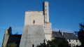
- Marmande Castle (11th–14th centuries) (8). Its keep and the tall watchtower rising above it are visible from afar.

Off the route: Mondion Castle (18th century), near the starting point.

Reviews and comments

4 / 5
Based on 4 reviews

Reliability of the description
4.5 / 5
Ease of following the route
3.8 / 5
Route interest
3.8 / 5
AYRAULT DANIELLE
AYRAULT DANIELLE

Overall rating : 3.3 / 5

Date of your route : May 30, 2025
Reliability of the description : ★★★★☆ Good
Ease of following the route : ★★★☆☆ Average
Route interest : ★★★☆☆ Average
Very busy route : No

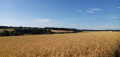
This walk is not to be undertaken in very hot weather, as there is little shade and this Saturday it was 33 degrees!!! At point 8, you arrive at the foot of the keep on the left, then take the next road on the right and you reach the foot of the castle in MARMANDRE; continuing along the route does indeed add another kilometre… The countryside is interesting, with fields of black mustard and flax, which is unusual in our region.

Machine-translated

randonneur de Châtellerault

Overall rating : 4 / 5

Date of your route : Aug 15, 2022
Reliability of the description : ★★★★★ Very good
Ease of following the route : ★★★☆☆ Average
Route interest : ★★★★☆ Good
Very busy route : No

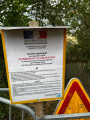
It is no longer possible to take the steep path described at waypoint no. 8. The route is closed off by a barrier and a municipal notice prohibiting access under penalty of prosecution. Consequently, you must take the alternative route already mentioned in the description, which adds more than a kilometre to the walk (the route was measured at 9.9 km by Visorando on my phone).

Machine-translated

communeau
communeau
• Edited:

Overall rating : 4.3 / 5

Date of your route : Oct 17, 2021
Reliability of the description : ★★★★☆ Good
Ease of following the route : ★★★★☆ Good
Route interest : ★★★★★ Very good
Very busy route : No

A very pleasant walk
Suitable for everyone
Stunning views

Machine-translated

Marie-France-Falaise

Overall rating : 4.3 / 5

Date of your route : Feb 28, 2021
Reliability of the description : ★★★★★ Very good
Ease of following the route : ★★★★★ Very good
Route interest : ★★★☆☆ Average
Very busy route : No

Thanks to the small village of Mondion. It provides toilets and a place to have a picnic.
The section near the Marnande tower is a bit tricky due to roadworks.

Machine-translated

Other walks in the area

For more walks, use our search engine .

The GPS track and description are the property of this route's author. Please do not copy them without permission.