


 Country:
 City:
City:


Start from the square, opposite the church. Follow the yellow signposts.
(S/E) Opposite the walking sign, turn right into Rue des Chênes, then right again into Rue du Levant, towards Dangé-Saint-Romain. Keep well to the right-hand side and take care as the verges are quite narrow. Pass two streets on your right and leave Vellèches.
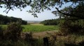
(1) After the ‘Vellèches’ sign on the right, take the tarmac path, which then becomes stony. Head towards the fields, which offer a sweeping view. Pass a path on the right (not shown on the IGN map) then turn naturally right until you reach the D76.
(2) Cross the D76. Head down a path lined with copses and continue to the houses at Le Riveau. Turn right and cross a bridge. Just after the bend, head up to the left along a gravel path through the fields. At the top, there’s a beautiful, unobstructed view, particularly of the Marmande Tower (which can be seen from various points along the route).
(3) At the end of the path, with the village on your right, turn sharply left towards the fields. At the next three-way junction, keep left. Enter the Bois des Rabiaults and ignore the paths on the right until you reach the road. Cross it in the middle of the woods to take the wider path under the pine trees.
(4) At the small junction, carry on straight ahead and turn naturally to the right. Continue straight ahead along the grassy path. You’ll cross Mondion route 33 until you reach the next junction.
(5) Take thesecond right. At the next three-way junction, turn right then carry on straight ahead.
(6) Before you reach the road, turn sharply right towards some vineyards before entering the woods again until you reach a road. Turn left onto this road until you join the D22.
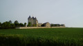
(7) Cross it carefully and stay on the road opposite until you reach the charming village of Marmande.
(7) At the foot of the tower (access via the private entrance), turn left then right. Walk past a farm.
(8) At the last house, just before leaving the village, head up to the right along the sloping road.
Ignore the path on the right leading to the tower. Take a stony path and head up onto the plateau with its panoramic views. At the end, at the Carrefour de Marmande, turn right then left. Walk towards the woodland, which consists mainly of hornbeams.
(9) At the Pasquiers crossroads, turn right then left at the next junction. As you leave the woodland, turn right. Carry on and ignore the path coming from the right. Continue to the hamlet known as Les Hautes Fontaines.
(10) Carry on to the hamlet known as Les Basses Loges and, at the corner of the house (cross), turn left to look out over the village of Vellèches. Try to spot the dolmen situated in the woods above the meadow.
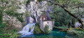
At the next crossroads, head down to the right. Cross a small bridge over the Ruisseau des Trois Moulins and head towards the church to return to the starting point (S/E).

 Tourist office
 Visorando Member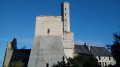
 Easy
Easy 
