The Bois de Saint-Gilles

A short, predominantly woodland walk, peaceful and in cool shade.

(Warning) Do not undertake this walk until further notice. A path closure was reported in August 2020.

Details

739486
Creation:
Last update:
Last review:
  • Walking
    Activity: Walking
  • ↔
    Distance: 5.19 mi
  • ◔
    Average duration: 2h 25 
  • ▲
    Difficulty: Easy

  • ⚐
    Back to start: Yes
  • ↗
    Ascent: + 30 ft
  • ↘
    Descent: - 30 ft

  • ▲
    Highest point: 436 ft
  • ▼
    Lowest point: 394 ft
  • ⚐ Country: France
  • ⚐ City: Braslou (37120)
  • ⚑
    Start/End: N 46.981703° / E 0.439015°
  • ❏
    IGN map(s): Ref. 1824SB, 1825SB
  • Hour-by-hour weather

Photos

Description of the walk

The walk starts at Carroi des Sept Chemins, accessible via a track between the village of Razines to the west and the D20 or D107 roads to the east.

(S/E) From the crossroads, take a well-marked path leading off under the pine trees to the north-east (the third on the left when facing the gate blocking one of the ‘seven paths’).

(1) At the first junction, turn sharply left and follow rural track (CR) no. 33, lined with ferns. Walk alongside a fence on your right and note a few narrow views of a pond beyond it. At the T-junction, turn left and you’ll soon return to the Carroi des Sept Chemins.

(S/E) Then follow the track suitable for vehicles (first on the right) westwards. You’ll come to a junction with a path marked ‘No Through Road’, which leads left to the hamlet of La Couarde.

(2) You will then see two grassy paths separated by a stream, both heading off to the right: cross the stream and take the second path. This quickly veers to the left and then runs along the right-hand side of a meadow enclosed by a hedge. At the junction with a path coming from the left, veer to the right and continue through the woods.

(3) At the next junction, carry on straight ahead (north-west), alternating between meadows and the edge of the woodland. After three rows of vines on the right-hand side, the dirt track gives way to a gravel path.

(4) At the junction at the corner of a meadow on the left (houses on the right), turn sharply left and follow a wide gravel track along the edge of the woodland on your right. Enter the woodland and ignore a path branching off to the right.

(5) At the fork in the road, leave the track and turn right onto a path. At the next junction, continue straight on. On the right, a recently cleared area in the woods offers a view of the village of Braslou. Ignore a path branching off to the right and you will immediately come to a small tarmac road.

(6) Follow the road to the right. After about a hundred metres, at a junction, take the road on the left and follow it for about 150 metres.

(7) Then take the grassy path on the left (east). After a short stretch along the edge of the woodland, enter the woods. Pass a grassy track on the right and come to a junction with a path on the left.

(8) Continue straight ahead (east-south-east), alternating between sections along the left-hand edge of the field and through the woods, and ignore all side paths. You’ll reach a crossroads at the foot of an electricity pylon.

(9) Turn left here and follow the grassy path that runs between two fields, parallel to the power line. Walk alongside a fenced woodland on your right until you reach the Carroi des Sept Chemins (S/E).


Waypoints

  1. S/E : mi 0 - alt. 423 ft - Carroi des Sept Chemins
  2. 1 : mi 0.44 - alt. 400 ft - Crossroads – CR33
  3. 2 : mi 1.14 - alt. 397 ft - Chemin de la Couarde
  4. 3 : mi 1.67 - alt. 430 ft - Crossroads
  5. 4 : mi 2.15 - alt. 417 ft - Le Millery
  6. 5 : mi 2.55 - alt. 423 ft - Fork
  7. 6 : mi 3.2 - alt. 430 ft - Tarmac road
  8. 7 : mi 3.33 - alt. 430 ft - Start of the trail
  9. 8 : mi 3.95 - alt. 427 ft - Junction with a path on the left
  10. 9 : mi 4.55 - alt. 417 ft - Crossroads – Power line
  11. S/E : mi 5.19 - alt. 423 ft - Carroi des Sept Chemins

Notes

Good trainers or low-cut walking boots are suitable for this short walk, which follows paths in very good condition.

No water sources were spotted along the route. There are no shops in the immediate vicinity. There is a picnic table at Carroi des Sept Chemins (S/E).

The route is not signposted. A detailed map is essential (at the very least, the one accompanying this description).

Alternatives:
This woodland route is not long, but it is still possible to shorten it:
- By skipping the initial circular loop which passes through (1). From the crossroads (S/E), head west and follow the track suitable for vehicles (the second right when facing the gate). This shortens the route by about 1.5 km.
- By staying on the gravel track at the Fork in the road (5). Further on, cross the track suitable for vehicles, continue south and rejoin the route at the junction (8). This shortens the route by approximately 1.25 km.

Hike completed by the author on 19 August 2017.

Worth a visit

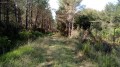
- Lovely pine woods, with undergrowth of heather or ferns.
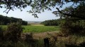
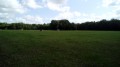
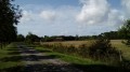
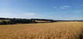
- The route alternates between woodland and fields or meadows.
- In season, blackberry lovers will find a few inviting bushes.

Reviews and comments

4 / 5
Based on 4 reviews

Reliability of the description
4.3 / 5
Ease of following the route
4 / 5
Route interest
3.8 / 5
Divehoggy
Divehoggy

Overall rating : 4.7 / 5

Date of your route : Nov 11, 2021
Reliability of the description : ★★★★★ Very good
Ease of following the route : ★★★★★ Very good
Route interest : ★★★★☆ Good
Very busy route : Yes

What about the section of the forest that’s closed off? I didn’t have any problems: I did the whole walk and got through just fine. An easy walk, no elevation gain, lovely in the woods. However, as I did it on 11 November (a public holiday), it was a bit busy: three motocross bikes, a quad bike and, above all, hunters. So the whole start wasn’t very pleasant and was quite noisy. I suppose I was just unlucky.

Machine-translated

Netra
Netra ★

Hello rzboy, and thank you for your feedback.

I’m sorry to hear about your misadventures. I did that walk three years ago and didn’t have any problems, but I haven’t been back since.

Before I find an alternative route, I’ll post a warning.

Machine-translated

rzboy
rzboy

Overall rating : 1.7 / 5

Date of your route : Aug 16, 2020
Reliability of the description : ★★☆☆☆ Disappointing
Ease of following the route : ★☆☆☆☆ Very disappointing
Route interest : ★★☆☆☆ Disappointing
Very busy route : No

The description on Visorando is out of date, as part of the Bois de St Gilles has been fenced off. From point 2 onwards, it is impossible to enter the woods. As a result, the route has lost some of its appeal and needs to be revised.

Machine-translated

Fayerando
Fayerando

Overall rating : 5 / 5

Date of your route : Mar 03, 2019
Reliability of the description : ★★★★★ Very good
Ease of following the route : ★★★★★ Very good
Route interest : ★★★★★ Very good

A lovely circular walk with plenty of sections through the forest, so we were lucky enough to see some beautiful deer
(it’s worth noting that it wasn’t a hunting day, which is very unusual)

Machine-translated

Fayerando
Fayerando
• Edited:

We weren’t able to go on this walk – there was an organised hunt taking place there that day!!!

Machine-translated

Sophie bm
Sophie bm

Overall rating : 4.7 / 5

Date of your route : Sep 23, 2017
Reliability of the description : ★★★★★ Very good
Ease of following the route : ★★★★★ Very good
Route interest : ★★★★☆ Good

The route is explained very clearly. You can’t get lost.

Machine-translated

Other walks in the area

For more walks, use our search engine .

The GPS track and description are the property of this route's author. Please do not copy them without permission.