Country:
 City:
City:


Park in the large car park at Collège Maurice Bedel, near the aquatic centre.
Yellow markings (sparse, on one side only in the direction of the description)
(S/E) With your back to the school entrance, head to the right. Just past a sign for the “Aquatic Centre”, turn left onto a shaded path (zigzag). Cross a small road and continue straight ahead along a compacted track, keeping a fence on your left. Cross a small bridge over a stream, walk alongside a lawn on your right and cross another small bridge. Then continue straight on with the Battreau lake on your right.
(1) When you reach a wooden hut, turn right and continue to follow the lake. Pass the finish sign for a fitness trail and follow a compacted track lined with fitness equipment. After fitness station no. 9, temporarily ignore the signposting by not taking the arrow that directs you to a small bridge on the left. Carry on straight ahead along the fitness trail, keeping a small river (a branch of the Veude) on your left. Pass a chicane, come out onto a farm track and follow it to the right. Return to the signposting and cross a second branch of the Veude.
(2) When the track bends to the right, take a grassy path to the left between the fields (be careful – there are no arrows or markers here). At a fork in the road, keep left. You’ll come out onto a small road; follow it to the left. Pass the old La Nouatrie farmstead on your right, then walk through the hamlet of Avrigny. Cross the Veude again and arrive at a crossroads (statue of the Virgin Mary on the right).
(3) Cross the road and go straight on along a gravel track. At a three-way junction (with a fine tree on the right), turn left onto a grassy path. Cross a stream and continue along a shaded path with a fence on the left-hand side. At the end, follow a road to the right. After about 50 metres (sign saying ‘Réserve de chasse’), turn left onto a grassy path (the IGN map is not up to date here). Climb slightly between two fields. At the end, follow a road to the right for about 150 metres and pass a shed on the right-hand side.
(4) At thefirst junction, turn left towards La Croix. Follow a small road that winds and climbs gently. Ignore a path branching off to the left and reach the hamlet of La Croix.
(5) Pass a house and a shed on your left and continue along a gravel track. The track immediately turns left and is bordered on the right by the fence of the LGV Atlantique railway right-of-way situated below (you can’t see it, but you can hear the TGVs). After a left-hand bend, the track gives way to a grassy path which goes round a house on the left. Continue along a track until you reach a small road at the hamlet of Les Normands.
(6) Follow the road to the left. When the road bends to the right (caution: narrow stretch), carry on straight ahead along a grassy path. At the end, cross the D22 (caution: busy road) and continue opposite along a grassy path. Go straight on, between the fields, down and then up again until you reach a small road at the hamlet of L’Angelardière.
No signposting
(7) Follow the road to the right and head back down. Ignore the turn-off to the left for the hamlet of Les Vaux (as well as an old signpost) and head back up. At the junction, turn left. Head down a gentle slope and pass the hamlets of La Tour des Bies and then Les Bies. Ignore a small road on the right and immediately look out for the start of a path on the left, just before the entrance gate to a sort of small castle.
(8) Leave the road and take the path on the left. When you reach a gate, turn right, pass a house on your left and follow a small road. At the junction, take the path opposite, which starts between a house on the right and a fenced-in garden on the left. Then cross a small wood.
Yellow markings (sparse, on one side only in the direction of the description)
(9) At the junction just as you emerge from the woodland (small house on the left), go straight on along a gravel track. Stay on this main track, which is partly shaded. At the end, follow a small road to the right. Cross two branches of the Veude at the hamlet known as Le Moulin de l’Alcoitre. Then ignore the access path to the hamlet known as La Perlotière on the right.
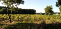
(10) Immediately afterwards, take a small road on the left. Walk through fields and meadows, noting a small vineyard on the left-hand side. At the end (with a dairy barn opposite on the right), follow a road to the left.
(11) When the road bends to the left, at the hamlet of Bel et Bat (incorrectly spelt on the 1:25,000 map), carry on straight ahead along a stony track and pass between two sheds. Then continue along a grassy path and go straight on (south) along the edge of the woodland on your right. When you reach a gate, turn right.
(12) At the T-junction, turn left onto a dirt track. Cross a road and continue straight ahead onto a grassy track. Cross another road and carry on straight ahead until you reach the secondary school car park (S/E).


 Visorando Member

 Tourist office
 Easy
Easy