


 Country:
 City:
City:


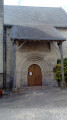
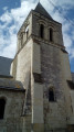

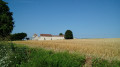
Start from the town hall in Saint-Christophe. Park in the small car park in front of the town hall (see map of the walk) or, if it is full, along the adjacent streets.
Green signposting
Signposting is sparse, consisting mainly of signposts at major junctions.
(S/R) With your back to the town hall, turn left onto Rue du Lavoir. Pass the war memorial and the old wash house on your right. At a Fork in the road, turn right.
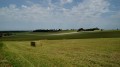
(1) After about thirty metres, turn left towards Les Planches. At the end of the tarmac road, continue along a good path. Wind your way through the fields, then climb gently towards a solitary tree. Pass this tree (marked with a signpost) and continue on roughly level ground.
(2) At the T-junction, head right towards a solitary walnut tree. You’ll come out onto a narrow lane; follow it to the left between the houses. At the end, follow the small road to the left, which climbs slightly. Ignore the first turn-off on the left towards La Tranchée.
(3) At thesecondleft-hand turn-off towards La Tranchée, leave the road and turn right onto a path between the fields (take care not to miss this turn-off; the marker post was lying on the ground in July 2018). At the next junction, continue straight ahead (north) along a grassy path (the cross on the marker post indicates the path running perpendicular to this one).
(4) At the T-junction, turn right and head slightly uphill. At the next junction, turn left towards a solitary walnut tree (there is neither an arrow nor a marker here).
(5) At the junction with a road, carry on straight ahead along a small tarmac road towards Les Cardinaux. When this road bends to the left (with a gate some distance ahead on the opposite side), turn right onto a path that descends between the fields.
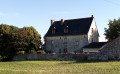
(6) At the junction at the hamlet of Les Duviviers, turn left onto a farm track running parallel to a power line. Cross the D74 and continue straight on towards Chougnes. Pass this hamlet (a fine building) and continue on the tarmac road. At a fork in the road, turn right and head downhill for about a hundred metres.
(7) At the junction, turn right onto a path that descends between the fields. At the bottom, cross a stream.
(8) Cross the D72 and head straight on towards La Rimonerie. The tarmac soon gives way to a gravel track. Walk alongside a woodland on your left and ignore a path branching off to the right.
(9) Just before a Fork in the road, take the first path on the left and enter the woodland. Further on, follow a wire fence on your right (the path is no longer shown on the map). At the corner of the fence (marker 75), turn right and continue to follow the fence on your right.
(10) At Liaunay (a few houses), follow a small road to the right. After about 150 metres, just as the road begins to curve to the right, leave the road and take the path on the left. Follow this wide path through the woodland, ignoring all the side paths.
(11) Return to the road and follow it to the left.
No signposting
At the recycling centre, carry on straight ahead along the road (ignore the green signposting heading off to the left).
Yellow signposting
(12) At the crossroads (waymark), turn left. Take thefirst road on the right, uphill towards Beauvais. Stay on the tarmac and pass through the hamlets of La Grande Bise and then La Petite Bise.
(13) A few dozen metres past the sign pointing left to the hamlet of Boué, turn right onto a path between the fields (no arrow or marker here). Head down a gentle slope. The field path gives way to a gravel track. Further on, rejoin the tarmac road and continue straight on to the village centre. Turn left and you’ll immediately reach the town hall car park (S/E).
 Visorando Member

 Easy
Easy 
 Tourist office
