Country:
 City:
City:


Park in the town hall car park.
(S/E) Head down to the right along Rue de la Mairie until you reach the crossroads.
(1) Turn left into Rue de l’Église, lined with old houses. Follow this street for about 600 m, ignoring the other route which climbs to the left towards Le Terrier, until you reach the junction with Rue de la Maltière (a beautiful building).
(2) Turn left and, after 250 m, at the end of the street, go straight on along a grassy path towards the countryside: there’s a pretty fountain and a viewpoint over the Vienne valley. Once at the end, turn left onto the road and continue to the three-way junction.
(3) Head slightly left under the trees towards Maligratte. Walk through this pretty hamlet, then after 250 m, turn left onto a sandy path with a lovely view.
(4) After 1 km, at the crossroads, head up to the right across open ground between the fields. Cross the road and carry on straight ahead.
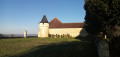
(5) At the Gibauts junction, keep left to reach the Barre farm. Walk past the farm (turn round for a panoramic view) and head straight up the path.
(6) Turn left onto the grassy lane to enter the woods. Walk through these peaceful woods, amongst a variety of tree species, until you reach the three-way junction.
(7) Turn right onto the wide lane and continue straight on until you reach the road (D76).
(8) Cross the D76 and continue straight on along the wide avenue (private lake on the left), ignoring the side paths, until you reach the road (D77).
(9) Turn left for about 200 m, then turn right before the farm onto a path lined with acacia trees. Walk alongside a field and enter a chestnut wood, following the path to the edge. Walk past the vineyards and head for the next junction.
(10) Turn left onto a pleasant wooded path and continue to the next junction, situated about 1,500 metres further on, in the middle of the fields.
(11) Turn right (panoramic view) then, after 250 m, turn left onto the path, which becomes a road at the entrance to the hamlet of Prédame. Walk through the hamlet.
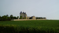
(12) At the Y-junction, turn left then immediately right onto a grassy track. You can cool off at the pond before climbing the stony hill (view of the village).
(13) At the top of the hill, amidst the vineyards, turn left towards the woods. Continue along this path, ignoring the tracks on the right, until you reach the village of Vaux-sur-Vienne via the Chemin de Pise Vieille. You’ll come out onto Rue de la Mairie, which you should follow to the left until you reach the junction from the outward journey.
(1) Carry straight on to return to the Town Hall car park (S/E).

 Tourist office
 Visorando Member