Country:

 City:


The start and finish point for this hike is at Breil-sur-Roya railway station.
(S/E) From the station, head left along the D6204 towards Tende for about 500 metres.
(1) Cross the D6204 and take the small road on the right towards the Aigara stadium and the “Castel du Roy” hotel. Walk down to the Roya and cross the bridge.
(2) Turn right, heading due south, and follow the track as it gradually moves away from the Roya.
(3) Take a small shortcut on the left which cuts across the bend in the track and rejoins it a little further up. Walk about thirty metres to the right (south).
(4) Leave the track and start the fairly steep, winding ascent on the left along the pine forest path, which leads onto theGR®52A.
(5) Turn left onto theGR®52A. Heading north, then east, reach marker 108.
(6) Leave the GR52Aon your left and continue straight on towards the east, through the shaded Zouayné valley. Cross the (dry) stream several times and arrive at a property.
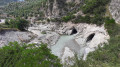
(7) Ignore the path on the left leading to the property; head south now, still through the woodland, and reach the Collet d’Aïné, which offers a magnificent view over the Roya. The Arpette is now clearly visible. Although it appears very close, there is still a climb of nearly 400 metres to tackle.
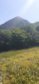
(8) Turn left to begin the ascent of L’Arpette. Make the most of the few copses to rest before tackling the final section, which is entirely exposed to the sun.
(9) At marker 109, near the Pas de l’Arpette, turn left onto the ridge path to the summit (antennae).
(10) After a break to take in the panoramic views over the Roya Valley, stretching as far as the peaks of the Mercantour (Grand Capelet, Mont Bégo, Cime du Diable, Mont Capelet inférieur, etc.), return to marker 109, which is the best spot for a lunch break (shaded copses).
(9) Back at marker 109, rejoin the path that follows the ridge and link up with a track coming from Italy.
(11) Leave this track on your left and continue to follow the ridge: the path is not always clearly visible, so do not descend onto the eastern slope, and certainly not onto the western slope. Keep heading towards the summit hump of the Tête d’Alpe.
(12) At the Tête d’Alpe, there is a magnificent view of the Arpette and also of the distance you have covered so far. Continue along the ridge, pass marker 438 and reach a junction.
(13) The path now leaves the ridge. Pass beneath the Cime de Crémo, begin the descent towards the Pas du Sausson and reach a junction.
(14) Turn left onto the small switchbacks and head for marker 437. If you’re feeling up to it and still have enough energy for the rest of the route, climb up to the Roche Fourquin (a magnificent promontory).
(15) Leave the path descending towards the border on your left and continue westwards to cross over onto the Roya side at the Roche du Tron. The hamlet of Libre is now visible, though 750 m below. Begin the long and arduous descent towards Libre, with marker 418 as your next destination.
(16) Turn right towards the north and lose a little more altitude to return to civilisation at the hamlet of Libre (marker 417)
(17) Turn right onto the D90 road, which leads out of the village for about 400 m. Pass the hamlet of Borgogni; in the bend on the right, you’ll find the start of the path known as the “Valléen”.
(18) Leave the road and follow this lovely path running alongside the Roya, which will cross a track at marker 106.
(19) Continue to the right. Follow the track to the hamlet of Rougna.
(20) At the bend, look out for a small path on the left which winds down in gentle switchbacks to the Carléva (a river renowned for canyoning). The descent continues to the bridge.
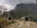
(21) Passing a small wayside shrine and a path on your right, then the Tour de Cruella path on your right again, continue for a good kilometre to reach Breil-sur-Roya. The path is pleasant, winding through olive groves and overlooking the Roya.
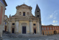
(22) Stroll through the narrow streets of Breil-sur-Roya, rejoin the D6204, cross the bridge over the Roya and take the first street on the right (public playground for children).
(23) Turn right onto Avenue des Combattants en A.F.N., pass the war memorial, the olive mill and the municipal swimming pool, and come out onto the D6204.
(24) Follow the road to the right until you reach the station (S/E).


 Visorando Member
 Difficult


 Moderate
 Easy