The Château de la Grillière and the Collegiate Church of Saint-Georges

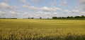
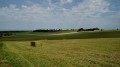
A short heritage walk in the Richelais region. Discover an ancient church, a castle and a Romanesque collegiate church, following small roads and field paths.

Details

n°93467
Creation:
Last update:
Last review:
  • Walking
    Activity: Walking
  • ↔
    Distance: 3.32 mi
  • ◔
    Average duration: 1h 45 
  • ▲
    Difficulty: Easy

  • ⚐
    Back to start: Yes
  • ↗
    Ascent: + 226 ft
  • ↘
    Descent: - 233 ft

  • ▲
    Highest point: 404 ft
  • ▼
    Lowest point: 236 ft

Photos

Description of the walk

Parking is available in the square opposite the town hall/school in Faye-la-Vineuse (7 km south of Richelieu, via the D749 and D757).

(S/E) With your back to the town hall, head for the street running along the bottom of the square. Turn left, then take thefirst right (Rue de Salvert). Walk downhill, ignore a street on the left and you’ll come to a three-way junction. Continue straight on (east), towards Marnay. At the junction (cross; elevation 76), veer left and cross a stream.

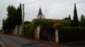
(1) At the entrance to Marnay (the former Saint-Pierre church), turn sharply right. As you leave the hamlet, the small road veers left, heading due south towards the Château de la Grillière.

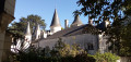
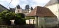
(2) Just before the end of the road, after a clump of trees, take the path on the right which heads south-west and goes round the château on the right. Walk alongside the property wall on your left and continue in the same direction. Once past the wall, there is a lovely view of the château’s façade and its staircase. Reach the D311 and follow it to the right. Head slightly downhill and cross a stream. You’ll come to a small road; head uphill opposite.

(3) At the fork in the road, take the small road on the left (let the D311 veer off to the right towards the village of Faye-la-Vineuse). At a junction, make a zigzag turn right then left to take a path heading north. Ignore another path leading off to the right towards some houses and continue to a T-junction.

(4) Take the track on the right. After two short right-left bends, walk alongside a football pitch. Join a small road and follow it straight ahead until you reach the junction.

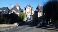
(5) Cross the D111 and follow Rue du Cimetière straight ahead. At the Fork in the road, turn right onto Rue du Champ Marteau. Then take thefirst right onto Rue de la Corne de Blin. At the end, turn right onto Rue de Richelieu. At the end, follow Grande Rue to the right, leading to the entrance of the Collégiale Saint-Georges.

(6) Take thefirst left onto Rue de l’Église and walk down past the church. Take thefirst street on the right to reach the town hall square (S/E).

Waypoints

  1. S/E : mi 0 - alt. 371 ft - Faye-la-Vineuse Town Hall
  2. 1 : mi 0.78 - alt. 240 ft - Marnay
  3. 2 : mi 1.31 - alt. 285 ft - Junction - Château de la Grillière
  4. 3 : mi 2.3 - alt. 282 ft - Fork
  5. 4 : mi 2.67 - alt. 390 ft - Crossroads
  6. 5 : mi 2.92 - alt. 400 ft - Crossroads at the entrance to Faye-la-Vineuse
  7. 6 : mi 3.22 - alt. 371 ft - Collégiale Saint-Georges
  8. S/E : mi 3.32 - alt. 371 ft - Faye-la-Vineuse Town Hall

Notes

In wet weather, the dirt tracks become slippery.

Grocery shop in Faye-la-Vineuse, Rue de la Domade, between the school and the collegiate church.

A detailed map is essential (at the very least the one accompanying this description).

This walk has been completed a dozen times by the author, with various variations, the first on 30 December 1993 and the last on 29 April 2019.

Worth a visit

In Marnay: the former Saint-Pierre Church (22nd century), now privately owned and used for agricultural purposes.

La Grillière Castle (16th–18th centuries), privately owned.

In Faye-la-Vineuse:
- Saint-Georges Collegiate Church (12th century), well worth a visit.
- Beautiful tuffeau stone houses.

Reviews and comments

4.3 / 5
Based on 2 reviews

Reliability of the description
4.5 / 5
Ease of following the route
5 / 5
Route interest
3.5 / 5
DenisGJ
DenisGJ

Overall rating : 4.3 / 5

Date of your route : Nov 08, 2026
Reliability of the description : ★★★★☆ Good
Ease of following the route : ★★★★★ Very good
Route interest : ★★★★☆ Good
Very busy route : No

A quick (1 hour 10 minutes) and pleasant route, as it offers plenty of variety between fields and truffle groves. Narrow, almost deserted roads. Unfortunately, with the hedge and then the wall in the way, the Château de la Grillière is barely visible. The best way to see it is to take a quick look whilst standing in front of the entrance gate.
There’s a small error on the map: the starting point (town hall) is incorrectly marked (it’s the Red Rectangle). But the route description is correct, even though there’s no longer a sign for Rue de Salvert as the direction to Marnay is signposted.

Machine-translated

marieetmichel
marieetmichel

Overall rating : 4.3 / 5

Date of your route : Nov 14, 2016
Reliability of the description : ★★★★★ Very good
Ease of following the route : ★★★★★ Very good
Route interest : ★★★☆☆ Average

A fairly short route with just one highlight: a glimpse of the Château de la Grillière. You can’t see the staircase as mentioned – there’s a big wall in the way! Otherwise, it’s a very beautiful collegiate church.

Machine-translated

Other walks in the area

For more walks, use our search engine .

The GPS track and description are the property of this route's author. Please do not copy them without permission.