The castles of La Pichardière and Le Verger

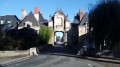
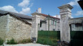
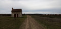
A short walk leading through pleasant countryside to two superb châteaux: the Pichardière, in the ‘manor house’ style, and the Verger, whose architectural features are reminiscent of the nearby town of Richelieu.

Details

n°75922565
Creation:
Last update:
Last review:
  • Walking
    Activity: Walking
  • ↔
    Distance: 5.00 mi
  • ◔
    Average duration: 2h 20 
  • ▲
    Difficulty: Easy

  • ⚐
    Back to start: Yes
  • ↗
    Ascent: + 52 ft
  • ↘
    Descent: - 52 ft

  • ▲
    Highest point: 226 ft
  • ▼
    Lowest point: 157 ft
  • ⚐ Country: France
  • ⚐ City: Chaveignes (37120)
  • ⚑
    Start/End: N 47.021068° / E 0.334388°
  • ❏
    IGN map(s): Ref. 1724SB, 1824SB
  • Hour-by-hour weather

Photos

Description of the walk

Park in the car park of the Chaveignes hypermarket, a well-known chain, at a place called La Coupure du Parc, at the north-eastern exit of Richelieu on the D757.

(S/E) On leaving the car park, cross the D757 at the pedestrian crossing on the left and follow the road to the right. Take the first left, the Route de Thuet. Pass the car park of a serviced apartment complex, then walk along the right-hand side of the wall of Richelieu Park. Ignore a small road on the left.

(1) A few hundred metres after a right-hand bend, take the first path on the left and walk alongside a hedge on your left. Cross the River Veude via a footbridge without a railing and head towards a wood. Walk alongside the wood on your right until you reach a T-junction.

(2) Then turn left onto a wide grassy path, which soon curves to the right.

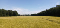
(3) You’ll come out onto a road; cross it carefully and follow it to the right for about 200 metres. At a right-hand bend, turn left onto a grassy path between two fields. Further on, walk along the right-hand side of a hedge and, in places, the remains of a property wall. You’ll reach a shaded crossroads (with a few sequoias and a fine plane tree).

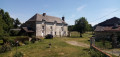
(4) Follow a small road to the right. Shortly afterwards, turn left onto the Route de la Pichardière. Continue straight on until you reach the château of the same name, situated on the left-hand side.

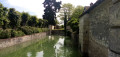
(5) Retrace your steps. At the T-junction, turn left and you’ll immediately see the Château du Verger on your right, with its moat.

(6) Retrace your steps, ignore Route de la Pichardière on the right and you’ll soon reach the original junction.

(4) Carry on straight ahead along the small road, which is shaded at the start but then runs through open countryside.

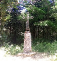
(7) When the road bends to the left, leave it and take a path on the right that leads into a wood. The path is not very well maintained and has a few damp patches. You’ll come to a crossroads (metal cross).

(8) Take the second left, a wide track. Leave the woodland and stay on the edge.

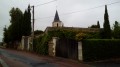
(9) At the ‘Give Way’ sign, cross the D757 with care and continue straight ahead along the Chemin des Carrières de Chauvin. The tarmac soon gives way to a track. Carry straight on and note the church at Chaveignes in the distance on the right. Cross a small road and continue straight ahead along a path at the edge of the woods. You’ll come out onto a small road; follow it to the left.

(10) Cross the Veude again (there’s a lovely old house on the right) and carry on along the road. Ignore a road on the right and continue straight on.

(11) At the ‘Give Way’ sign, cross the D357 with care and carry on straight ahead onto the C302 towards Champvent.

(12) At the entrance to Champvent, turn left onto a stony track between the fields, the Allée des Verrières. When you reach the first houses, the track gives way to tarmac. At the T-junction, turn right. At the Stop sign, turn right and follow the D757 along its right-hand verge. Cross Rue de la Grenouillère and you’ll immediately come to the hypermarket car park on your right (S/E).

Waypoints

  1. S/E : mi 0 - alt. 174 ft - Hypermarket car park
  2. 1 : mi 0.84 - alt. 171 ft - Start of the path
  3. 2 : mi 1.13 - alt. 177 ft - T-junction
  4. 3 : mi 1.4 - alt. 180 ft - D20 road
  5. 4 : mi 1.94 - alt. 210 ft - Junction with the ‘Circular’ loop
  6. 5 : mi 2.18 - alt. 220 ft - Château de la Pichardière
  7. 6 : mi 2.4 - alt. 226 ft - Château du Verger
  8. 7 : mi 2.88 - alt. 180 ft - Start of the path
  9. 8 : mi 3.05 - alt. 180 ft - Crossroads – Cross
  10. 9 : mi 3.36 - alt. 187 ft - Crossing the D757
  11. 10 : mi 3.84 - alt. 157 ft - Verrières Mill - Veude (rivière)
  12. 11 : mi 4.18 - alt. 177 ft - Crossing the D357
  13. 12 : mi 4.47 - alt. 171 ft - Allée de Verrières
  14. S/E : mi 5 - alt. 174 ft - Hypermarket car park

Notes

Good walking shoes are sufficient for this short walk, which follows well-maintained paths and quiet country lanes.

No water source identified in the car park. All supplies can be obtained from the hypermarket (S/E) or, opposite, at the local farmers’ shop (open all day on Fridays and Saturdays and on Sunday mornings).

A detailed map is useful (at the very least, the one accompanying this description).

Walk completed by the author on 24 May 2025.

Worth a visit

The two castles, (5) and (6), are the destination of the walk, which also offers a pleasant stroll through peaceful countryside. 

Reviews and comments

3.8 / 5
Based on 2 reviews

Reliability of the description
4 / 5
Ease of following the route
5 / 5
Route interest
2.5 / 5
DenisGJ
DenisGJ

Overall rating : 4.3 / 5

Date of your route : Apr 19, 2026
Reliability of the description : ★★★★★ Very good
Ease of following the route : ★★★★★ Very good
Route interest : ★★★☆☆ Average
Very busy route : No

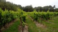
The photos give a perfect impression of the route and what makes it interesting. At point (7), it’s not that the path isn’t well maintained; it’s that it’s been rutted by tractors driving over it... That said, in dry weather, no problem! I extended this circular route by starting from Richelieu: at point (12), I went straight on, following cycle route no. 50. In total, I covered about 10 km.

Machine-translated

nicole.l
nicole.l

Overall rating : 2.5 / 5

Date of your route : Aug 10, 2025
Reliability of the description : ★★★☆☆ Average
Ease of following the route : Not used / Not applicable
Route interest : ★★☆☆☆ Disappointing
Very busy route : No

Many roads in the plains, some sections in forests on well-maintained paths. Completely flat route with no hills, very little of interest except for the Château du Verger, which is magnificent

Machine-translated

Other walks in the area

For more walks, use our search engine .

The GPS track and description are the property of this route's author. Please do not copy them without permission.