


 Country:
 City:
City:


Start: Place de la Mairie, in Faye-la-Vineuse (car park).
No signposting
(S/E) Opposite the town hall (school building), go round the building to the right and head straight on along Rue de l’École. Turn right onto this road and, at the end, turn left. Take the first right, Rue de la Huchette. At the end (small car park on the right), turn left and cross Place Neuve.
Blue signposts
(1) At the junction, turn right towards Richelieu by bike. At the fork in the road that appears immediately, keep left. At the three-way junction that follows, veer left, passing a large house on your right. Then turn right and ride alongside the cemetery on your left.
(2) At the end of the cemetery, continue along a grassy path and head down between the fields.
(3) Cross a small road (cross) and continue along another road opposite. Further on, the tarmac gives way to a gravel track.
(4) At a fork in the road just past a solitary walnut tree, turn right onto the track and immediately ignore a path branching off to the right. Pass a copse on your left and follow the Bois de Faye on your right. Pass under a high-voltage power line. Continue between the fields, climbing slightly, and note the turrets of Poulesse Castle on your right.
Yellow markings
(5) At the top, just before a solitary walnut tree, turn right onto a small road and walk past Château de Poulesse. Pass the main gate on your left and follow a shaded track to the Poulesse farm.
Signposted with two red dashes on a white background
(6) Pass the farm on your right and continue straight on along a path that soon becomes shaded. At a fork in the road, take the left-hand path, which is the better marked of the two. Walk alongside a copse on your right, then another on your left.
(7) At the three-way junction at the end of the woodland, veer to the right then turn left along the path (with a distant view of the Château de la Grillère). Pass a shed and continue straight on along a small road. Pass a pond on your right, cross a stream and head slightly uphill. Walk past a large house on your left and, at the corner, cross a small road on your left and continue straight on.
No signposting
(8) When you reach the next house on the left (with a landscaping sign), turn right onto a grassy path towards the hilltop on which the village of Faye-la-Vineuse is perched. Pass the base of an electricity pylon, cross a stream and continue straight on between the fields. Ignore a path branching off to the right (not shown on the IGN map) and climb gently.
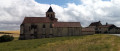
(9) At a three-way junction, turn right. Soon after, turn left with the path and continue uphill: the Collegiate Church of Saint-Georges gradually comes into view.
(10) Cross a small road and continue straight ahead onto a gravel track. You’ll soon reach the tarmac again, level with No. 4, and carry on straight ahead. Cross Rue de Richelieu on the right-hand side and, at the next junction, continue straight ahead to the foot of the Collégiale Saint-Georges.
(11) Follow Rue de la Domade straight on. At the end of the street, you’ll immediately find Place de la Mairie on your left (S/E).
 Visorando Member
 Moderate
 Tourist office
