Country:
 City:
City:


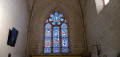
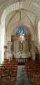
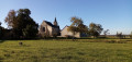
Start from the car park in the centre of Sérigny, between the church and the town hall and alongside the cemetery (hiking sign).
Yellow markings
Here and there, you’ll find signposts marked with the number 48.
(S/E) Follow the D72 towards Saint-Christophe, keeping the church on your left. After a long green gate on the right-hand side, turn left onto a field track. Pass a pond on your left.
(1) At the T-junction, turn left. Cross the D23 at a place called Le Couvent and continue straight ahead along a stony track with a fence on your right. At the corner of the fence, turn right onto a grassy path. Cross the Bois de la Baronnerie, staying on the main signposted path.
(2) At the junction (small metal cross on the left), carry straight on. After about a hundred metres, ignore a turn-off to the left. You’ll come out onto the D70; follow it as it continues.
(3) When the road bends to the left, as you approach Château de Launay, take a track on the right. Walk uphill through meadows and fields.
(4) At the top, cross the D23 and carry on straight ahead along a small road towards La Maison Neuve. At the Fork in the road that appears shortly afterwards, keep to the right. As you approach the hamlet of La Maison Neuve, take a shortcut by going straight on along a grassy track.
(5) Return to the tarmac road and carry on straight ahead (ignore the road on the right leading towards Marne). At the next junction, go straight on towards La Baindonnière.
(6) When you reach the house, carry on straight ahead along a farm track. Head downhill, then pass a pond on your left. Ignore a grassy path on the left, veer to the right and head uphill towards a stone building. At the top, walk alongside the building on your left and, at the corner, turn left onto the path. Then veer right (on your left, you’ll see the bell tower of the Collégiale Saint-Georges in Faye-la-Vineuse).
(7) When you reach the tarmac, turn sharply right onto a stony track. Further on, ignore a turn-off on the left towards Le Cormier (track not shown on the map) and then a turn-off on the right (elevation 117).
(8) Return to the tarmac road at a place called Les Favreaux. When the road bends to the right, carry on straight ahead along a grassy track. Continue along the tarmac road between the houses in the hamlet of Les Cardinaux.
(9) At the T-junction, turn right. Cross a road and continue straight ahead along a tarmac track which quickly turns into a grassy path. At the next junction (elevation 127), go straight on.
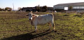
(10) At the junction with a small road, continue straight on again, passing a stone house on your left. You’ll arrive at a livestock farm in the hamlet of Le Monteil. Here, the path runs between two pastures and, in October 2021, was blocked by an electric fence low enough to step over without difficulty. You will then pass another electric fence, which you can open and close using a handle.
(11) Then follow a farm track to the right. At the junction (elevation 128), go straight on. Head downhill, cross a small road and continue downhill along a grassy path. This will take you to a junction you passed on the way there.
(1) Turn left here, keeping the pond on your right. You’ll come out onto the D72; follow it to the right until you reach the car park (S/E).



 Visorando Member

 Easy
Easy  Tourist office