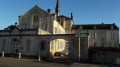
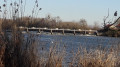
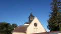
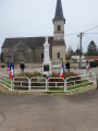
Water catchments and the Poncey dam at the start of the route in Athée

A pleasant, easy walk exploring the two villages of Athée and Poncey-lès-Athée, which also takes in the drinking water treatment plant and its catchments for the Dijon metropolitan area, the Poncey dam, the church and the Athée retirement home.

Details

2919351
Creation:
Last update:
Last review:
  • Walking
    Activity: Walking
  • ↔
    Distance: 5.76 mi
  • ◔
    Average duration: 2h 45 
  • ▲
    Difficulty: Easy

  • ⚐
    Back to start: Yes
  • ↗
    Ascent: + 79 ft
  • ↘
    Descent: - 98 ft

  • ▲
    Highest point: 679 ft
  • ▼
    Lowest point: 597 ft
  • ⚐ Country: France
  • ⚐ City: Athée (21130)
  • ⚑
    Start/End: N 47.23157° / E 5.369755°
  • ❏
    IGN map(s): Ref. 3123E
  • Hour-by-hour weather

Photos

Description of the walk

Park near the cemetery on Rue de Tuilerie in Athée: please note that there are two cemeteries in this town.

(S/E) Follow the footpath marked by wooden barriers as you head away from the village centre. Then take the first left, Chemin des Grebottes, and at the end, turn left onto the grassy path which leads to a narrow lane. Join Rue du Centre (D976).

(1) Follow this street to the right, cross at the pedestrian crossing to join Rue de la Serpentière. After the wash house, continue along this street and keep to the right to reach Rue de la Saône.

(2) Turn right, cross at the pedestrian crossing and continue in this direction. Pass the wayside shrine and continue along the roadside verge. Further on, take a small road on the left with a Stop sign, and head towards the TGV bridge. Before this bridge, turn left onto a grassy path which later turns left. At the end of this path, after passing a double row of poplars, turn right towards the drinking water treatment plant.

(3) Go round the plant on the right. Pass the relay station and, at the green gate, go round the side to take the small path on the left with cycle barriers.

(4) The first catchment well is visible through the wire mesh. Follow this path to reach the Saône and then walk alongside it, turning left.

(5) Cross the footbridge and continue along the river. After the fishermen’s huts, the path turns left, then right and left again to come out onto Rue du Buisson Brûlé. Turn right and then immediately right again towards a red footbridge.

(6) Cross the footbridge and stay along the banks of the Saône until you reach the weir.

(7) Turn left onto Rue Galante and, at the end of this street, at the fire hydrant, turn left then immediately right onto Rue Bourgalin. Further on, turn left at another fire hydrant to follow Rue du Champ Communal.

(8) Turn right onto Rue Lucot, then left onto Rue Saint-Médard towards the town hall. In front of the town hall, turn left onto Avenue du 8 Mai 1945, then turn right towards the bridge. Cross the bridge and continue straight on along Rue Lamotte until you reach the crossroads. There, turn right onto Rue du Buisson Brûlé and continue straight on until you reach the wayside shrine and the Stop sign. Turn left and head towards the village centre. Pass in front of the church and continue along this street.

(9) Cross at the pedestrian crossing in front of the retirement home to enter Rue de Tuilerie and reach the car park (S/E).

Waypoints

  1. S/E : mi 0 - alt. 676 ft - Cemetery car park, Rue de Tuilerie
  2. 1 : mi 0.64 - alt. 673 ft - Rue du Centre
  3. 2 : mi 1.25 - alt. 627 ft - Rue de la Saône
  4. 3 : mi 2.63 - alt. 607 ft - Drinking water treatment plant
  5. 4 : mi 3.06 - alt. 604 ft - First water collection well - La Saône
  6. 5 : mi 3.14 - alt. 604 ft - Small footbridge
  7. 6 : mi 3.6 - alt. 600 ft - Long red footbridge
  8. 7 : mi 3.88 - alt. 607 ft - Dam spillway
  9. 8 : mi 4.23 - alt. 636 ft - Rue Lucot
  10. 9 : mi 5.68 - alt. 669 ft - Retirement home and castle
  11. S/E : mi 5.76 - alt. 676 ft - Cemetery car park, Rue de Tuilerie

Notes

Please note: there are two cemeteries in the commune of Athée.
The route is exposed, so take care in hot weather.
Picnic table at point (5).
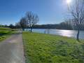
Several benches along the Saône.

Worth a visit

Athée Castle, built of pink brick with its four watchtowers.
Retirement home in a magnificent building created by its founders Victor and Fanny Moussier (1875).
The 13th-century church of Athée.
The water catchments (52) for Dijon Métropole.
The Dijon Métropole drinking water treatment plant.
The dam that regulates the turbulent Saône.

Reviews and comments

4.5 / 5
Based on 5 reviews

Reliability of the description
4.5 / 5
Ease of following the route
4.4 / 5
Route interest
4.6 / 5
User 28272078

Overall rating : 5 / 5

Date of your route : Feb 10, 2026
Reliability of the description : ★★★★★ Very good
Ease of following the route : ★★★★★ Very good
Route interest : ★★★★★ Very good
Very busy route : No

Pleasant walks, discovering villages in a different way

Machine-translated

G. Philippe
G. Philippe

Overall rating : 5 / 5

Date of your route : Mar 30, 2025
Reliability of the description : Not used / Not applicable
Ease of following the route : ★★★★★ Very good
Route interest : ★★★★★ Very good
Very busy route : No

We enjoyed this lovely walk, particularly the section along the Saône. You can have a picnic on the benches just past point 5. There are several tables and benches near point 6.

Machine-translated

Madolo
Madolo

Overall rating : 3.7 / 5

Date of your route : Apr 29, 2024
Reliability of the description : ★★★★☆ Good
Ease of following the route : ★★★☆☆ Average
Route interest : ★★★★☆ Good
Very busy route : No

Lack of information to track the journey

Machine-translated

Xxxxxxxxx
Xxxxxxxxx

Overall rating : 4.7 / 5

Date of your route : Oct 18, 2022
Reliability of the description : ★★★★☆ Good
Ease of following the route : ★★★★★ Very good
Route interest : ★★★★★ Very good
Very busy route : No

Tb

Machine-translated

VEVE55
VEVE55

Overall rating : 4.3 / 5

Date of your route : Feb 21, 2022
Reliability of the description : ★★★★★ Very good
Ease of following the route : ★★★★☆ Good
Route interest : ★★★★☆ Good
Very busy route : No

OK, but it’s about 2 km along the side of the road (watch out for cars):

Machine-translated

Other walks in the area

For more walks, use our search engine .

The GPS track and description are the property of this route's author. Please do not copy them without permission.