Country:

 City:
City:


Park at Vachères, Place de la Mairie.
(S/E) Turn right as you leave the square opposite the museum, go round the back of the church and turn left onto the D114 (yellow signposts) between the lavender fields.
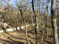
(1) Leave the D114 before La Font Neuve and take the path opposite through the oak woodland. Carry on straight ahead in the same direction and pass in front of Les Lavandins.
(2) A few dozen metres further on, stay on the path to the right and continue straight on until the next T-junction.
(3) Turn left and join theGR® 4 (tarmac road with red and white markings).
(4) Take the hairpin bend to the right onto theGR® 4 and follow it until the Fenouillet junction.
(5) Take the path straight ahead and rejoin theGR® 4 after just under a kilometre: theGR® route shown on the IGN map is incorrect here.
(6) Turn left towards Oppedette and join the D201.
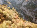
(7) Turn left towards the Gorges d’Oppedette, then turn right atthe first junctiontowards the viewpoint car park.
(8) The start of the gorges (left bank) is to the left of the car park (yellow markings). Follow the path until you reach the D201 again.
(9) Cross with great care as visibility is poor due to the bend, then rejoin the path opposite. This runs alongside the road before joining it a second time.
(10) Cross again with the same caution and continue straight ahead to reach the D201 for a third time at the Grand Vallat bridge, which spans a tributary of the Calavon.
(11) Turn right onto the D201 and, after about a hundred metres, turn right again after the Blaque Bridge (yellow markings) to take the left-bank path, a stony, uphill track with a few large boulders.
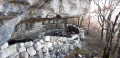
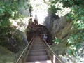
(12) The route then follows the cliff edge after a section equipped with handrails for about twenty metres.
(13) After passing through a trench fitted with a handrail, the path goes beneath the Refour climbing site and reaches a ford on the Cavalon.
(14) Cross this ford to arrive below the village of Opeddette.
(15) Turn left onto theGR®4and walk carefully alongside the D201. Cross the bridge over the Cavalon.
(16) Continue along the D201 for about 1 km.
(17) Leave the road and turn right onto the path towards the Saut du Moine waterfall (yellow markings).
(18) As you emerge from the waterfall, take the path on the right towards L’Abbadie, then follow the access road to the hamlet until you reach the junction for Valsaintes-aux-Plaines.
(19) Turn right onto thePR® path, which eventually leads to a bend in a small road (elevation 756).
(20) Follow the road to the left to join the D14.
(21) Turn left to follow this road; then, when you reach the château on your left, turn right again onto the Route de Banon, which leads back to Vachères via a long, steady climb (S/E).


 Visorando Member

 Moderate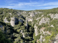
 Easy
Easy