


ergador

 Visorando Member
 Premium user
 Sign up:
Published route(s)
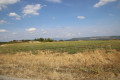
 The Vachères viewpoint and the Oppedette Gorges
 13.78 mi
 +2,070 ft
 -2,060 ft
 8h 10
8h 10
 Difficult
 Departure from Vachères (Alpes-de-Haute-Provence)
There’s a sweeping view of Haute Provence and a bird’s-eye view of the Oppedette Gorges with their cliffs and ‘giants’ potholes’.
The Bouiron and Seygne trails starting from Lardiers
11.04 mi
+991 ft
-994 ft
5h 55
 Moderate
Departure from Lardiers (Alpes-de-Haute-Provence)
Moderate
Departure from Lardiers (Alpes-de-Haute-Provence)
In the land of the white oak, through the lavender and heather.
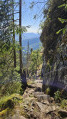
Sentiers des Roches and Sentiers des Couloirs from the Col de la Schlucht
 9.03 mi
+2,523 ft
-2,507 ft
6h 20
Difficult
Departure from Le Valtin (Vosges)
9.03 mi
+2,523 ft
-2,507 ft
6h 20
Difficult
Departure from Le Valtin (Vosges)
A beautiful, challenging hike in the Vosges mountains, taking the Sentier des Roches and the Couloirs trails and the lesser-known climb up to the Col de Falimont from Frankental, then going around the Petit Hohneck via the Schiessroth and returning via the Hohneck and the Trois Fours.
Please note: hiking is prohibited in winter. Read the practical information about the difficulties encountered on this hike.