Asnois route

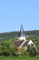
On this route, discover the richness of the local heritage. Walk through the Coteaux de Tannay vineyards and meet the winegrowers who produce this famous grape variety known as ‘Melon’. Follow the famous waterway, the Nivernais Canal, and with a bit of luck, as you round a lock, you’ll see a boat passing through. Discover the 13th-century Saint-Loup Church and the bust of Paul-Jean Rigollot, inventor of “Papier Rigollot”.

Details

80972903
Creation:
Last update:
Last review:
  • Walking
    Activity: Walking
  • ↔
    Distance: 7.22 mi
  • ◔
    Average duration: 3h 40 
  • ▲
    Difficulty: Moderate

  • ⚐
    Back to start: Yes
  • ↗
    Ascent: + 371 ft
  • ↘
    Descent: - 381 ft

  • ▲
    Highest point: 761 ft
  • ▼
    Lowest point: 522 ft
  • ⚐ Country: France
  • ⚐
    Area: Morvan
  • ⚐ City: Asnois (58190)
  • ⚑
    Start/End: N 47.39717° / E 3.60156°
  • ❏
    IGN map(s): Ref. 2622SB
  • Hour-by-hour weather

Photos

Description of the walk

Starting point: Car park by the canal 47°23'48.9"N 3°36'04.9"E

(S/E) As you leave the car park, take the road on the left, which leads up to the village, and follow the red and white markings. Continue through the village along the Grande Rue.

(1) Turn left, following the signs for the church. Keep right at the junction. From here, the markings are yellow.

(2) Walk past the church, keeping it on your right, then take the grassy path on the right. At the junction, take the path on the left towards the Canal du Nivernais.

(3) When you reach the canal, take the towpath on the right towards Decize.

(4) At the double lock, carry on straight ahead along the towpath.

(5) At the junction with the D119, turn left. Cross the two bridges and you’ll arrive in the village of Cuzy. Cross the D985 carefully and turn left at the junction with the tower, then take the first path on the left. Pass under the power lines. When you reach the junction with the road, take the D165 by turning right towards Champagne.

(6) Walk through the village. After the last houses, leave the departmental road and turn left onto the road.

(7) After walking 1.2 km, turn left onto the path through the fields. It is marked in red and white. Cross the D985 carefully, then continue along the road opposite to reach the car park (S/E).

Waypoints

  1. S/E : mi 0 - alt. 548 ft - Car park by the canal
  2. 1 : mi 0.46 - alt. 682 ft - Signpost for the church
  3. 2 : mi 0.79 - alt. 604 ft - Church
  4. 3 : mi 1.26 - alt. 531 ft - Canal du Nivarnais
  5. 4 : mi 1.98 - alt. 541 ft - Lock - Canal du Nivarnais
  6. 5 : mi 3.43 - alt. 558 ft - D119 - Gare de Flez-Cuzy-Tannay
  7. 6 : mi 5.09 - alt. 738 ft - Champagne
  8. 7 : mi 6.03 - alt. 696 ft - Saint-Jacques
  9. S/E : mi 7.22 - alt. 548 ft - Car park by the canal - Yonne (l')

Worth a visit

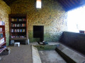
Saint-Loup Church and bust of Rigollot.

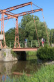
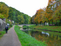
Nivernais Canal.

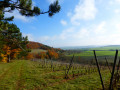
The Coteaux de Tannay vineyards.

Other walks in the area

For more walks, use our search engine .

The GPS track and description are the property of this route's author. Please do not copy them without permission.