


Griesalp – Hundshubel


Hike with 1,300 metres of elevation gain: be warned, it’s going to be tough. It’s a challenging day, all uphill from the hotel to the campsite. We’ll arrive in the heart of the countryside. We’ll need to set up camp before having a nap and getting out the card games (not forgetting the food).
This walk is part of a multi-day hike: Treck : 4 jours/ 3nuits en Suisse dans l'Oberland Bernois
Details
Creation:
Last update:
Last review:
–
–
-
 Activity: Walking
 -
 Distance: 5.09 mi
 -
 Average duration: 5h 50
 -
 Difficulty: Difficult
 -
-
 Back to start: No
 -
 Ascent: + 4,052 ft
 -
 Descent: - 1,250 ft
 -
-
 Highest point: 8,560 ft
 -
 Lowest point: 4,626 ft
-
 Country:
Switzerland
Country:
Switzerland
-
 Area: Alps
 -
 City:
Reichenbach im Kandertal
City:
Reichenbach im Kandertal -
 Start: N 46.547273° / E 7.761448°
 -
 End: N 46.542546° / E 7.825318°
 -


 Hour-by-hour weather


Waypoints
- S : mi 0 - alt. 4,662 ft - Hotel - Griesalp Hotel
- 1 : mi 1.55 - alt. 5,308 ft - Büngli
- 2 : mi 2.67 - alt. 6,568 ft - Obere Dürreberg
- 3 : mi 3.99 - alt. 8,553 ft - Col
- E : mi 5.09 - alt. 7,454 ft - Water
Other walks in the area
Hundshubel – Mürren
 Visorando Member4.71 mi
+256 ft
-2,333 ft
2h 25
Visorando Member4.71 mi
+256 ft
-2,333 ft
2h 25
 Moderate
Departure from Lauterbrunnen (Canton of Bern)
Moderate
Departure from Lauterbrunnen (Canton of Bern)
This hike takes you back to the town, which is well worth a visit. There are several campsites to choose from. Much of the route is downhill. Water is available along the way if needed. If the descent is too steep, you can take public transport for part of the way.
Kiental - Kandersteg
 12.21 mi
+4,098 ft
-3,360 ft
9h 10
12.21 mi
+4,098 ft
-3,360 ft
9h 10
 Very difficult
Departure from Reichenbach im Kandertal (Canton of Bern)
Very difficult
Departure from Reichenbach im Kandertal (Canton of Bern)
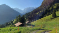
This second stage will take you from Kiental to Kandersteg. After a fairly challenging climb to Ramslauenen, you will cross the beautiful Horewald forest and then overlook the Kander valley. You will enjoy more views of Lake Thun and the Niesen. You will also have a bird's eye view of the trains on the Lötschberg line. Kandersteg is the station where vehicles board the shuttle trains before the Lötschberg railway tunnel.
From Kandersteg Campsite to Lake Oeshinensee
4.64 mi
+1,476 ft
-1,503 ft
3h 25
Moderate
Departure from Kandersteg (Canton of Bern)
This hike makes for a relaxing day out. You can stroll around the lake and enjoy a bite to eat. The starting point, at Camping Kanderseg, is at an altitude of 1,228 metres, whilst Lake Oeshinensee is at 1,590 metres. You then return to the starting point
Lake Oeschinensee from Kandersteg
 4.13 mi
+1,371 ft
-1,358 ft
3h 05
Moderate
Departure from Kandersteg (Canton of Bern)
4.13 mi
+1,371 ft
-1,358 ft
3h 05
Moderate
Departure from Kandersteg (Canton of Bern)
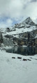
A lovely little hike offering access to Lake Oeschinen, at the mere cost of a bit of a sweat, rather than paying for the cable car. There are no difficulties on this route, apart from the fact that it’s uphill all the way on the way there, but nothing technically challenging in itself.
Kandersteg - Selde
 6.89 mi
+4,895 ft
-3,658 ft
7h 25
Moderate
Departure from Kandersteg (Canton of Bern)
6.89 mi
+4,895 ft
-3,658 ft
7h 25
Moderate
Departure from Kandersteg (Canton of Bern)
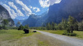
This third stage will take you from Kandersteg to the hamlet of Selde. The Kander river will accompany you throughout this beautiful route. Calm from Kandersteg to Eggeschwand, the Kander can be heard as you climb up through the gorges, where you can enjoy the various waterfalls and cascades. You will then follow it more peacefully through the wide Gastertal valley to Selde.
Mürren – Lauterbrunnen
5.15 mi
+528 ft
-3,291 ft
2h 50
Difficult
Departure from Lauterbrunnen (Canton of Bern)
Depart from the Mürren campsite to visit Lauterbrunnen. You can take a stroll around the town and its surroundings before heading to Lauterbrunnen station to return to Geneva. It’s a quiet day to relax.
Selde - Lauchernalp
 7.15 mi
+3,937 ft
-2,313 ft
6h 45
Difficult
Departure from Kandersteg (Canton of Bern)
7.15 mi
+3,937 ft
-2,313 ft
6h 45
Difficult
Departure from Kandersteg (Canton of Bern)
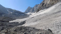
This fourth stage will take you from Selde to Lauchernalp. You will start by crossing the Kander via a suspension bridge. After Gfelalp, you will have a superb view of the Kanderfin glacier, the source of the Kander. The climb to the Lötschenpass crosses a glacier without any difficulty. An equipped passage takes you to the pass, where you can enjoy a break at the hut. You will admire the wide panorama of the 4,000-metre peaks of the Valais Dom, Weisshorn and Matterhorn. At the Lötschen Pass, as at Lauchernalp, you can see the Restipass, which is the planned route for the next day's stage.
Lauchernalp - Leukerbad (Rinderhütte)
 9.12 mi
+2,854 ft
-2,011 ft
6h 40
Difficult
Departure from Wiler (Lötschen) (Valais)
9.12 mi
+2,854 ft
-2,011 ft
6h 40
Difficult
Departure from Wiler (Lötschen) (Valais)
This last stage will take you from Lauchernalp to Leukerbad. The route passes through several mountain pastures, including Kummenalp and Restialp. As you climb up to the Restipass, you will enjoy magnificent views of the Lötschental and the peaks, from the Jungfrau to the Aletschhorn. The Weisshorn will also often be visible. The western slope of the Restipass will take you easily to the upper station of Leukerbad at the Rinderhütte.
For more walks, use our search engine .
The GPS track and description are the property of this route's author. Please do not copy them without permission.

