


Refine your search for walks in Lanrivain
Lanrivain walks


 Circular route around the Étang de Kerné Uhel via the Chaos de Toul Goulic
 Visorando Member
 10.21 mi
 +302 ft
 -292 ft
 4h 55
4h 55
 Moderate
 Departure from Lanrivain (Côtes-d'Armor)
A lovely circular route around the Étang de Kerné Uhel along the left bank of the Blavet, then along the river through the Chaos de Toul Goulic. The return route, following a pretty stream, will take you back to the hydroelectric dam, then along the right bank, round the Goz-ar Hand peninsula before reaching the bridge and the car park. You’ll also have the pleasure of spotting a wide variety of birds and many remarkable trees.
⚠️15/09/2026: Route modified between points 6 and 8.
Circular route to Maël-Pestivien via Le Loc'h and La Chaire des Druides
7.95 mi
+531 ft
-522 ft
4h 05
Moderate
Departure from Maël-Pestivien (Côtes-d'Armor)
This circular walk around Maël-Pestivien will take you to several megalithic sites such as the Roch Du Dolmen and the Chaire des Druides, as well as a few local heritage monuments such as the Saint-Isidore and Loc'h chapels. You will walk along various paths, including farm tracks, white roads, forest trails and tarmac roads.
Covered walkways of Liscuis and Daoulas Gorges
 3.81 mi
+472 ft
-492 ft
2h 10
3.81 mi
+472 ft
-492 ft
2h 10
 Easy
Departure from Laniscat (Côtes-d'Armor)
Easy
Departure from Laniscat (Côtes-d'Armor)
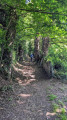
A short circular walk to discover the covered alleys listed as Historic Monuments, then the Daoulas Gorges in a somewhat wild rocky environment. A complete change of scenery guaranteed. As a bonus, and for a short 1 km detour, I suggest you visit the ruins of Notre-Dame de Bon Repos Abbey.
Around the Abbey of Notre-Dame de Bon-Repos
 6.92 mi
+492 ft
-469 ft
3h 35
Moderate
Departure from Saint-Gelven (Côtes-d'Armor)
6.92 mi
+492 ft
-469 ft
3h 35
Moderate
Departure from Saint-Gelven (Côtes-d'Armor)
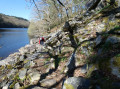
Take a short loop around Bon Repos Abbey by following the towpath of the Nantes-Brest canal to the Bellevue lock. The hike continues on theGR®34trail, which runs along the shores of Lake Guerlédan before venturing into the countryside and returning to the abbey.
In the Bois du Fao
 Association / Club / Walk leader
 4.52 mi
+761 ft
-735 ft
2h 45
Easy
Departure from Saint-Gelven (Côtes-d'Armor)
4.52 mi
+761 ft
-735 ft
2h 45
Easy
Departure from Saint-Gelven (Côtes-d'Armor)
This walk starts from Notre-Dame de Bon Repos Abbey (which you can visit by booking in advance). After crossing the Nantes–Brest Canal, it will take you into the Bois de Fao to discover its biodiversity.
Tour of the Glomel ponds
9.35 mi
+400 ft
-400 ft
4h 40
Moderate
Departure from Glomel (Côtes-d'Armor)
A pretty, bucolic circular route through the Breton countryside, around the Glomel ponds and along the Nantes-Brest Canal. This route combines waterways, locks, woods and villages, ideal for a change of scenery.
The Charcoal Burners’ Route in the Bois d’Avougour
 4.54 mi
+167 ft
-138 ft
2h 15
Easy
Departure from Saint-Péver (Côtes-d'Armor)
4.54 mi
+167 ft
-138 ft
2h 15
Easy
Departure from Saint-Péver (Côtes-d'Armor)
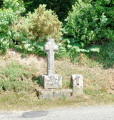
You won’t see any charcoal burners. However, as you enjoy this gentle walk, which can be done in any season, you’ll be able to imagine their lives in this forest of majestic trees. There’s no need to worry about getting lost – the route is clearly signposted.
In the Bois Meur
 4.84 mi
+230 ft
-230 ft
2h 25
Easy
Departure from Lanrodec (Côtes-d'Armor)
4.84 mi
+230 ft
-230 ft
2h 25
Easy
Departure from Lanrodec (Côtes-d'Armor)
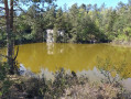
A walk almost entirely in the forest with sections along sunken paths. This route leads to a disused quarry that is now a pond (see photo).
Tro Vras circuit in the Bois d'Avaugour and Bois Meur
16.89 mi
+942 ft
-958 ft
8h 35
 Very difficult
Departure from Lanrodec (Côtes-d'Armor)
Very difficult
Departure from Lanrodec (Côtes-d'Armor)
The Bois d'Avaugour and Meur offer a mix of gravel tracks and footpaths. The Tro Vras route follows the western circular loop, featuring beautiful paths through heathland, along the Avaugour (which reveals its beauty in winter, when the vegetation clears) and forest tracks. The transition to the eastern circular loop is challenging (with mud in winter) but offers sections passing by some very beautiful trees. The eastern circular loop, pleasant at the start, is less interesting on the return leg, except for the last three kilometres of descent, initially amongst tree stumps in a fir forest.
Tour of Butte de Malvran
3.20 mi
+515 ft
-495 ft
1h 55
Easy
Departure from Saint-Aignan (Morbihan) (Morbihan)
A beautiful route that initially follows the edge of Lake Guerlédan via theGR® 341, then climbs up to the Butte de Malvran, which overlooks the surrounding area.
Two-day tour of Lake Guerlédan
 22.13 mi
+1,581 ft
-1,604 ft
2 days
22.13 mi
+1,581 ft
-1,604 ft
2 days
 Difficult
Departure from Saint-Aignan (Morbihan) (Morbihan)
Difficult
Departure from Saint-Aignan (Morbihan) (Morbihan)
A superb hike, mostly through woodland, with magnificent views of the lake from the highest points. Some sections of the trail are quite steep – ideal for giving your thighs a good workout – but these are short stretches. Walking poles may be useful for those who find the going a bit tough. There are plenty of lodges and campsites available for an overnight stay. There are seven different starting points; check the lake’s website for details: http://www.lacdeguerledan.com/.The trail is very well signposted with ‘Sentier de Guerlédan’ signposts along the entire route and the red and white markings ofthe GR®® 341 andGR®® 37. A few paths branch off from the main trail to stay close to the lake or climb a little higher into the forest, but they always rejoin the main trail.Please note! The entire route around the lake is open from 1 March to 15 September. Outside this period, sections of the trail are closed for hunting.
Anse de Sordan - Le Mané
 10.69 mi
+883 ft
-889 ft
5h 40
Moderate
Departure from Saint-Aignan (Morbihan) (Morbihan)
10.69 mi
+883 ft
-889 ft
5h 40
Moderate
Departure from Saint-Aignan (Morbihan) (Morbihan)
First section of the tour around Lake Guerlédan, Brittany’s largest lake. Departure from Anse de Sordan towards Le Mané, passing by the Guerlédan dam. This route follows the eastern shore of the lake.
Le Mané - Anse de Sordan
11.43 mi
+702 ft
-712 ft
5h 50
Moderate
Departure from Caurel (Côtes-d'Armor)
The second part of the tour of Lake Guerlédan, the most physically demanding, particularly at the start. Departure from Le Manet towards Anse de Sordan, passing by the former Abbey of Notre-Dame de Bon Repos. Return route via the western side of the lake.
Caurel Woods and Lake Guerlédan
 9.81 mi
+748 ft
-771 ft
5h 10
Moderate
Departure from Caurel (Côtes-d'Armor)
9.81 mi
+748 ft
-771 ft
5h 10
Moderate
Departure from Caurel (Côtes-d'Armor)
This hike was completed and written during the summer of 2015, an exceptional period when the lake was drained for dam maintenance.We invite hikers to do this walk in spring, when the colours and scents are at their best, with the clear waters of the lake as a backdrop.
Since 2024, major work has been underway between points 3 and 4 with a view to building a free Himalayan footbridge for crossing the Blavet, which cuts the complete tour of the lake in two. This will still be possible for the most experienced walkers. (See note in "Practical information".
Circular route around Plougonver
6.37 mi
+358 ft
-358 ft
3h 15
Moderate
Departure from Plougonver (Côtes-d'Armor)
This easy, short walk takes you through the countryside around the village of Plougonver. You will follow pretty forest and farm tracks, passing through typical hamlets. You will discover magnificent landscapes, particularly after Kermaçonnet as you head towards Ménez Kerespers. In the village, you can also visit the Museum of Old Trades (free admission) next to the entrance to the famous Menou biscuit factory.