Lann Droën, a nature reserve comprising heathland, meadows and ponds in Plounérin

A short walk through the Plounérin nature reserve, with its moors, meadows and ponds

Details

n°18910887
Creation:
Last update:
Last review:
  • Walking
    Activity: Walking
  • ↔
    Distance: 2.27 mi
  • ◔
    Average duration: 1h 05 
  • ▲
    Difficulty: Easy

  • ⚐
    Back to start: Yes
  • ↗
    Ascent: + 26 ft
  • ↘
    Descent: - 26 ft

  • ▲
    Highest point: 541 ft
  • ▼
    Lowest point: 509 ft
  • ⚐ Country: France
  • ⚐ City: Plounérin (22780)
  • ⚑
    Start/End: N 48.57942° / W 3.545842°
  • ❏
    IGN map(s): Ref. 0615ET
  • Hour-by-hour weather

Photos

Description of the walk

Park in the car park by the roadside. On Route du Petit Saint-Junay, there is a small car park with space for a maximum of 3 to 4 cars.

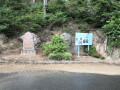
(S/E) From the car park, you’ll see the path right in front of you (leading towards a tourist information sign).
In the car park, there is a tourist information board with plenty of details and a map of the walk. Head to the right along this path, away from the tarmac road.

At the first junction, turn left. At every junction, there’s a signpost marked ‘Tro Lann Droën’ with a small drawing of an otter (see photo).
You can’t go wrong if you follow these signs.
At the next junction, turn left again, then follow the path until you reach a tarmac road.

(1) Cross the road and head straight ahead (the signpost is on the other side of the road on the right).
Follow the path until you reach a field.

(2) Opposite this, the path continues to your left. It’s hidden amongst the trees separating the field in front of you from the field on your left; there’s a sign, but it’s not very visible. Carry on along the path.
At the next junction, turn left again, follow the path to the next junction and head straight on towards a panoramic viewpoint (there’s a sign pointing the way).

(3) The viewpoint is less than 100 metres from the sign and offers a view of a field full of heather – particularly worth seeing when it’s in bloom. Retrace your steps to the junction with the viewpoint sign and turn right. Follow the path to the next junction.

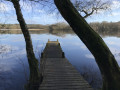
(4) Turn left onto a path that runs almost in a straight line. On this path, on your left, there is a viewing point overlooking a small pond (see photo). A sign will point you towards this viewing point; then continue along the path, which will take you back to the tarmac road.
Cross the road and you’ll find yourself back at the car park (S/E).

Waypoints

  1. S/E : mi 0 - alt. 535 ft - Car park by the roadside
  2. 1 : mi 0.65 - alt. 531 ft - Tarmac road
  3. 2 : mi 0.81 - alt. 522 ft - Path running alongside the field
  4. 3 : mi 1.32 - alt. 509 ft - Signpost to the viewpoint
  5. 4 : mi 1.95 - alt. 538 ft - Crossroads
  6. S/E : mi 2.27 - alt. 535 ft - Car park by the roadside

Notes

- The path is quite muddy in winter.
- Small car park with space for a maximum of 3 to 4 cars.
- The path is fully signposted.
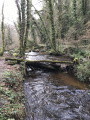
- Several footbridges to cross marshy areas.

Worth a visit

- Several vantage points for observing nature.

Reviews and comments

5 / 5
Based on 1 review

Reliability of the description
5 / 5
Ease of following the route
Non utilisé
Route interest
5 / 5
le piaf
le piaf

Overall rating : 5 / 5

Date of your route : Feb 21, 2022
Reliability of the description : ★★★★★ Very good
Ease of following the route : Not used / Not applicable
Route interest : ★★★★★ Very good
Very busy route : Yes

A lovely walk we did in February 2022. The paths are very well marked and passable even in winter. The only place where we got stuck was at point 3 on the path leading to the viewpoint. There was too much water, so we had to turn back.
The route takes you right into the heart of nature and it’s completely silent.
So thank you, and we’d definitely recommend it.
For your information, it took us 1 hour 20 minutes to complete the route, and we found it helpful to have a walking stick for the slippery sections.

Machine-translated

Other walks in the area

For more walks, use our search engine .

The GPS track and description are the property of this route's author. Please do not copy them without permission.