Lake Peirou

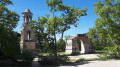
A short, very easy circular loop that can serve as a starting point for several routes. There is a car park at the start, near the lake, which makes a good spot for a picnic.

Details

n°1167166
Creation:
Last update:
Last review:
  • Walking
    Activity: Walking
  • ↔
    Distance: 1.35 mi
  • ◔
    Average duration: 0h 55 
  • ▲
    Difficulty: Easy

  • ⚐
    Back to start: Yes
  • ↗
    Ascent: + 328 ft
  • ↘
    Descent: - 328 ft

  • ▲
    Highest point: 755 ft
  • ▼
    Lowest point: 427 ft

Photos

Description of the walk

Park in the car park near Lac du Peirou.

(S/E) With your back to the car park, head uphill (east) and turn right to reach a Fork in the road.

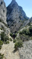
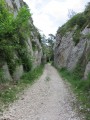
(1) Turn right and follow the clearly marked path which climbs steadily. Ignore the side paths and continue to a water tank situated near the county road.

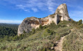
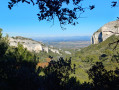
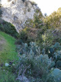
(2) Take the hairpin bend to the left and continue the climb to reach the highest point, which offers a view of the Rocher des Deux Trous.

(3) Start the descent straight ahead and reach a cleared area.

(4) Turn left to rejoin the fork from the outward journey.

(1) Turn right and, following the reverse route of the outward journey, return to the car park near the lake (S/E).

Waypoints

  1. S/E : mi 0 - alt. 427 ft - Car park at the - Lac de Peïrou (Saint-Rémy-de-Provence)
  2. 1 : mi 0.13 - alt. 469 ft - Junction of the circular loop
  3. 2 : mi 0.66 - alt. 676 ft - Citerne
  4. 3 : mi 0.89 - alt. 755 ft - View of the Rocher des Deux Trous - Site de Glanum
  5. 4 : mi 1.11 - alt. 594 ft - Deforested area
  6. S/E : mi 1.35 - alt. 427 ft - Lac du Peirou car park

Worth a visit

Reviews and comments

5 / 5
Based on 1 review

Reliability of the description
5 / 5
Ease of following the route
5 / 5
Route interest
5 / 5
fdurance
fdurance

Overall rating : 5 / 5

Date of your route : Feb 10, 2025
Reliability of the description : ★★★★★ Very good
Ease of following the route : ★★★★★ Very good
Route interest : ★★★★★ Very good
Very busy route : No

A technical hike, as there are via ferrata sections in places. Stunning scenery. A brilliant hike.

Machine-translated

Other walks in the area

For more walks, use our search engine .

The GPS track and description are the property of this route's author. Please do not copy them without permission.