Visorando Visorando
Visorando Visorando
  •  Tools 
    • Walking route planner
    • Import a GPX file
  • Walks
  • Help ↗
  • Visorando Premium
  • Sign up
  • Log in
Loading…
  1. Visorando
  2. Jef13670

Jef13670

Jef13670
Visorando Member

Sign up: 20 May 2018

Published routes 3

Published route(s)

  • List
  • Map

Walking The Eagle's Step

Le Pas de l'Aigle
↔5.57 mi ↗+709 ft ↘-709 ft ◔3h 10 ▲Easy
⚑Departure from Saint-Rémy-de-Provence (Bouches-du-Rhône)
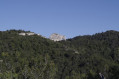
How do you get from the plain or the centre of the Alpilles to a place where you can see as far as the sea, nearly 50 km away, and in good weather, as far as the Cévennes? From the Pas de l'Aigle, with binoculars, you can see very far.
Download PDF  PDF Download GPX  GPX

Walking Lake Peirou

Lac du Peirou
↔1.35 mi ↗+328 ft ↘-328 ft ◔0h 55 ▲Easy
⚑Departure from Saint-Rémy-de-Provence (Bouches-du-Rhône)
A short, very easy circular loop that can serve as a starting point for several routes. There is a car park at the start, near the lake, which makes a good spot for a picnic.
Download PDF  PDF Download GPX  GPX
Back to top
  • Contact
  • Manage my cookies
  • Visorando community

Download the app now and go on an adventure!

App storeApp Store
Google playGoogle Play

Checking services status…© 2026 Visorando
 Loading…