


Refine your search for walks in Lac des Sagnes (Jausiers)
Lac des Sagnes (Jausiers) walks


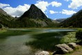
 Towards Lac de Pelouse from Lac des Peatlands
 Visorando Member
 6.87 mi
 +1,900 ft
 -1,896 ft
 4h 50
 Moderate
 Departure from Jausiers (Alpes-de-Haute-Provence)
This hike starts at the beautiful Lac des Sagnes and ends at Lac de Pelouse, passing through woods (full of raspberries when we were there) and mountain pastures (with flocks of sheep and their canine guardians), where you may be lucky enough to spot lots of chamois.
Lac des peatlands starting from Lans
 11.06 mi
+1,739 ft
-1,739 ft
6h 35
Moderate
Departure from Jausiers (Alpes-de-Haute-Provence)
This walk takes you to Lac de Sagnes on foot from the hamlet of Lans. A lovely path through the forest leads to Lac de Sagnes. Return via a DFCI track to complete a circular route.
From Lac des Sagnes to Lac de Pelouse, via the Cime de Pelousette
 8.38 mi
+2,858 ft
-2,838 ft
6h 20
Moderate
Departure from Jausiers (Alpes-de-Haute-Provence)
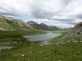
A magnificent, unspoilt valley, and a stunning panoramic view from the Cime de Pelousette at an altitude of 2,757 metres.
Tour of Lac des Sagnes, a peatland lake
 1.39 mi
+46 ft
-46 ft
0h 40
 Easy
Departure from Jausiers (Alpes-de-Haute-Provence)
This lovely, short and easy route offers a touch of adventure: it involves crossing a stream over a few tree trunks forming a makeshift footbridge, then wading across another one with your shoes off – a refreshing experience guaranteed.
Walks near Lac des Sagnes (Jausiers)
Camp des Fourches - Ferrere Refuge
 6.25 mi
+1,381 ft
-2,615 ft
4h 05
Moderate
Departure from Saint-Dalmas-le-Selvage (Alpes-Maritimes)
This first stage of the Tour du Mont Aiga starts from Camp des Fourches on the Bonette road and, via the Col des Fourches, descends into the large Salso Moreno valley, which you climb back up to the Col de Pouriac. From the Col de Pouriac, you quickly reach Bassa di Colombart and then, after a long descent through the mountain pastures, the charming village of Ferrere. You may encounter flocks of sheep in Salso Moreno and, at night, the wolves that prey on them.
Col de Larche – Rifugio della Gardetta
 10.06 mi
+4,019 ft
-2,877 ft
8h 10
 Difficult
Departure from Larche (Alpes-de-Haute-Provence)
On this fourth day, you’ll head briefly back into France to walk through the Orrenaye valley with its magnificent lake. You’ll return to Italy at the Col du Ruburent, then enjoy the beauty of Lake Ruburent as you walk around it. You’ll cross the very rocky Passo della Scaletta, which contrasts with the mountain pastures as you climb to the Passo della Gardetta.
Larche – Chiappera
 Association / Club / Walk leader
 10.20 mi
+3,369 ft
-3,494 ft
7h 35
Difficult
Departure from Larche (Alpes-de-Haute-Provence)
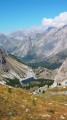
This stage will take you to the pretty Vallon de la Montagnette, then on to the Col des Monges, which offers a stunning view of the Southern Alps.
Larche - Saint-Dalmas-le-Selvage
17.35 mi
+5,102 ft
-5,633 ft
12h 25
Difficult
Departure from Larche (Alpes-de-Haute-Provence)
Étape de la traversée des Alpes par le GR®5 de Larche à Saint Dalmas le Selvage. Passage dans le Parc National du Mercantour sauvage et authentique puis transition entre la Haute Tinée et le Vallon de Jalorgues avec un passage sur la plus haute route d'Europe vers le Col de la Bonnette.
From Bousiéyas to Roya
 19.22 mi
+5,515 ft
-6,716 ft
13h 40
 Very difficult
Departure from Saint-Dalmas-le-Selvage (Alpes-Maritimes)
This seventeenth stage continues the crossing of the Mercantour massif. From Bousiéyas, the GR®5 climbs gently along the forest track, crosses the Tinée valley and reaches the small lake of Lauzarouotte. The path then crosses the Issias valley and reaches the Col de la Colombière. Winding its way down, it plunges straight into the Vallon de la Combe and, hugging the hillside, reaches the Rochepin chalet before returning to the bottom of the Vallon de la Combe and reaching Saint-Dalmas-le-Selvage. The GR®5 follows the Route d’Anelle, crossing a few torrents before reaching the Col d’Anelle. It descends to Saint-Étienne-de-Tinée, which it passes through, before entering the Tinée Valley. At the hamlet of Drogon, it winds its way up the valley side in a series of hairpin bends to the resort of Auron, then passes through woodland to reach the Col du Blainon before descending the sunny side of the Vallon de la Roya and arriving at the “Ma Vieille École” lodge.
From Restefond to Sestrière via Cime de la Plate and Col de la Braïssa
 8.53 mi
+2,067 ft
-3,399 ft
5h 45
Moderate
Departure from Jausiers (Alpes-de-Haute-Provence)
A very beautiful high-mountain hike at the foot of Cime de la Bonette between the Alpes Maritimes and Alpes de Haute Provence. Very little traffic. Magnificent, rocky landscape. The upper Braissette lake is a very beautiful spot for bivouacking.
Le Pra – Vens Mountain Hut
4.69 mi
+2,792 ft
-417 ft
4h 35
Moderate
Departure from Saint-Dalmas-le-Selvage (Alpes-Maritimes)
A first day to stretch your legs and discover the magnificent natural setting of the Vens lakes.
Note: as this route ends in Saint-Étienne-de-Tinée, it is advisable, if possible, to park a second car in Saint-Étienne-de-Tinée to shuttle back to the starting point. Otherwise, allow around €25 for the taxi journey from Saint-Étienne-de-Tinée to Le Pra, but please note that booking is required a few hours in advance.
Bacchi Rossi Refuge - Vens Lakes Refuge
 4.60 mi
+2,359 ft
-807 ft
4h 10
Moderate
Departure from Argentera (Cuneo)
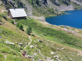
On thissecond day of the Tour of Mount Aiga from the Ferrere Refuge, you will pass through Plan de Belvédère, where there is a tin shelter overlooking the Rio Forneris valley and a fountain. You will also pass below Lake Emma, Monte Peiron at 2,796 m and Pointe Testa di Garbe at 2,749 m, to arrive, after a few hairpin bends, at Col de Fer at 2,584 m. You will then head towards Small Pass of Tortisse and the Vens Refuge, the end of this stage.
Saint-Ours – Larche
 5.26 mi
+1,102 ft
-1,417 ft
3h 25
Moderate
Departure from Meyronnes (Alpes-de-Haute-Provence)
Return to the starting point in Larche via theGRP® de la Frontière Fortifiée.
Small pass of Tortisse – Cime du Fer – Saint-Étienne-de-Tinée
 9.23 mi
+1,955 ft
-6,621 ft
5h 55
Difficult
Departure from Saint-Étienne-de-Tinée (Alpes-Maritimes)
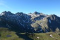
Before descending back to Saint-Etienne-de-Tinée, you climb to the Cime du Fer (2,700 m), which offers a superb 360° view, notably of the Tête de Moïse (3,104 m) and the magnificent Mont Viso (3,841 m).
Then we descend alongside the Tortisse torrent before heading back towards the Lacs de Vens and climbing up to the Lac des Babarottes.
We continue along a section of the Chemin de l’Énergie until we catch sight of Mont Ténibre.
We then finish with a long descent (-1,200 m) down to the village.