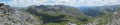
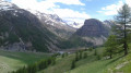
From Lac des Sagnes to Lac de Pelouse, via the Cime de Pelousette

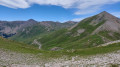
A magnificent, unspoilt valley, and a stunning panoramic view from the Cime de Pelousette at an altitude of 2,757 metres.

Details

3100553
Creation:
Last update:
Last review:
  • Walking
    Activity: Walking
  • ↔
    Distance: 8.38 mi
  • ◔
    Average duration: 6h 20 
  • ▲
    Difficulty: Moderate

  • ⚐
    Back to start: Yes
  • ↗
    Ascent: + 2,858 ft
  • ↘
    Descent: - 2,838 ft

  • ▲
    Highest point: 9,039 ft
  • ▼
    Lowest point: 6,217 ft

Photos

Description of the walk

From Jausiers, take the road to the Col de la Bonnette. Just before the hamlet of Lans, turn left onto the Vallon des Sagnes track. About ten kilometres further on, park in the small car park.

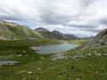
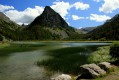
(S/E) Cross the bridge over the Torrent d’Abriès, then walk along the left-hand side of the lake, following the path which, at the start, passes in front of the small hydroelectric power station and leads to the Vallon de Pelouse.

(1) A little further up the valley, turn right. The path becomes a bit overgrown and is less obvious to follow in places, but it is easy to make out. Cross the Torrent d’Abriès, navigate a few hairpin bends, then head north to the Col de Pelouse (2,553 m).

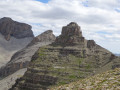
(2) From the pass, head towards the Cime de Pelousette (2,757 m) along a better-marked path. Reach the summit, where you’ll find the ruins of the Fortin de Pelousette.

(3) After exploring the ruins, go round the fort heading east. Ignore the path on the right which descends to the Col des Fourches and reach the Col de Pelousette (2,720 m).

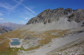
(4) Turn left to descend to the path leading to Lac de Pelouse, taking great care as this section is off-trail. Follow this path to the right to reach the lakeshore.

(5) From the far end of the lake, continue down into the valley, heading north-west.

(1) Carry on straight ahead along the path you took on the way up to reach the car park (S/E).

Waypoints

  1. S/E : mi 0 - alt. 6,217 ft - Lac des Sagnes (Jausiers)
  2. 1 : mi 1.75 - alt. 7,149 ft - Junction of the circular loop – Vallon de Pelouse
  3. 2 : mi 3.41 - alt. 8,379 ft - Col de Pelouse (2553m)
  4. 3 : mi 4.08 - alt. 9,032 ft - Cime de Pelousette (2757m)
  5. 4 : mi 4.27 - alt. 8,835 ft - Col de Pelousette (2720m)
  6. 5 : mi 5.3 - alt. 8,025 ft - Lac de Pelouse
  7. S/E : mi 8.38 - alt. 6,217 ft - Lac des Sagnes (Jausiers)

Notes

Much of the route is not shown on IGN and OSM maps. A mobile app will be a useful aid.
The off-trail section after (4) requires caution but will pose no problem for experienced walkers.

This route passes through a protected area, which may be subject to special regulations:

Reviews and comments

4.7 / 5
Based on 3 reviews

Reliability of the description
5 / 5
Ease of following the route
4.3 / 5
Route interest
4.7 / 5
Manue BZH
Manue BZH

Overall rating : 4.7 / 5

Date of your route : Aug 18, 2026
Reliability of the description : ★★★★★ Very good
Ease of following the route : ★★★★☆ Good
Route interest : ★★★★★ Very good
Very busy route : No

I followed the route in the direction suggested on Visorando. The section between points 4 and 5 is tricky, particularly the start, where you have to descend in a straight line down a scree slope. I would recommend turning back once you’ve reached the summit of Pelousette (point 3) to rejoin the path you came up on, thereby avoiding this descent down the scree slope just after point 4.*
I did this walk on Sunday 2 August 2026 and there were very few people about. I also went round Lac des Sagnes on the left on the way back, to avoid taking the same route as on the way there.

Machine-translated

Syl20R
Syl20R
• Edited:

Overall rating : 4.7 / 5

Date of your route : Aug 25, 2022
Reliability of the description : ★★★★★ Very good
Ease of following the route : ★★★★☆ Good
Route interest : ★★★★★ Very good
Very busy route : No

A little-used path beyond the lake. Follow the cairns carefully as you descend through the scree slope from the summit towards Lac de Pelouse.
On the return journey, go round the left-hand side of Lac des Sagnes and do not take the same route as on the way there. The scenery is well worth it as you enter the peatland (be careful: there is a ford halfway along the route, which may be more difficult in winter)

Machine-translated

Christian Delale
Christian Delale

Overall rating : 4.7 / 5

Date of your route : Jul 26, 2020
Reliability of the description : ★★★★★ Very good
Ease of following the route : ★★★★★ Very good
Route interest : ★★★★☆ Good
Very busy route : No

I found it to be a lovely route, through a pleasant little valley with magnificent views.
I did, however, have two minor reservations.
Firstly, I found this route more difficult than advertised.
In particular, between points 4 and 5 – that is, from the Col de Pelousette almost all the way to Lac de Pelouse – you have to follow a 1.5 km path along the mountainside through scree and rocky ground, which I found hard on my feet and which spoilt some of the enjoyment. Incidentally, this path, which appeared on older maps, is no longer shown on IGN maps. And unfortunately, it seems there is no other way to complete this lovely circular route.
Secondly, to reach the start of the walk, you have to follow a track for 10 km there and the same again on the way back, which also takes away a good bit of the fun.
Access via the track to the start of the walk is clearly marked in the guidebook, but the long stretch along the mountain-side path might perhaps require clearer signposting.

Machine-translated

Other walks in the area

For more walks, use our search engine .

The GPS track and description are the property of this route's author. Please do not copy them without permission.