


Refine your search for walks in Lac des Pres Soubeyrand ou Lac Miroir
Lac des Pres Soubeyrand ou Lac Miroir walks


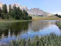
 Lakes Miroir and Sainte-Anne and the Charanchettes viewpoint in Ceillac
 Visorando Member
 8.60 mi
 +2,949 ft
 -2,936 ft
 6h 30
 Difficult
 Departure from Ceillac (Hautes-Alpes)
A circular route that takes in the valley’s most beautiful spots whilst avoiding the ski resort facilities.
Most of the hike is through woodland and the route follows theGR® trails, so the gradients are gentle and the paths are in good condition; moreover, the signposting in the Queyras is excellent.
GTA, Great Alpine Crossing via the GR®5 and GR®55. From Lake Geneva to Nice.
 342.76 mi
+99,633 ft
-100,915 ft
21 days
 Very difficult
Departure from Saint-Gingolph (Haute-Savoie)
The Grande Traversée des Alpes (GTA) mainly follows the GR®5, with a few possible variations such as the crossing of the Haute Vanoise via the GR®55 and the Via Alpina, which this route takes instead of the GR®5 route via the Col de l’Iseran. It crosses the French Alps from north to south, from Saint-Gingolph to Nice. The guide includes web links to the many accommodation options along the route or nearby: mountain huts, lodges, campsites, cabins and shelters, excluding hotels. Although this guidebook details the GTA as a three-week trek, it can be adapted to suit your own pace, with stages of varying lengths, either completed in one go or in sections over several years. This journey, fuelled by the joy of freedom in unspoilt natural surroundings, will remain a superb and unforgettable experience, offering, moreover, the opportunity to meet many people with whom you can share this same passion for the mountains.
From Ceillac to Fouillouse
 13.37 mi
+4,452 ft
-4,216 ft
10h 00
Difficult
Departure from Ceillac (Hautes-Alpes)
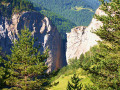
This fifteenth stage crosses the Escreins massif (not to be confused with the Écrins massif) and, via the Ubaye valley, enters the Chambeyron valley. From the Refuge de la Cime, the route—off the GR®5—crosses the Torrent du Mélezet valley and climbs up the Pré Girardin valley via the ski runs; then, on the plateau, it skirts the rocky ridge overlooking Lac Miroir, reaches the lake and rejoins the GR®5. The route climbs up the valley between the shoulder of the Pic des Heuvières and the Crête de Coste Belle, passing the small pass of Sainte-Anne and then the lake of the same name before reaching the Col Girardin. It descends towards a basin, where the Torrent des Séchoirs has its source, and follows it. Clinging to the side of a steep slope, it joins the D25 road in the upper Ubaye valley and continues downstream, alternating between the road and paths close to the river. It leaves the D25 for the Fouillouse road, passes the vertiginous Pont du Châtelet, a tunnel and, via a path, reaches the hamlet of Fouillouse.
Walks near Lac des Pres Soubeyrand ou Lac Miroir
Ceillac - Le Cros
6.30 mi
+3,386 ft
-2,585 ft
5h 50
Difficult
Departure from Ceillac (Hautes-Alpes)
This is the fourth and final stage of this journey between Queyras (05) and Ubaye (04). Passing through the Col des Estronques brings you back to the starting point in the hamlet of Cros.
Ceillac - Basse Rua
8.29 mi
+4,613 ft
-4,219 ft
7h 50
Difficult
Departure from Ceillac (Hautes-Alpes)
Passing by Pic d'Escreins, make the connection between the Cristillan valley and the Val d'Escreins.
Ceillac – Saint-Véran
 8.54 mi
+4,252 ft
-2,986 ft
7h 40
Difficult
Departure from Ceillac (Hautes-Alpes)
A good warm-up for thisfirst stage. Thefirst pass is the Col des Estronques, followed by a round trip to the nearby summit of the Tête de la Jacquette, where an exceptional panorama awaits you, taking in the Pics de la Font Sancte, the Aiguille de Chambeyron, the Bric de Rubren, the Peouvou and, to the north, the Grand Glaiza and the Rochebrune.
Ceillac - Saint Véran
 7.82 mi
+4,321 ft
-3,045 ft
7h 20
 Moderate
Departure from Ceillac (Hautes-Alpes)
The third stage is entirely on theGR®58, heading towards the rising sun.
Ceillac - Maljasset
 8.18 mi
+3,694 ft
-2,799 ft
7h 00
Difficult
Departure from Ceillac (Hautes-Alpes)
A stage of the Queyras Alpine crossing to reach the Haute Ubaye Valley, including a section via Lake Sainte-Anne and the Col Girardin.
Tête de Rissace
8.53 mi
+2,933 ft
-4,075 ft
6h 30
Difficult
Departure from Ceillac (Hautes-Alpes)
This summit can be tackled as a round trip or as a traverse. The route described below is the traverse option: leave a car at the Mélezet ski resort car park.
Basse Rua - Maljasset
10.62 mi
+4,688 ft
-4,186 ft
9h 00
Very difficult
Departure from Vars (Hautes-Alpes)
There is a long crossing before the Col des Houerts, which takes you into the Ubaye Valley.
Maljasset - Ceillac
9.92 mi
+3,320 ft
-4,242 ft
7h 25
Difficult
Departure from Saint-Paul-sur-Ubaye (Alpes-de-Haute-Provence)
The passage between the two departments of Alpes de Haute Provence and Hautes Alpes is via the famousGR®5, which supports theGRP® of the Tour de la Font Sancte on this section.
Trek around Chambeyron Mountain Range (4) Maljasset - Refuge Campo Base
 9.28 mi
+2,408 ft
-3,304 ft
6h 20
Difficult
Departure from Saint-Paul-sur-Ubaye (Alpes-de-Haute-Provence)
Quite a long stage but a steady route. A climb up to Col de Mary then a long downhill hike all the way to the shelter, in Chiaperra, Italy.
Maljasset - Ceillac
 7.50 mi
+2,808 ft
-3,678 ft
5h 55
Difficult
Departure from Saint-Paul-sur-Ubaye (Alpes-de-Haute-Provence)
Return to Queyras by crossing the Col Girardin via a path that starts off quite steep but then levels out before ending with large hairpin bends that finish at the pass. This is followed by a long descent past the lakes, which reflect the famous Font Sancte, the highest point in Queyras.