From the Refuge de l’Oule to the village of Artigues

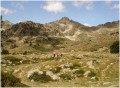
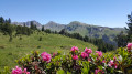
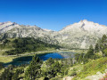
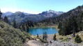
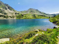
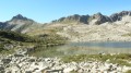
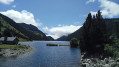
Second day of a three-day circular route. You can book a packed lunch if you’re spending the night at the Refuge de l’Oule, as well as top up your water flasks. Afterwards, the trail is lovely as it runs alongside the lake. It passes through the Col de Bastanet, with magnificent lakes all along the way. At the Campana de Cloutou mountain refuge, you can sit at a table to eat your packed lunch and refill your water flask. The path then descends, passing by pretty lakes, to the village of Artigues.

Details

92525346
Creation:
Last update:
Last review:
  • Walking
    Activity: Walking
  • ↔
    Distance: 10.75 mi
  • ◔
    Average duration: 7h 00 
  • ▲
    Difficulty: Moderate

  • ⚐
    Back to start: No
  • ↗
    Ascent: + 2,365 ft
  • ↘
    Descent: - 4,377 ft

  • ▲
    Highest point: 8,212 ft
  • ▼
    Lowest point: 3,937 ft

Description of the walk

(S) Setting off from the Refuge de l’Oule, head up to the right immediately as you leave the refuge, following the path. Walk alongside Lac de l’Oule, with the path running above the lake. Continue towards the end of the lake and pass close to the designated bivouac area.

(1) Take the GR®10 path on the right, which climbs quite steeply.

(2) At the fork, leave the GR®10 on your right. Turn left onto the GR®10 Accès, heading due north, passing by the Bastan Lakes: the Lower Lake, the Middle Lakes and the Upper Lake, towards the Bastan Refuge.

(3) (This refuge is undergoing major renovation work in 2026 and is not available.) Continue on the GR® Accès, heading northwards up towards the pass.

(4) Cross the Col de Bastanet and descend, then continue close to the lakes: Lac de la Hourquette and Lac du Campana. Above Lac du Campana lies the recently built Campana de Cloutou mountain refuge. (Opportunity to have a picnic and top up your water supplies.)

(5) Leave the refuge and continue along the GR®10 Access route to the village of Artigues, passing close to Lac de Gréziolles and other small, equally pretty lakes. Walk through the village to the municipal campsite (E).

Waypoints

  1. S : mi 0 - alt. 5,965 ft - Refuge de l’Oule
  2. 1 : mi 1.21 - alt. 5,968 ft - GR10
  3. 2 : mi 2.25 - alt. 6,936 ft - Junction. Access to the GR10
  4. 3 : mi 3.3 - alt. 7,365 ft - Refuge de Bastan
  5. 4 : mi 4.44 - alt. 8,212 ft - Bastanet Pass
  6. 5 : mi 5.78 - alt. 7,283 ft - Campana de Cloutou Mountain Hut
  7. E : mi 10.75 - alt. 3,937 ft - Artigues Municipal Campsite - Station de ski

Notes

  • You can top up your water supplies at the Refuge de l’Oule and the Refuge de Campana de Cloutou.
  • You can have a picnic at the Campana de Cloutou mountain refuge.
  • You can camp at the Artigues Municipal Campsite or at the Auberge des Cascades lodge.

Worth a visit

The trail passes by numerous lakes.

Always be cautious and plan ahead when you're outdoors. Visorando and the author of this route cannot be held responsible for any accidents occurring on this route.

The GR® and PR® markings are the intellectual property of the Fédération Française de Randonnée Pédestre.

Other walks in the area

For more walks, use our search engine .

The GPS track and description are the property of this route's author. Please do not copy them without permission.