


Refine your search for walks in Lac de Savine (2450m)
Lac de Savine (2450m) walks


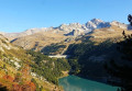
 Lake Savine and the Col Clapier or Col de Savine as seen from Le Suffret
 Visorando Member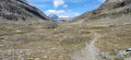
 10.72 mi
 +2,887 ft
 -2,867 ft
 7h 25
7h 25
 Moderate
 Departure from Bramans (Savoie)
A long hike offering the chance to follow in the (potential, as they are unproven) footsteps of Hannibal and his elephants during his war against the Roman Empire.
Aside from this historical fact, this walk winds through the beautiful and wild Savine valley, leading to the lake of the same name and to the Col du Clapier or Col de Savine on the France–Italy border.
Walks near Lac de Savine (2450m)
From the Ambin Refuge to Le Planey
 Association / Club / Walk leader
 11.65 mi
+3,363 ft
-5,233 ft
8h 15
11.65 mi
+3,363 ft
-5,233 ft
8h 15
 Difficult
Departure from Bramans (Savoie)
Difficult
Departure from Bramans (Savoie)
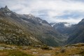
A very beautiful route amongst glaciers and lakes, which crosses the Italian border (beautiful view of the Val di Suza) and returns to France via the Col Clapier, which Hannibal and his elephants probably passed through.
This route follows on from the hike “From the Bramanette Refuge to the Ambin Refuge”, but can easily be done starting from the Ambin Refuge alone.
The Refuge de Bramanette
 2.24 mi
+1,575 ft
-138 ft
2h 25
Moderate
Departure from Bramans (Savoie)
2.24 mi
+1,575 ft
-138 ft
2h 25
Moderate
Departure from Bramans (Savoie)
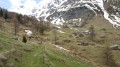
This short hike is the starting point for a magnificent three-day trek between Haute Maurienne and Val de Suze (Italy), with beautiful lakes and numerous small glaciers.But the setting and the welcome at the Refuge de Bramanette are such that they alone justify spending the night there and descending back down to the valley the next day!
From the Bramanette Refuge to the Ambin Refuge
 8.50 mi
+4,186 ft
-3,665 ft
7h 35
Difficult
Departure from Bramans (Savoie)
8.50 mi
+4,186 ft
-3,665 ft
7h 35
Difficult
Departure from Bramans (Savoie)
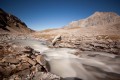
A beautiful route, sometimes off the beaten track or on poorly marked paths. From the top of the passes, you can see both the peaks of the Vanoise (the Dent Parachée) and the Barre des Ecrins.This hike follows on from the "Le refuge de Bramanette" route.
Aussois - Valfréjus
 12.42 mi
+3,225 ft
-2,923 ft
8h 30
Difficult
Departure from Aussois (Savoie)
12.42 mi
+3,225 ft
-2,923 ft
8h 30
Difficult
Departure from Aussois (Savoie)
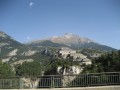
Étape de la Grande Traversée des Alpes d'Aussois (Vanoise) à Valfréjus (Maurienne).
 The Sentier des Sources snowshoe trail from the cable car
1.97 mi
+236 ft
-801 ft
1.5 hrs
 Easy
Departure from Villarodin-Bourget (Savoie)
Easy
Departure from Villarodin-Bourget (Savoie)
A lovely, easy walk in the peaceful forest, starting at the top of the gondola lift and returning by chairlift.
Map of Amont – Roc de la Pêche mountain hut
 9.99 mi
+3,852 ft
-4,390 ft
7h 55
Difficult
Departure from Aussois (Savoie)
9.99 mi
+3,852 ft
-4,390 ft
7h 55
Difficult
Departure from Aussois (Savoie)
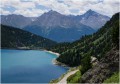
The walk begins with a gentle, rural route to the Fond de l’Aussois mountain hut, followed by a steep climb to the Col de l’Aussois.
Refuge de la Fournache - Refuge de l'Orgére
 5.91 mi
+2,336 ft
-3,750 ft
4h 45
Difficult
Departure from Aussois (Savoie)
5.91 mi
+2,336 ft
-3,750 ft
4h 45
Difficult
Departure from Aussois (Savoie)
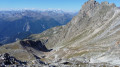
The final stage of this fabulous route from the Refuge de la Fournache to the Refuge de l'Orgére, via the Col de la Masse. The ascent of this pass is difficult due to the steep gradient. The end of the ascent and a good part of the descent are very technical. The view from the pass is absolutely exceptional; you will be able to see the Écrins and the Thabor massif.
Refuge de l'Arpont - Refuge de la Fournache
 10.62 mi
+2,533 ft
-2,365 ft
7h 05
Difficult
Departure from Termignon (Savoie)
10.62 mi
+2,533 ft
-2,365 ft
7h 05
Difficult
Departure from Termignon (Savoie)
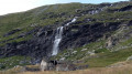
Stage7 of this journey takes you from the Refuge de l’Arpont to the very welcoming Refuge de la Fournache. This stage skirts around the Dent Parrachée. This is the last time you will see the Vanoise glaciers. This trail, which is at times technical and challenging due to its elevation gain, overlooks the Maurienne Valley, Val Cénis and, on the other side, Italy. You will also catch a glimpse of the Thabor, before arriving at the bottom of Aussois, with its two lakes and the Aussois dam.
From the Refuge de l'Arpont to the Refuge de l'Orgère
 17.46 mi
+3,816 ft
-5,043 ft
11h 20
Difficult
Departure from Termignon (Savoie)
17.46 mi
+3,816 ft
-5,043 ft
11h 20
Difficult
Departure from Termignon (Savoie)
This tenth stage completes the crossing of the Vanoise massif. From the Refuge de l’Arpont, the GR®5 descends to the hamlet of Le Mont, crosses the Combe d’Enfer, climbs the flank of the Crête de Belle Place and crosses the valley of the Ruisseau de Bonne Nuit to reach the ruins of the hamlet of La Loza. It follows the contour of a rocky ridge like a balcony and descends via a few hairpin bends towards a ravine, then continues almost level through the Bellecôte valley. The path passes beneath the chairlifts of the Aussois ski resort and runs alongside the Plan Sec and La Fournache mountain huts. It skirts around Lac du Plan d’Amont and runs along the upper edge of Lac du Plan d’Aval before crossing the Col du Barbier. It climbs towards the Barbier chalets and descends to the hamlet of l’Orgère to reach the Refuge de l’Orgère.
Refuge de la Chardouse - Pamplinet
10.60 mi
+3,166 ft
-3,681 ft
7h 40
 Very difficult
Departure from Oulx (Torino)
Very difficult
Departure from Oulx (Torino)
This is the first stage of a journey that will take you across France, following the 45th parallel as closely as possible (within 10 km). To truly cross France and avoid going back and forth, the starting point is in Italy. However, it is possible to start from Pamplinet and climb up to the Col de Désertes to start from the French-Italian border.