Lac de la Douche from Le Casset

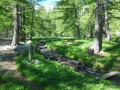
A classic family hike. Most of the trail is in the forest, sheltered from the sun, except at the end of the trail to reach the lake.
The trail runs alongside the Parc des Écrins and enters it in places. Please note the National Park regulations, in particular the ban on dogs, even on a leash (see the notice at the start of the trail).

Details

3254730
Creation:
Last update:
Last review:
  • Walking
    Activity: Walking
  • ↔
    Distance: 4.98 mi
  • ◔
    Average duration: 3h 25 
  • ▲
    Difficulty: Moderate

  • ⚐
    Back to start: Yes
  • ↗
    Ascent: + 1,319 ft
  • ↘
    Descent: - 1,319 ft

  • ▲
    Highest point: 6,257 ft
  • ▼
    Lowest point: 4,938 ft

Photos

Description of the walk

After Le Monêtier-les-Bains, continue towards the Col du Lautaret and turn left onto the D300 towards Le Casset. Park at the entrance to the village (plenty of parking spaces).

(S/E) Cross the village of Le Casset and reach the bridge over the Guisane. Cross it and continue opposite on the track supporting theGR®54, also mentioned on the signpost. Follow the red and white markings. Continue along the track; it is also possible to cut the bends by taking the paths. Reach the Pont du Clot du Gué.

(1) Take this bridge and then turn left to continue on theGR®54. You will reach a picnic area near the Glacier du Casset torrent.

(2) Stay on theGR® (marked trail) or take the grassy path on the right, keeping to the right bank of the Petit Tabuc torrent. You will reach a stony area.

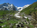
(3) Continue climbing, taking care as the path becomes increasingly stony. You will reach a flatter section which will take you between some boulders to Lac de la Douche.

(4) Take the same route in reverse to return to the Casset car park (S/E).

Waypoints

  1. S/E : mi 0 - alt. 4,938 ft - Village of Casset. Head towards the bridge over the - Guisane (rivière)
  2. 1 : mi 0.8 - alt. 5,138 ft - Clot du Gué bridge
  3. 2 : mi 1.61 - alt. 5,545 ft - Option Gr or path on the right
  4. 3 : mi 2.13 - alt. 6,014 ft - Very stony section in the forest
  5. 4 : mi 2.45 - alt. 6,250 ft - Lac de la Douche
  6. S/E : mi 4.98 - alt. 4,938 ft - Village of Casset

Notes

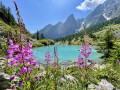
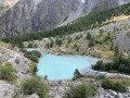
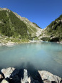
(4) You can walk around the lake and/or take a break. At the edge of Lac de la Douche, numerous benches have been built using makeshift materials (wood, stones). The lake lies at the foot of a glacier tongue and is fed by the Petit Trabuc torrent.
Depending on the time of day and the season, the lake takes on different colours and reflections. The Col d'Arsine and the mountains are reflected in the lake. The main colour of the lake is a silty blue.
The hike can continue towards the Col d'Arsine and Villar d'Arêne for the more experienced and better equipped.
See here

Worth a visit

You can plan a picnic with or without the children.
There are numerous waterfalls and streams. You can enjoy the peace and quiet of nature if there are not too many people around.
In autumn, the larch trees turn golden.

Always be cautious and plan ahead when you're outdoors. Visorando and the author of this route cannot be held responsible for any accidents occurring on this route.

The GR® and PR® markings are the intellectual property of the Fédération Française de Randonnée Pédestre.

Reviews and comments

4.8 / 5
Based on 38 reviews

Reliability of the description
4.9 / 5
Ease of following the route
4.9 / 5
Route interest
4.6 / 5
fuster23
fuster23

Overall rating : 5 / 5

Date of your route : Sep 02, 2026
Reliability of the description : ★★★★★ Very good
Ease of following the route : ★★★★★ Very good
Route interest : ★★★★★ Very good
Very busy route : Yes

A lovely walk along the stream through the forest.

Machine-translated

User 24978764

Overall rating : 4.5 / 5

Date of your route : Aug 10, 2026
Reliability of the description : Not used / Not applicable
Ease of following the route : ★★★★★ Very good
Route interest : ★★★★☆ Good
Very busy route : Yes

It was early August, so quite busy. A very easy walk to follow, along a wide path. It’s a bit of a climb, but you reach the lake and it’s well worth it. Everyone’s having a picnic and some are dipping their feet in the water. 🥶 It’s cool, even in August.
Toilets are available near the start of the route, on the path.

Machine-translated

Bouchon58
Bouchon58

Overall rating : 5 / 5

Date of your route : Aug 24, 2026
Reliability of the description : ★★★★★ Very good
Ease of following the route : ★★★★★ Very good
Route interest : ★★★★★ Very good
Very busy route : Yes

A lovely, cool walk along a mountain stream.

Machine-translated

Perry36
Perry36
• Edited:

Overall rating : 5 / 5

Date of your route : Jul 31, 2026
Reliability of the description : ★★★★★ Very good
Ease of following the route : ★★★★★ Very good
Route interest : ★★★★★ Very good
Very busy route : Yes

A lovely walk along the GR54 trail. The Casset Glacier is still visible.
No mobile signal (Free network)
Toilets along the route + picnic tables

Machine-translated

User 2213522

Overall rating : 3.7 / 5

Date of your route : Sep 15, 2025
Reliability of the description : ★★★☆☆ Average
Ease of following the route : ★★★★☆ Good
Route interest : ★★★★☆ Good
Very busy route : Yes

At times, the recorded mileage is underestimated... and there are no problems with areas not covered by satellite

Machine-translated

User 26415041

Overall rating : 5 / 5

Date of your route : Sep 01, 2025
Reliability of the description : ★★★★★ Very good
Ease of following the route : ★★★★★ Very good
Route interest : ★★★★★ Very good
Very busy route : Yes

Top hike!

Machine-translated

J.rocci
J.rocci

Overall rating : 5 / 5

Date of your route : Aug 18, 2025
Reliability of the description : ★★★★★ Very good
Ease of following the route : ★★★★★ Very good
Route interest : ★★★★★ Very good
Very busy route : Yes

Very nice hike. The path is three-quarters shaded and follows a beautiful stream. The lake is truly magnificent, but the downside is the crowds. Lots of people making noise...

Machine-translated

Pat_rando83
Pat_rando83

Overall rating : 5 / 5

Date of your route : Aug 04, 2025
Reliability of the description : ★★★★★ Very good
Ease of following the route : ★★★★★ Very good
Route interest : ★★★★★ Very good
Very busy route : Yes

A pleasant route along rivers and streams, with lots of raspberries 😋

Machine-translated

Bia
Bia
• Edited:

Overall rating : 5 / 5

Date of your route : Jul 24, 2025
Reliability of the description : ★★★★★ Very good
Ease of following the route : ★★★★★ Very good
Route interest : ★★★★★ Very good
Very busy route : Yes

a beautiful site that is well worth a visit and can be extended
Machine-translated

bertrandbrigitte84
bertrandbrigitte84

Overall rating : 5 / 5

Date of your route : Jul 21, 2025
Reliability of the description : ★★★★★ Very good
Ease of following the route : ★★★★★ Very good
Route interest : ★★★★★ Very good
Very busy route : Yes

Round trip hike along the same path.
Three-quarters of the route is shaded and runs alongside a stream.
It's very pleasant to picnic around the small lake at La Douche.

Machine-translated

tcheuma
tcheuma

Overall rating : 4.7 / 5

Date of your route : Aug 10, 2024
Reliability of the description : ★★★★★ Very good
Ease of following the route : ★★★★★ Very good
Route interest : ★★★★☆ Good
Very busy route : Yes

This is a very popular route because the lake is relatively accessible. The hike climbs steadily – exposed to the sun – except for the last kilometre, which is steeper but fortunately in the shade. I did this hike one afternoon when it was 32°C and I must admit that I struggled on the last climb, but I'm not getting any younger... The arrival at the lake is the reward for all our efforts. You have to walk around it to fully appreciate its colour.

Machine-translated

Herbi
Herbi

Overall rating : 5 / 5

Date of your route : Jun 20, 2025
Reliability of the description : ★★★★★ Very good
Ease of following the route : ★★★★★ Very good
Route interest : ★★★★★ Very good
Very busy route : Yes

Hike done in June. Lots of flowers on the trail at this time of year. When you arrive at the lake, you find yourself below the Casset Glacier.

Machine-translated

LETEVE Claudie
LETEVE Claudie

Overall rating : 5 / 5

Date of your route : Jun 23, 2025
Reliability of the description : ★★★★★ Very good
Ease of following the route : ★★★★★ Very good
Route interest : ★★★★★ Very good
Very busy route : Yes

A steady climb all the way to the top. The last kilometre and a half is even tougher. Very rocky. The reward is at the top, where you can picnic by the lake. Some will dip their feet in, but not for long...

Machine-translated

Hugo38500
Hugo38500

Overall rating : 4.7 / 5

Date of your route : Aug 11, 2024
Reliability of the description : ★★★★★ Very good
Ease of following the route : ★★★★★ Very good
Route interest : ★★★★☆ Good
Very busy route : Yes

A beautiful hike in the shade of larch trees, ending at a lake with stunning colours.
Please note that this hike is easy to access and therefore extremely popular.

Machine-translated

Evrat
Evrat

Overall rating : 4 / 5

Date of your route : Aug 12, 2024
Reliability of the description : ★★★★☆ Good
Ease of following the route : ★★★★☆ Good
Route interest : ★★★★☆ Good
Very busy route : Yes

Machine-translated

Other walks in the area

For more walks, use our search engine .

The GPS track and description are the property of this route's author. Please do not copy them without permission.