The Puy Chevalier Mountain circular loop

A long circular walk starting from Monêtier-les-Bains, passing by the former Moulette mine and then along the Chemin de Roy balcony path, marked by theGR®50. Return via a steep descent, passing close to the Sainte-Anne Chapel overlooking Monêtier-les-Bains.

Details

26256246
Creation:
Last update:
Last review:
  • Walking
    Activity: Walking
  • ↔
    Distance: 7.16 mi
  • ◔
    Average duration: 5h 35 
  • ▲
    Difficulty: Moderate

  • ⚐
    Back to start: Yes
  • ↗
    Ascent: + 2,644 ft
  • ↘
    Descent: - 2,631 ft

  • ▲
    Highest point: 7,677 ft
  • ▼
    Lowest point: 5,089 ft

Description of the walk

Park in the upper car park at Monêtier-les-Bains at the end of the Chemin de Puy Chevalier.

(S/E) Continue uphill along the wide track, passing the mobile phone masts, until you reach a junction of tracks with a large signpost.

(1) Turn right where the track quickly turns into a footpath.

(2) Continue the climb along a series of hairpin bends. Follow the yellow markings, ignoring all paths to the right or left, to reach a forest hut. Carry on for a few metres until you reach a crossroads with a signpost for Rocher des Chiens.

(3) Turn left towards Vallon de la Moulette and begin a more direct ascent here, first along a footpath and then along a wider track. You’ll emerge into the Vallon de la Moulette at the junction with the Chemin du Roy, where there’s a signpost for Près du Vallon.

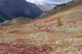
(4) Turn left here onto theGR®50, marked in white and red. Go round the old mine via a wide left-hand bend, then continue along this path. You will soon come to another junction marked by a cairn.

(5) Leave the descending path on your left and keep to the right on theGR®. Follow a long, balcony-like traverse to reach the Grand Vallon junction.

(6) Turn left downhill, following the numerousGR® markings. After a series of hairpin bends, you’ll reach a junction in a small valley with a signpost for Clôt de la Selle.

(7) Leave theGR® here and turn left towards Retour Monêtier. Cross the Torrent de la Pisse valley and come to another junction

(8) Turn right and begin a steeper descent, passing close to the Sainte-Anne Chapel. A few metres further on, you’ll come to a wider track near some chalets.

(9) Take this track and continue the descent, crossing the stream via a footbridge before reaching the junction you passed on the way out.

(1) Turn right and retrace your steps along the route you took on the way there to return to the upper car park at Monêtier-les-Bains (S/E).

Waypoints

  1. S/E : mi 0 - alt. 5,089 ft - Upper car park at Monêtier-les-Bains
  2. 1 : mi 0.2 - alt. 5,285 ft - Crossroads at the end of the circular loop
  3. 2 : mi 0.39 - alt. 5,509 ft - Junction
  4. 3 : mi 1.32 - alt. 6,217 ft - Rocher des Chiens
  5. 4 : mi 2.33 - alt. 6,955 ft - Near the Vallon
  6. 5 : mi 2.94 - alt. 7,313 ft - Crossroads with cairn
  7. 6 : mi 4.25 - alt. 7,671 ft - Grand Vallon junction
  8. 7 : mi 4.98 - alt. 7,142 ft - Clôt de la Selle
  9. 8 : mi 5.56 - alt. 6,991 ft - Path junction
  10. 9 : mi 6.55 - alt. 5,682 ft - Chalets
  11. S/E : mi 7.16 - alt. 5,089 ft - Upper car park at Monêtier-les-Bains

Notes

Before (3), the fountain at the forest hut is, unfortunately, dry at the end of summer 2022.

Worth a visit

Always be cautious and plan ahead when you're outdoors. Visorando and the author of this route cannot be held responsible for any accidents occurring on this route.

The GR® and PR® markings are the intellectual property of the Fédération Française de Randonnée Pédestre.

Reviews and comments

4.5 / 5
Based on 2 reviews

Reliability of the description
4.5 / 5
Ease of following the route
4.5 / 5
Route interest
4.5 / 5
JPC07
JPC07

Overall rating : 4 / 5

Date of your route : Aug 23, 2026
Reliability of the description : ★★★★☆ Good
Ease of following the route : ★★★★☆ Good
Route interest : ★★★★☆ Good
Very busy route : Yes

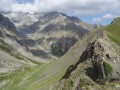
Given the ratio of the walk’s length to the estimated time taken and the elevation gain, this walk is definitely a ‘red’ one. Apart from a few sections through the woods that are of little interest, the majority of the route along the ridge offers much-appreciated views of the Écrins and the GUISANNE valley. However, the final descent from point 8 is tough: steep and often stony.
If we were to do it again, we’d do it in the opposite direction to the description.

Machine-translated

LaLDD
LaLDD

Overall rating : 5 / 5

Date of your route : Jun 18, 2024
Reliability of the description : ★★★★★ Very good
Ease of following the route : ★★★★★ Very good
Route interest : ★★★★★ Very good
Very busy route : No

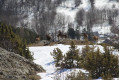
In mid-June, there were still two snowfields to cross on this route. Otherwise, it was a lovely walk.

Machine-translated

Other walks in the area

For more walks, use our search engine .

The GPS track and description are the property of this route's author. Please do not copy them without permission.