Circular walk from Boussières to Busy via Notre-Dame du Mont

A lovely circular loop around Boussières that will take you to the Monsieur Canal cut-through at Thoraise. After a stretch along the River Doubs, beneath the ruins of Montferrand Castle, you’ll head back up to Busy via the hamlet of Le Moulinot. You’ll then reach Vorges via the old Roman road, which offers a lovely view over the Doubs valley.

Details

n°1005812
Creation:
Last update:
Last review:
  • Walking
    Activity: Walking
  • ↔
    Distance: 9.49 mi
  • ◔
    Average duration: 5h 15 
  • ▲
    Difficulty: Moderate

  • ⚐
    Back to start: Yes
  • ↗
    Ascent: + 984 ft
  • ↘
    Descent: - 984 ft

  • ▲
    Highest point: 1,289 ft
  • ▼
    Lowest point: 748 ft
  • ⚐ Country: France
  • ⚐ City: Boussières (25320)
  • ⚑
    Start/End: N 47.158137° / E 5.900509°
  • ❏
    IGN map(s): Ref. 3323ET, 3323O, 3324ET
  • Hour-by-hour weather

Photos

Description of the walk

Park in the car park at the Boussières village hall.

(S/E) Walk down Rue des Ichets to join the D104. Cross the road and head towards Besançon on the D105, turning right at the Fork in the road. Walk through the village and past the sawmill. You’ll reach the junction by the recycling centre.

(1) Take the path leading to it. Go past it and carry on straight ahead into the woods. When you reach a small car park, turn right onto theGR®59, marked in red and white. Once you reach the wider track, turn right.

(2) At the signpost, keep to theGR® on the left and head for the Chapel of Notre-Dame du Mont. Enjoy the panoramic view over Besançon and walk along the retaining wall on the right. Continue through the forest until you reach a junction.

(3) Head down to the left onto the strategic path. Follow it all the way down, ignoring any side paths. You’ll reach the edge of the canal.

(4) Take the grassy towpath on the left, following the canal. Cross the canal via the steps overlooking the tunnel and go round the barge turning basin to reach the cycle route.

(5) Turn right onto the cycle route between the River Doubs and the canal. Pass the derelict industrial site of the old factory and cross the canal via the bridge. You’ll come back to the junction you passed earlier.

(4) As soon as you come off the bridge, follow the cycle route to your left. Enjoy the view of the ruins of the feudal castle of Montferrand. Ride alongside the meadows until you reach the junction with the track leading to Moulinot.

(6) Leave the cycle route by turning right and heading up towards Busy. Pass through the hamlet of Moulinot and continue uphill to join the D478 (Route de Larnod).

(7) Turn right and cycle through the whole village. At a right-hand bend on the descent, you’ll come to the Voie Romaine junction.

(8) Take it straight ahead. Carry on following the pastures and ignore the various side paths. Pass the farm inn and the guesthouse and continue to the right.

(9) At the junction in front of the farm, leave the Voie Romaine and head down to the right towards the village of Vorges-les-Pins. At the entrance to the village, turn left at the junction and head towards the church.

(10) Take the D104 (Grande Rue) on the left and head towards Boussières. At the start of the large hairpin bend to the right, take the small path on the right which emerges on the other side of the bend. Continue to the right along this road until you reach the junction with the D105. In front of the bakery, turn right and walk for about fifty metres.

(11) Turn left onto Rue des Richets and head for the starting car park (S/E).

Waypoints

  1. S/E : mi 0 - alt. 932 ft - Car park at the village hall
  2. 1 : mi 0.54 - alt. 988 ft - Turn-off for the recycling centre
  3. 2 : mi 0.81 - alt. 1,125 ft - Walk up to the chapel
  4. 3 : mi 1.21 - alt. 1,280 ft - Descent along the strategic path
  5. 4 : mi 2.34 - alt. 761 ft - Chemin du Contre-Halage - Canal du Rhône au Rhin
  6. 5 : mi 2.73 - alt. 758 ft - Access to the cycle route - Doubs (rivière)
  7. 6 : mi 4.47 - alt. 761 ft - Exit from the cycle route
  8. 7 : mi 5.31 - alt. 938 ft - Junction with the Larnod road
  9. 8 : mi 6.08 - alt. 1,001 ft - Start of the Roman road
  10. 9 : mi 7.11 - alt. 1,280 ft - Crossroads at the farm
  11. 10 : mi 7.66 - alt. 1,063 ft - Church in Vorges-les-Pins
  12. 11 : mi 9.41 - alt. 906 ft - Rue des Richets
  13. S/E : mi 9.49 - alt. 932 ft - Car park at the village hall

Notes

Local bakery and grocery shop in Boussières.
A bar adjoining the grocery shop serving light snacks.
A restaurant open every weekday lunchtime next to the other two shops.
Accommodation available at the Lodges of the Wood (see website to book).

Worth a visit

(3) Strategic Path: so named since the War of 1870, when the Prussians used it to bring up artillery to bombard Besançon.
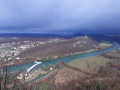
Panoramic view of Besançon and the Doubs valley from the chapel.
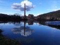
Ruins of Montferrand as seen from the banks of the Doubs.
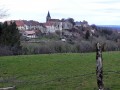
The church and porch at Boussières are listed as historic monuments.

Always be cautious and plan ahead when you're outdoors. Visorando and the author of this route cannot be held responsible for any accidents occurring on this route.

The GR® and PR® markings are the intellectual property of the Fédération Française de Randonnée Pédestre.

Reviews and comments

4.7 / 5
Based on 1 review

Reliability of the description
5 / 5
Ease of following the route
5 / 5
Route interest
4 / 5
pnuninger
pnuninger

Hello. I’m glad you enjoyed this walk.
It was a good idea to go via the ridges. It’s true that you should treat the suggested routes as a guide only. Everyone can then adapt them to suit their own preferences and abilities.
As for the climb back up to Boussières, I know it’s a bit of a slog. There’s no other way round it without crossing private land. After the path leading to the gypsum works (which is currently being renovated), take the path below that heads into the meadows. Head towards the drinking trough above, go into the copse to see the iron mines, and follow the meadow again until you reach the top corner near the gate. Carry on along the forest track until you come out onto a tarmac road, turn right and you’ll reach the entrance to Boussières.😉
Have a lovely evening and enjoy your walks

Machine-translated

BRUNO1
BRUNO1

Overall rating : 4.7 / 5

Date of your route : Feb 16, 2025
Reliability of the description : ★★★★★ Very good
Ease of following the route : ★★★★★ Very good
Route interest : ★★★★☆ Good
Very busy route : Yes

Stunning views from the Notre Dame du Mont Chapel.
The section where you walk alongside the canal and then the River Doubs is very pleasant.
It’s also quite nice along the Roman road near Vorges. There, we took a detour along the ridge path between points 8 and 9, on the left, which gave us a stunning panoramic view. To reach this viewpoint, you have to climb a bit further and walk a few hundred metres extra.
The downside of this walk is the return journey to Boussières from point 10. You walk alongside a main road with quite a lot of traffic for over 2 km. It’s a bit of a slog. That’s why I’m giving the route a rating of 4 for its interest.

Machine-translated

Other walks in the area

For more walks, use our search engine .

The GPS track and description are the property of this route's author. Please do not copy them without permission.