Circular walk from Boussières to the Vorges ridge and back via the Caillet mill

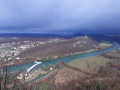
This is a lovely little walk in the hills above Boussières and Vorges-les-Pins, combining a departmental road, a dirt track and a forest track, offering you various views of the villages in the west of Besançon.

Details

n°986225
Creation:
Last update:
Last review:
  • Walking
    Activity: Walking
  • ↔
    Distance: 8.84 mi
  • ◔
    Average duration: 4h 45 
  • ▲
    Difficulty: Moderate

  • ⚐
    Back to start: Yes
  • ↗
    Ascent: + 768 ft
  • ↘
    Descent: - 791 ft

  • ▲
    Highest point: 1,594 ft
  • ▼
    Lowest point: 896 ft
  • ⚐ Country: France
  • ⚐ City: Boussières (25320)
  • ⚑
    Start/End: N 47.158503° / E 5.900337°
  • ❏
    IGN map(s): Ref. 3324ET
  • Hour-by-hour weather

Photos

Description of the walk

:Park in the car park at the Salle des Fêtes in Boussières.
(S/E) Walk down Rue des Richets on your right and join the D104, which you follow to the right for about 100 metres.

(1) Then turn left onto the D104 towards Vorges. After one kilometre, you’ll leave the village and reach a somewhat isolated property.

(2) You are now at a place called “La Cornette”. Take the small path on the right as it emerges from the woods. Follow it through the forest and fields until you reach a crossroads at the foot of a large walnut tree.

(3) At the Champ Mougin walnut tree, head straight on along the white track. Follow theGR®59. Continue through the pastures after passing the Jovinets farm and you’ll soon come to a slightly wider road.

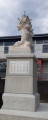
(4) 50 metres ahead on your left stands the Chouzelot or Montgardot Monument. It was erected in memory of the soldiers of the 1870 war who fell in battle. You are now on the Roman road, which you will follow to the left until you reach the next memorial stone, known as the ‘Monument de Vorges’, erected for the same purpose as the previous one.

(5) Walk past the monument and turn right into the pasture along a more or less marked path. Walk towards the clearing in the forest ahead of you. After a short but steep climb, you will reach the summit of the Vorges ridge.

(6) At the summit, turn left, following either the path that runs along the ridge or the much wider but less picturesque track slightly below it.

(7) When you reach a junction after a descent over rocky ground, continue straight on along the path. You’ll have the same choice as before: path or track? From the path, a few gaps in the boxwood trees—devoured by the box tree moth—offer views of the farmhouse inn, the guest rooms, the farm and the village of Vorges.
Further on, you’ll reach a well-equipped viewpoint with picnic tables.

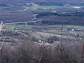
(8) From the open space beneath the power line, you can see the upper reaches of Charnay and the landscapes of the first plateaus. On the other side, you can observe the terraced Jura landscape, with the Doubs valley and the foothills dotted with ruins, chapels and villages. After taking some time to look around and explore, continue your walk by heading down steeply to the left, passing in front of the reservoir to reach the Roman road coming from Busy, which climbs up to the farmhouse inn. Turn right, then, 50 metres further on, turn left to reach the heart of the village, passing the Fontaine des Lêches on the way.

(9) When you reach the junction with the D104, turn left towards Boussières, which is about 3 km away.

(1) Turn right and walk up through the village to admire the Romanesque church and its porch, both listed as historic monuments. Turn left at the chemist’s and head for the car park (S/E).

Waypoints

  1. S/E : mi 0 - alt. 938 ft - Car park at the Salle des Fêtes
  2. 1 : mi 0.23 - alt. 896 ft - Crossroads
  3. 2 : mi 0.89 - alt. 1,030 ft - La Cornette
  4. 3 : mi 1.79 - alt. 1,201 ft - Champ Mougin walnut tree
  5. 4 : mi 2.91 - alt. 1,325 ft - Chouzelot Monument
  6. 5 : mi 3.86 - alt. 1,463 ft - Vorges Monument
  7. 6 : mi 4.02 - alt. 1,581 ft - Vorges ridge summit
  8. 7 : mi 5.12 - alt. 1,473 ft - At the crossroads, go straight on.
  9. 8 : mi 6 - alt. 1,368 ft - Junction power line
  10. 9 : mi 6.78 - alt. 1,037 ft - Junction with the D104
  11. S/E : mi 8.84 - alt. 935 ft - Car park at the Salle des Fêtes

Notes

Bakery and grocery shop in Boussières.
A bar serving light meals and snacks in the centre of Boussières, with a new restaurant next door.
Farm inn (booking required) in Vorges
The ‘Orée du Bois’ lodges can also accommodate walkers wishing to enjoy the area for a few days. See website.

Option: there is an alternative route available after the point (8). After reaching the Roman road at the foot of the reservoir, you can turn left and follow it to the inn, then turn right at the farm to reach the church in Vorges.

In both cases, at the hairpin bend, you will see ruins ahead of you in the pasture. These are the remains of the old gypsum works. Further on, you’ll walk past the ruins of the old mill with its water channel. A little further on, rejoin the original path, which takes you back to Boussières.

Worth a visit

Fontaine des Leches in Vorges.
Ruins of the old gypsum works.
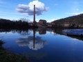
Ruins of the Caillet mill.
Church and porch at Boussières.

Always be cautious and plan ahead when you're outdoors. Visorando and the author of this route cannot be held responsible for any accidents occurring on this route.

The GR® and PR® markings are the intellectual property of the Fédération Française de Randonnée Pédestre.

Reviews and comments

4.7 / 5
Based on 1 review

Reliability of the description
5 / 5
Ease of following the route
5 / 5
Route interest
4 / 5
pnuninger
pnuninger

Thank you for your comment. Enjoy your walks – there are plenty more to be had in Boussières.
I saw you walking past my house.😉😉

Machine-translated

pon39
pon39

Overall rating : 4.7 / 5

Date of your route : Nov 22, 2023
Reliability of the description : ★★★★★ Very good
Ease of following the route : ★★★★★ Very good
Route interest : ★★★★☆ Good
Very busy route : No

The route description was quite detailed, and the paths were easy to follow despite the rainy spell we’re currently experiencing. There were numerous views between 6 and 8 through the trees, thanks to the fallen leaves. Well done on this walk!

Machine-translated

Other walks in the area

For more walks, use our search engine .

The GPS track and description are the property of this route's author. Please do not copy them without permission.