Walk along the cliffs between Carolles and Le Lude

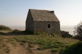
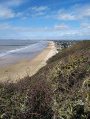
Combining a walk along the cliff face with a stroll along the beach, this route allows you to explore the landscape of Carolles Bay.

Warning! This walk is only possible at low tide. It is essential to check the tide times before setting off on this route.

Details

n°21523569
Creation:
Last update:
Last review:
  • Walking
    Activity: Walking
  • ↔
    Distance: 1.55 mi
  • ◔
    Average duration: 0h 55 
  • ▲
    Difficulty: Easy

  • ⚐
    Back to start: Yes
  • ↗
    Ascent: + 246 ft
  • ↘
    Descent: - 246 ft

  • ▲
    Highest point: 213 ft
  • ▼
    Lowest point: -3 ft
  • ⚐ Country: France
  • ⚐ City: Carolles (50740|)
  • ⚑
    Start/End: N 48.757236° / W 1.571728°
  • ❏
    IGN map(s): Ref. 1215ET
  • Hour-by-hour weather

Description of the walk

To get to the start point, follow the D911, Rue de la Plage, and between numbers 26 and 28, take the Chemin des Pendants. Then turn right onto Rue de la Croix Paqueray and head for the Croix Paqueray car park.

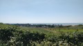
(S/E) From the car park, you’ll be treated to a magnificent view over the Carolles hills, with a sweeping vista all the way to Granville.
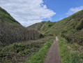
Head to the orientation table just below the car park and take the path immediately to the left of it. Follow the cliff edge until you reach a fork at the bottom of the gully.

(1) Take the path on the right and you’ll reach a small pebble beach. Cross this until you reach the narrow strip of sand.

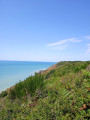
(2) Continue to the right and walk along the cliff face northwards towards Carolles.

(3) Take the steps leading down to the beach when you reach Carolles. Walk between the fishermen’s huts until you reach a car park. Turn right, then take the steps. After climbing the two hundred steps, you’ll reach the Croix Paquerey car park (S/E).

Waypoints

  1. S/E : mi 0 - alt. 180 ft - Croix Paquerey car park
  2. 1 : mi 0.66 - alt. 46 ft - First junction
  3. 2 : mi 0.94 - alt. 13 ft - Strip of sand
  4. 3 : mi 1.47 - alt. 23 ft - Stairs leading down to the beach
  5. S/E : mi 1.55 - alt. 180 ft - Croix Paquerey car park

Notes

(1) You can climb up the opposite side to reach Rocher du Sard for a different viewpoint.

You’ll need a good pair of shoes.

Be aware of the tide times; there are many accidents caused by carelessness, so it’s better to turn back than to risk walking around via the beach if you’re unsure.

Worth a visit

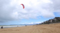
Enjoy the beach. You can spot marine life such as prawns, oysters, mussels and other sea creatures.

Reviews and comments

4.3 / 5
Based on 2 reviews

Reliability of the description
4.5 / 5
Ease of following the route
4 / 5
Route interest
4.5 / 5
Lafourmie14
Lafourmie14

Overall rating : 4 / 5

Date of your route : Aug 15, 2024
Reliability of the description : ★★★★☆ Good
Ease of following the route : ★★★★☆ Good
Route interest : ★★★★☆ Good
Very busy route : Yes

This route is very busy, even with cyclists who are dangerous and don’t show any consideration for walkers – it’s their path.

Machine-translated

Rouilletata
Rouilletata

Overall rating : 4.7 / 5

Date of your route : Oct 01, 2023
Reliability of the description : ★★★★★ Very good
Ease of following the route : ★★★★☆ Good
Route interest : ★★★★★ Very good
Very busy route : Yes

A lovely walk along the seafront and on the beach. Be sure to check the tide times before you set off, as the section along the beach is only accessible for a few hours at each tide.

Machine-translated

Other walks in the area

For more walks, use our search engine .

The GPS track and description are the property of this route's author. Please do not copy them without permission.