In the Loudéac Forest

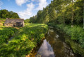
A short walk to explore the Loudéac State Forest, which covers 2,500 hectares. The southern part is state-owned and the rest is private. Do take a moment to smell the scents of the trees and listen to nature, all whilst walking along well-maintained paths.

Details

96685988
Creation:
Last update:
Last review:
  • Walking
    Activity: Walking
  • ↔
    Distance: 4.54 mi
  • ◔
    Average duration: 2h 15 
  • ▲
    Difficulty: Easy

  • ⚐
    Back to start: Yes
  • ↗
    Ascent: + 184 ft
  • ↘
    Descent: - 197 ft

  • ▲
    Highest point: 666 ft
  • ▼
    Lowest point: 541 ft
  • ⚐ Country: France
  • ⚐ City: Loudéac (22600)
  • ⚑
    Start/End: N 48.181656° / W 2.694543°
  • ❏
    IGN map(s): Ref. 0918SB
  • Hour-by-hour weather

Description of the walk

Start from the car park on Rue du Soua.

(S/E) Leave the car park, follow Rue du Soua to the left, then turn left onto Chemin de la Messe and walk alongside the forest, then enter it for 100 metres.

(1) Turn right at the junction and continue for about 400 metres.

(2) Turn left at the fork and continue straight on, cross a road and carry on straight ahead.

(3) At the end, turn left onto the forest track, then stay on the first track on the left, Chemin de la Messe, and rejoin the outbound route by continuing straight ahead.

(1) Turn left, following the same route as on the way there.

(2) Carry on straight ahead until you reach the Étoile multi-way junction.

(4) Take the first track on the right, then at the next junction veer slightly to the left before taking the first right and heading back to the car park via Rue du Soua (S/E).

Waypoints

  1. S/E : mi 0 - alt. 597 ft - Car park, Rue du Soua
  2. 1 : mi 0.62 - alt. 620 ft - Junction shared by outbound and return routes
  3. 2 : mi 0.87 - alt. 633 ft - Junction shared by outbound and return routes
  4. 3 : mi 1.84 - alt. 666 ft - End of the trail
  5. 4 : mi 3.56 - alt. 636 ft - Étoile multi-way junction
  6. S/E : mi 4.54 - alt. 597 ft - Car park, Rue du Soua

Notes

No water points.

Other walks in the area

For more walks, use our search engine .

The GPS track and description are the property of this route's author. Please do not copy them without permission.