The Chambon Valley

This walk takes place entirely within the commune of Saivres, whose inhabitants are known as Sapuriens and Sapuriennes.
You will mainly be walking along paths and a few sections of minor roads, which will take you through some of the many small hamlets found in the commune.
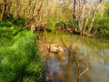
You’ll come across three wash houses, only two of which are in good condition, and cross a footbridge over the Chambon, the river on which the Touche Poupard dam is built.

Details

n°17990524
Creation:
Last update:
Last review:
  • Walking
    Activity: Walking
  • ↔
    Distance: 6.85 mi
  • ◔
    Average duration: 3h 40 
  • ▲
    Difficulty: Moderate

  • ⚐
    Back to start: Yes
  • ↗
    Ascent: + 604 ft
  • ↘
    Descent: - 610 ft

  • ▲
    Highest point: 604 ft
  • ▼
    Lowest point: 240 ft
  • ⚐ Country: France
  • ⚐ City: Saivres (79400)
  • ⚑
    Start/End: N 46.45769° / W 0.217576°
  • ❏
    IGN map(s): Ref. 1627SB, 1628SB
  • Hour-by-hour weather

Photos

Description of the walk

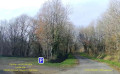
The start is next to the water reservoir on the left, 500 m after the top of the Côte de Donia, near the hamlet of Les Entes. Park along the fence.

(S/E) Head north-west along theGRP® des Marches de Gâtine.

(1) At the T-junction, leave theGRP® by turning left towards La Métiverie. Just before turning right, look out for the remains of a wash house hidden beneath the vegetation. Head downhill and cross Vinché, ignoring the road on the left and, further down, the path on the right. Continue along this path – which is damp in winter – until you reach the road.

(2) Take this road with care, keeping to the left. Ignore the two roads on the left.

(3) Just after the second one (after Montru), take the path on the left which descends until it joins a small road. Turn left, ignore the crossroads and carry on until you reach the Beuvet road on the left.

(4) Turn left and carry on straight ahead along the track, which will soon start to descend. This is a stony section which can be slippery after rain. You’ll reach the road.

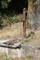
(5) Take it on the right, pass La Jamonelière and arrive at Le Pissot. At the siren (see section below), take the path leading down to the left, pass the wash house and continue along the often damp track to reach Maunay. Note the dovecote on the right. Head straight on through the hamlet and, after the house on the left, turn left, crossing the Chambon via the footbridge. Continue along the narrow path as it climbs and reach the road. Turn right and walk carefully for150 m until you reach the path on the left.

(6) Take this path, pass Le Pinier and continue on to La Chaillochère.

(7) Set off straight ahead along the path that runs past the house. Continue down the path until you reach the road, passing a house on your right.

(8) Carefully take the road on the right leading to the quarry. Ignore the road on the left and, after an area known as the ‘de bâchage’ on the left, you’ll reach the start of a path opposite the quarry entrance.

(9) Turn left and follow this track towards Les Vallées, which you can see behind the vegetation.

(10) Turn right onto a small, uphill path and follow it until you reach a small road, which you should take on the left. Cross the Fragnelière and continue to the road.

(11) Turn left, cross the Oumeau and then the Mardière, passing a pretty private wash house on the left. At the large livestock building at the crossroads, veer right onto the uphill road until you reach the start of a path on the right-hand side of the bend.

(12) Walk along this track until you return to the starting point (S/E).

Waypoints

  1. S/E : mi 0 - alt. 604 ft - Water supply point next to Les Antes, at the top of Donia
  2. 1 : mi 0.28 - alt. 535 ft - Crossroads, exit from the GRP
  3. 2 : mi 0.95 - alt. 453 ft - Crossroads (path/road)
  4. 3 : mi 1.51 - alt. 509 ft - Junction on the path
  5. 4 : mi 2.15 - alt. 486 ft - Crossroads (road/track) towards Beuvet
  6. 5 : mi 2.74 - alt. 305 ft - Junction of the path and the road at La Jamonelière
  7. 6 : mi 3.46 - alt. 354 ft - Crossroads (road/track)
  8. 7 : mi 4.02 - alt. 476 ft - Junction of the road and La Chaillochère track
  9. 8 : mi 4.66 - alt. 253 ft - Crossroads (path/road) at Maunay Bridge on the - Chambon (rivière)
  10. 9 : mi 5.04 - alt. 285 ft - Crossroads (road/track) opposite the quarry
  11. 10 : mi 5.45 - alt. 351 ft - Crossroads at Les Vallées
  12. 11 : mi 5.98 - alt. 528 ft - Crossroads (path/road)
  13. 12 : mi 6.46 - alt. 551 ft - Crossroads (road/track) at the top of La Mardière
  14. S/E : mi 6.85 - alt. 604 ft - Water supply point next to Les Antes, at the top of Donia

Notes

You’ll need sturdy footwear for this walk, as some sections can be a bit more challenging.
The road between the quarry and Maunay Bridge is used by many lorries travelling to and from the quarry, so please take care.
Apart from the short section ofthe GRP® des Marches de Gâtine, this walk is not signposted.

Worth a visit

The Donia quarry covers an area of 35 ha. Blue diorite is quarried there. Annual production stands at 700,000 t.
The commune of Saivres covers more than 20 km² and comprises over 60 hamlets. There are several castles within the area: Saugé, L’Herbaudière, Beauregard, Russey and La Roche Naide.
There are no fewer than 19 wash houses in the commune of Saivres, some of which are, unfortunately, in a very poor state of repair.
This part of the Chambon Valley lies downstream of the Touche Poupard dam. It falls within the ‘quarter-hour zone’ (the distance the dam’s waters would travel in 15 minutes in the event of a breach). This is why the company that manages the dam has installed sirens to warn residents to evacuate the area and seek higher ground in the event of an alert.
It is a livestock-farming region, specialising in particular in Parthenaise cattle (La Mardière farm).

Reviews and comments

4.7 / 5
Based on 1 review

Reliability of the description
5 / 5
Ease of following the route
5 / 5
Route interest
4 / 5
JMP17
JMP17

Overall rating : 4.7 / 5

Date of your route : May 01, 2023
Reliability of the description : ★★★★★ Very good
Ease of following the route : ★★★★★ Very good
Route interest : ★★★★☆ Good
Very busy route : No

We did the route, starting from the dam. A very easy route to follow, and very picturesque.
We had a picnic at the Pissot wash house – it was lovely. We hardly saw anyone.

Machine-translated

Other walks in the area

For more walks, use our search engine .

The GPS track and description are the property of this route's author. Please do not copy them without permission.