


Refine your search for walks in Saivres
Saivres walks


 The Donia Quarry
 Visorando Member
 6.55 mi
 +571 ft
 -591 ft
 3h 30
3h 30
 Moderate
 Departure from Saivres (Deux-Sèvres)
A 3-hour walk in the commune of Saivres along the sunken paths that are still accessible. You’ll explore the banks of the Chambon downstream of the Touche Poupart dam, a stretch offering a view of the Donia quarry, its working face and its spoil heap. The walk ends with a stroll through an arboretum.
Circular walk around Saivres
 6.04 mi
+387 ft
-358 ft
3h 05
Moderate
Departure from Saivres (Deux-Sèvres)
6.04 mi
+387 ft
-358 ft
3h 05
Moderate
Departure from Saivres (Deux-Sèvres)
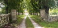
This walk circles the village of Saivres via minor roads, dirt tracks and footpaths. It passes through several of the area’s many villages. You will cross the River Chambon twice, via the Cailletière and Coutancière footbridges, and walk past the Château de l’Herbaudière.
.
Around Maixent-l'École and Azay-le-Brûlé
 4.92 mi
+200 ft
-217 ft
2h 25
4.92 mi
+200 ft
-217 ft
2h 25
 Easy
Departure from Saint-Maixent-l'École (Deux-Sèvres)
Easy
Departure from Saint-Maixent-l'École (Deux-Sèvres)
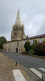
This short hike takes place in two towns: Azay-le-Brûlé, between trails and dirt roads, not far from the shopping area, and Saint-Maixent-l'École, with decking along the Sèvre Niortaise river and in the town streets.
Puits d'Enfer from Saint-Maixent-l'École
 5.65 mi
+400 ft
-374 ft
2h 55
Moderate
Departure from Saint-Maixent-l'École (Deux-Sèvres)
5.65 mi
+400 ft
-374 ft
2h 55
Moderate
Departure from Saint-Maixent-l'École (Deux-Sèvres)
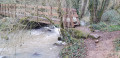
This short 9 km circular loop will take you to the Puits d'Enfer site. This site is famous for its legend and is an area of ecological interest due to the presence of rare species. There you will discover a breathtaking view of the town of Saint-Maixent-L'École and its abbey church.
You will walk along country lanes and small roads. You will follow the railway line linking La Rochelle to Paris and the Ruisseau du Puits d'Enfer stream, which is sometimes dry in summer.
The Puits d’Enfer in Exireuil
1.47 mi
+236 ft
-243 ft
0h 55
Moderate
Departure from Exireuil (Deux-Sèvres)
A short, hilly walk that’s very pleasant, especially in summer as the route is shaded.
Circular route of the Rabané and Renardière valleys
 5.60 mi
+472 ft
-443 ft
3h 00
Easy
Departure from Exireuil (Deux-Sèvres)
5.60 mi
+472 ft
-443 ft
3h 00
Easy
Departure from Exireuil (Deux-Sèvres)
A peaceful hike in the countryside around Exiroise and Nanteuillaise. This circular hike, marked by the presence of several streams, takes you through villages, across a ford and past a 19th-century private cemetery.
The Montbrune stream and the village of Augé
 7.92 mi
+633 ft
-617 ft
4h 10
Moderate
Departure from Augé (Deux-Sèvres) (Deux-Sèvres)
7.92 mi
+633 ft
-617 ft
4h 10
Moderate
Departure from Augé (Deux-Sèvres) (Deux-Sèvres)
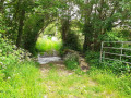
This unmarked hike will first take you through the village of Augé and its narrow streets, then along paths that will lead you to the Montbrune stream via several footbridges and through a few pretty villages with their wash houses. The end of the route is on the old Deux-Sèvres tramway line (TDS).
Le Chambon and La Ligueure
 8.02 mi
+702 ft
-702 ft
4h 20
Moderate
Departure from Augé (Deux-Sèvres) (Deux-Sèvres)
8.02 mi
+702 ft
-702 ft
4h 20
Moderate
Departure from Augé (Deux-Sèvres) (Deux-Sèvres)
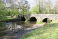
A unique walk offering the chance to explore the Chambon and Ligueure valleys, featuring fountains and wash houses, family cemeteries, the Roman bridge at Azay-le-Brûlé, the Valette dairy farm, the village of Augé with its narrow lanes and medieval houses, and the church at Augé.
A tour of the hamlets in Augé
 5.82 mi
+433 ft
-427 ft
3h 05
Easy
Departure from Augé (Deux-Sèvres) (Deux-Sèvres)
5.82 mi
+433 ft
-427 ft
3h 05
Easy
Departure from Augé (Deux-Sèvres) (Deux-Sèvres)
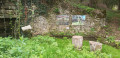
This walk, starting from the village of Augé, will take you through some of the hamlets that make up the parish, along shaded paths and small country lanes. You’ll have the chance to pass three of Augé’s many wash houses and catch a glimpse of the Houmelière farmhouse.
The Bois de Cathelogne
 6.61 mi
+436 ft
-446 ft
3h 25
Moderate
Departure from Saint-Georges-de-Noisné (Deux-Sèvres)
6.61 mi
+436 ft
-446 ft
3h 25
Moderate
Departure from Saint-Georges-de-Noisné (Deux-Sèvres)
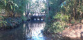
A walk that takes place largely within the commune of the ‘Nénéens’ (the inhabitants of Saint-Georges-de-Noisné). You’ll pass through villages with working farms. The first part follows shaded paths in summer, though these can be damp in winter. The rest of the route takes you along two stretches of minor roads, ending with a walk through the Bois de Cathelogne, with its ponds and a cabin that has a touch of Canada about it.
Walk along the banks of the Sèvre Niortaise
 5.92 mi
+367 ft
-367 ft
3h 05
Easy
Departure from Saint-Martin-de-Saint-Maixent (Deux-Sèvres)
5.92 mi
+367 ft
-367 ft
3h 05
Easy
Departure from Saint-Martin-de-Saint-Maixent (Deux-Sèvres)
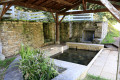
A lovely hike near Saint-Maixent that allows you to discover the landscapes on either side of the Sèvre Niortaise. This route also allows you to discover beautiful traditional and modern architecture, wash houses and the splendour of nature in a fairly wild area.
A glimpse of Lac de la Touche-Poupard from Lachereau
 5.52 mi
+144 ft
-144 ft
2h 40
Easy
Departure from Exireuil (Deux-Sèvres)
5.52 mi
+144 ft
-144 ft
2h 40
Easy
Departure from Exireuil (Deux-Sèvres)
A very beautiful walk to discover a section ofthe GR® de Pays des Marches de Gâtine along Lac de la Touche Poupard. This route offers lovely views and magnificent scenery, made all the more enjoyable by the frequent sunshine.
Circular Pommier starting from Lachereau
 5.28 mi
+207 ft
-210 ft
2h 35
Easy
Departure from Exireuil (Deux-Sèvres)
5.28 mi
+207 ft
-210 ft
2h 35
Easy
Departure from Exireuil (Deux-Sèvres)
In the commune of Exireuil, this short route follows the eastern bank of the La Touche Poupard reservoir.Starting from the Lachereau sailing club car park, it partly follows the GR®364 trail, passes through the Bois de la Vergne and Bois de Chantoiseau woods, and joins the Clavé au Pommier road.
The banks of the Sèvre Niortaise at the start of Ricou
 5.04 mi
+417 ft
-420 ft
2h 40
Easy
Departure from Azay-le-Brûlé (Deux-Sèvres)
5.04 mi
+417 ft
-420 ft
2h 40
Easy
Departure from Azay-le-Brûlé (Deux-Sèvres)
Hike starting from Ricou. The trail first joins the approximately five-hectare Ricou quarry geosite, located on the right bank of the Sèvre Niortaise river in the commune of Azay-le-Brûlé. It consists of an open-air quarry formerly exploited for its limestone of varying types used as building material (rubble stone). Leaving the site, the route descends into the Sèvre Niortaise valley and leads to Veillon, before turning right onto the other bank of the river to reach the first houses of Sainte-Néomaye. You will then have to cross the Sèvre again to return to Ricou after passing through La Corbelière.
Between Ligueure and Chambon in Azay-le-Brûlé
 7.24 mi
+630 ft
-627 ft
3h 55
Moderate
Departure from Azay-le-Brûlé (Deux-Sèvres)
7.24 mi
+630 ft
-627 ft
3h 55
Moderate
Departure from Azay-le-Brûlé (Deux-Sèvres)
This walk takes place largely within the commune of Azay-le-Brûlé and, to a very small extent, in Augé.
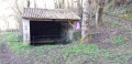
It follows paths that mostly run alongside the Ligueure and Chambon streams. It takes you through a few pretty hamlets with restored houses, and you’ll come across wash houses and footbridges.