The Bois de Cathelogne

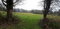
A walk that takes place largely within the commune of the ‘Nénéens’ (the inhabitants of Saint-Georges-de-Noisné). You’ll pass through villages with working farms. The first part follows shaded paths in summer, though these can be damp in winter. The rest of the route takes you along two stretches of minor roads, ending with a walk through the Bois de Cathelogne, with its ponds and a cabin that has a touch of Canada about it.

Details

n°17960167
Creation:
Last update:
Last review:
  • Walking
    Activity: Walking
  • ↔
    Distance: 6.61 mi
  • ◔
    Average duration: 3h 25 
  • ▲
    Difficulty: Average

  • ⚐
    Back to start: Yes
  • ↗
    Ascent: + 436 ft
  • ↘
    Descent: - 446 ft

  • ▲
    Highest point: 636 ft
  • ▼
    Lowest point: 397 ft

Photos

Description of the walk

The walk starts at the memorial to an act of the Resistance on the D 24, south of Danzay.

(S/E) Head north and ignore the three paths on the left, pass through the hamlet of Les Champs and continue to the T-junction.

(1) Take the road on the left, then at the left-hand bend, go straight on along the track and continue straight on at the next junction. On the right, you’ll see the Logis de Salette, then you’ll reach the D 142.

(2) Take the road on the left for a few metres, then turn right towards Pillemil. Continue until you reach the uphill track that passes in front of the goat farm. This narrow track can be difficult to navigate in winter. Follow it, after a right-hand bend, until you reach a four-way crossroads.

(3) Turn left, head towards the hamlet of Le Vigneau Nord and walk through it until you reach the D 130.

(4) Set off carefully along the D 130 to the left. Follow it for just over 1.5 km, ignoring the roads to the right and left, until you reach a track on the left, just past La Pilotière du Haut.

(5) Take this path downhill, which runs alongside the woodland until it reaches the D 142 at La Croix de Salette.

(6) Turn right and walk carefully along the road for 900 metres until you reach the first path on the left, which leads into the Bois de Cathelogne.

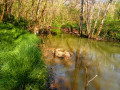
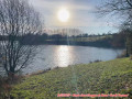
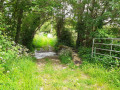
(7) Follow this path down through the woodland to the bottom of the valley. After a bend, you’ll see a first pond on your left, followed by a second. At the end of the second pond, a wooden gate blocks access to Cathelogne, a private estate which hikers are permitted to cross. To the left of the gate, a passageway provides access. In summer, you can cross the ford over the Saint-Rémy stream; in winter, go round the side of the pond through another gate – which you must open and close – cross the bridge over the weir and exit through another gate. Continue along the small, stony and sometimes damp uphill path until you reach a crossroads.

(8) Carry on to the left until you reach the next crossroads.

(9) Turn left, ignore the next two paths on the left and arrive at La Vacherie with its wash house. Continue slightly uphill to Lacheneau.

(10) Take the path opposite the farm buildings and walk past a house on your right. Continue straight on until you rejoin the original route at Les Champs.
Turn right, ignore the two turnings on the right and return to the starting point near the memorial stone (S/E).

Waypoints

  1. S/E : mi 0 - alt. 551 ft - Memorial stone by the side of the D 24
  2. 1 : mi 0.48 - alt. 564 ft - Road junction
  3. 2 : mi 0.99 - alt. 492 ft - Junction with the D 142
  4. 3 : mi 2.06 - alt. 600 ft - Crossroads
  5. 4 : mi 2.4 - alt. 636 ft - Junction on the D 130
  6. 5 : mi 3.56 - alt. 528 ft - Crossroads before a woodland
  7. 6 : mi 4.09 - alt. 469 ft - The Salette Cross
  8. 7 : mi 4.64 - alt. 538 ft - Junction of the D 142 and Chemin du Bois de Cathelogne
  9. 8 : mi 5.28 - alt. 482 ft - Crossroads
  10. 9 : mi 5.51 - alt. 528 ft - Crossroads
  11. 10 : mi 6.01 - alt. 541 ft - Crossroads (road/path) at Lacheneau
  12. S/E : mi 6.61 - alt. 551 ft - Memorial stone by the side of the D 24

Notes

This walk can be very wet in winter, so you’ll need sturdy footwear as some sections are over rocky ground.
Depending on the season, there may be a section that is difficult due to brambles.
Take care on the roads, although there is little traffic.

Worth a visit

The memorial stone commemorates an act of resistance. It marks the clandestine burial of two 20-year-old resistance fighters belonging to Triangle 16.
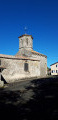
The Salette farmstead dates from the 15th century and is a fine example of a Cistercian farm. It features a dovecote and a 12th-century chapel.
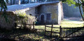
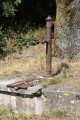
The wash house at La Vacherie is one of nine wash houses in the commune of Saint-Georges-de-Noisné and is still in good condition.

Reviews and comments

4.3 / 5
Based on 2 reviews

Reliability of the description
4.5 / 5
Ease of following the route
4.5 / 5
Route interest
4 / 5
TINO1779
TINO1779

Hello

Nor the weather... and that’s a real shame because otherwise it would be almost perfect

Machine-translated

philouis
philouis

Thank you for your comment.
Unfortunately, I am not responsible for maintaining the footpaths.

Kind regards.

Machine-translated

TINO1779
TINO1779

Overall rating : 4.3 / 5

Date of your route : Jul 11, 2024
Reliability of the description : ★★★★★ Very good
Ease of following the route : ★★★★★ Very good
Route interest : ★★★☆☆ Average
Very busy route : No

Hello

A lovely route, but as well as good walking shoes, you’ll need a brush cutter. The narrow path between point 2 and point 3 isn’t well maintained. Brambles are growing across the path… which is a shame, as the narrow path itself is lovely.

The walk is still very pleasant, though, with plenty of shade.

Machine-translated

philouis
philouis

I’m glad you enjoyed it.
I’m sure that, with the recent rain, the sections I’d mentioned as being damp are now wet.
Thanks again.

Machine-translated

alrandeaupyr
alrandeaupyr

Overall rating : 4.3 / 5

Date of your route : Jan 11, 2022
Reliability of the description : ★★★★☆ Good
Ease of following the route : ★★★★☆ Good
Route interest : ★★★★★ Very good
Very busy route : No

Avoid this route in winter after heavy rain. Fortunately, I’d put on my wellies (between Pillemil and the right-angled bend at Cote 204), where you actually have to walk through a field, as the path has turned into a puddle. This section is also narrow, with brambles and thorns that give the walker a bit of a scratch. But it’s fine. The tarmac between 4 and 5 is a bit monotonous, as is the stretch between 6 and 7, but after that it’s a real treat. Varied and wild – definitely worth exploring.

Machine-translated

Other walks in the area

For more walks, use our search engine .

The GPS track and description are the property of this route's author. Please do not copy them without permission.