Circular walk around Saivres

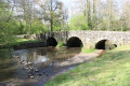
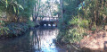
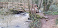
This walk circles the village of Saivres via minor roads, dirt tracks and footpaths. It passes through several of the area’s many villages. You will cross the River Chambon twice, via the Cailletière and Coutancière footbridges, and walk past the Château de l’Herbaudière.
.

Details

n°55821529
Creation:
Last update:
Last review:
  • Walking
    Activity: Walking
  • ↔
    Distance: 6.04 mi
  • ◔
    Average duration: 3h 05 
  • ▲
    Difficulty: Moderate

  • ⚐
    Back to start: Yes
  • ↗
    Ascent: + 387 ft
  • ↘
    Descent: - 358 ft

  • ▲
    Highest point: 476 ft
  • ▼
    Lowest point: 203 ft
  • ⚐ Country: France
  • ⚐ City: Saivres (79400)
  • ⚑
    Start/End: N 46.436059° / W 0.244189°
  • ❏
    IGN map(s): Ref. 1627SB, 1628SB
  • Hour-by-hour weather

Photos

Description of the walk

Cemetery car park, Route du Plessis.

(S/E) Join the D130 and turn right, towards Le Plessis. Ignore the junction just after the cemetery and, after Les Rousselottes, take a path on the left.

(1) Take this track, pass the autocross route and turn right. When you reach a road, turn right and head down the track opposite, until you reach the next junction.

(2) Turn left, rejoin the Route des Sources and carry on straight ahead. At the next junction, turn left onto the Route des Sources, ignore the next four streets and continue to number 16.

(3) Turn left onto Chemin du Pilavoine and head towards the hamlet of Vix via Impasse des Sapins. At the junction with Rue du Château, go straight on into Rue des Ouches, ignore the next two roads and carry on to the next crossroads.

(4) Turn left onto Route de Vix. Walk past the old waste collection centre and turn right after No. 3. Walk down the road and, at the next crossroads, turn right onto the path leading to the sewage treatment plant. Reach Route du Chambon, cross it carefully and walk a few dozen metres to the left.

(5) Follow the path on the right and take the footbridge over the Chambon. Walk past the equestrian centre and reach Rue des Combes-Paunay. Turn left, ignore the path on the right and head towards the Thibaudière junction.

(6) Turn left, passing the entrance to the Château de l’Herbaudière. Continue down the small road which bends to the right and reach the D24. Turn left and follow the D24 for about a hundred metres. Then cross it carefully and turn right opposite the old cottage. Follow the small road to l’Audouinière.

(7) Opposite the house, turn left, then cross the Chambon via the Coutancière footbridge. At the next junction, first turn left then right towards the Arboretum; walk the entire length of the Arboretum until you come out onto a small road.

(8) Turn left, pass Le Blanchard and, just after that, turn right onto the white track, following it until you reach the D24. Cross it carefully and head for the junction.

(9) Take the small road on the left until you reach the cemetery junction. Turn left to return to the car park where you started (S/E).

Waypoints

  1. S/E : mi 0 - alt. 436 ft - Cemetery car park
  2. 1 : mi 0.39 - alt. 400 ft - Path on the left
  3. 2 : mi 1.03 - alt. 377 ft - Crossroads
  4. 3 : mi 1.37 - alt. 348 ft - Chemin du Pilavoine
  5. 4 : mi 1.9 - alt. 279 ft - At the crossroads, turn left
  6. 5 : mi 2.47 - alt. 207 ft - Wastewater treatment plant before the - Chambon (rivière)
  7. 6 : mi 3.13 - alt. 318 ft - Thibaudière crossroads
  8. 7 : mi 4.05 - alt. 233 ft - L’Audouinière
  9. 8 : mi 5.04 - alt. 423 ft - At the crossroads, turn left
  10. 9 : mi 5.45 - alt. 476 ft - At the crossroads, turn left
  11. S/E : mi 6.04 - alt. 436 ft - Cemetery car park

Notes

This circular route follows sections of road where you should take care. Some parts of the paths require sturdy footwear.

There are several picnic tables along the route, particularly near the arboretum.

In the village of Saivres, there is a bakery/patisserie/snack bar: closed on Saturday afternoons and Sundays.

Worth a visit

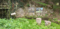
The village of Saivres has several wash houses (Route de Lugné, at Le Magnou).
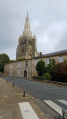
Saint-Pierre Church is listed in the General Inventory of Cultural Heritage.
The Château de l’Herbaudière, a 14th-century building, has been listed as a Historic Monument since 1994. Unfortunately, it is not open to visitors.

Reviews and comments

4.2 / 5
Based on 2 reviews

Reliability of the description
4 / 5
Ease of following the route
4.5 / 5
Route interest
4 / 5
Gaston1258
Gaston1258

Overall rating : 3.3 / 5

Date of your route : Sep 18, 2024
Reliability of the description : ★★★☆☆ Average
Ease of following the route : ★★★★☆ Good
Route interest : ★★★☆☆ Average
Very busy route : No

An easy route to follow, but with lots of tarmac roads and tracks.
A shame

Machine-translated

GILMIC79
GILMIC79

Overall rating : 5 / 5

Date of your route : Jul 17, 2024
Reliability of the description : ★★★★★ Very good
Ease of following the route : ★★★★★ Very good
Route interest : ★★★★★ Very good
Very busy route : No

A very pleasant walk, and indeed superb in the second half (after crossing the D24), in a peaceful, rural setting.
Takes about 2 hours (excluding breaks) for a less fit older person; the stated duration is very, very generous
Well worth doing, time and time again!

Machine-translated

Other walks in the area

For more walks, use our search engine .

The GPS track and description are the property of this route's author. Please do not copy them without permission.