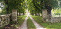
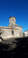
Between the Gâtine paths and the banks of the Plan d’Eau de la Touche Poupard

This walk takes place entirely within the municipality of Saint-Georges-de-Noisné.
The walk starts at Vigneau Sud, a small hamlet on the outskirts of Saivres.

Details

n°23679093
Creation:
Last update:
Last review:
  • Walking
    Activity: Walking
  • ↔
    Distance: 8.56 mi
  • ◔
    Average duration: 4h 15 
  • ▲
    Difficulty: Moderate

  • ⚐
    Back to start: Yes
  • ↗
    Ascent: + 348 ft
  • ↘
    Descent: - 348 ft

  • ▲
    Highest point: 643 ft
  • ▼
    Lowest point: 427 ft

Photos

Description of the walk

Park in front of the low stone wall next to the rosemary bushes in the small hamlet of Vigneau Sud.

(S/E) Leave the village, rejoin the finishing route, head north-west until you reach the first path on the left and continue to a four-way junction, ignoring thefirst path on the left.

(1) Carry on straight ahead, cross the stream and reach the T-junction. Turn right and head towards the road.

(2) Turn left until you reach the first path on the right, just before a house. Go round the farm. At the T-junction, turn right and you’ll reach a Y-junction not far from the apple trees.

(3) Take the path on the right, cross the orchard and the road, then continue along the path opposite until you reach a road.

(4) Turn left, then immediately right, and continue along the path downhill opposite, which joins theGRP® des Marches de Gâtine. Reach the road in the village of La Michenardière.

(5) Leave theGRP® by turning right, cross the village and reach the D329. Follow it carefully as far as the bridge.

(6) Take the path on the right which runs alongside the lake until you rejoin theGRP® at the embankment.

(7) Follow theGRP® along the lakeshore.

(8) Leave the lakeside whilst continuing along theGRP®. Pass through La Marotière and La Braconnerie, and cross Les Raslières. When you reach a road, turn left onto it and continue to a junction.

(9) Head towards La Protellerie, still following theGRP®. Pass a wash house and, immediately afterwards, look out for the small path on the right (not necessarily easy to spot) which leads down towards the stream.

(10) Leave theGRP® and take this path, walking through the water in places. After 400 m, the path widens into a track, then a road. Continue straight on until you reach the crossroads not far from the glass recycling bin.

(11) Take the road on the left and head towards La Barlière, which you cross, passing a wash house on the way, before reaching a crossroads.

(12) Take the small road towards La Breuille. Pass through the hamlet and arrive at the crossroads you passed earlier.

(1) Turn left and follow the route back the way you came to return to the starting point at a place called Le Vigneau Sud (S/E).

Waypoints

  1. S/E : mi 0 - alt. 456 ft - A place called Le Vigneau Sud
  2. 1 : mi 0.49 - alt. 456 ft - Junction of the circular loop
  3. 2 : mi 0.73 - alt. 469 ft - Crossroads (path/road)
  4. 3 : mi 1.57 - alt. 623 ft - Crossroads not far from the orchards
  5. 4 : mi 2.06 - alt. 610 ft - Crossroads (path/road)
  6. 5 : mi 2.32 - alt. 558 ft - The village of La Michenardière
  7. 6 : mi 2.79 - alt. 440 ft - There is a fork in the road before the bridge at - Chambon (rivière)
  8. 7 : mi 4.58 - alt. 433 ft - Dike
  9. 8 : mi 5.01 - alt. 433 ft - Crossroads near the car park
  10. 9 : mi 5.94 - alt. 604 ft - Road junction at Les Raslières
  11. 10 : mi 6.44 - alt. 535 ft - Path after the wash house
  12. 11 : mi 7.31 - alt. 607 ft - Road junction
  13. 12 : mi 7.78 - alt. 502 ft - Crossroads at La Barlière
  14. S/E : mi 8.56 - alt. 456 ft - A place called Le Vigneau Sud

Notes

Some paths can be difficult in winter, so you should wear suitable footwear.
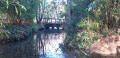
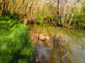
Between (1) and (2), you’ll need to cross a stream by stepping on stones, and between (10) and (11), you’ll need to wade through a shallow stream.
The roads are small, quiet roads, except for the D329; please take care.
At the bridge, at point (6), there is a water supply point and toilets available.

Worth a visit

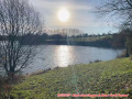
The walk starts 3 km from the Touche Poupart dam, a structure commissioned in 1995. The reservoir you’ll be walking alongside is used for water supply. Fishing is permitted there.
The walk passes through small hamlets where there are farms. You’ll also see a wash house at La Protellerie and another at La Barlière.

Reviews and comments

4.7 / 5
Based on 1 review

Reliability of the description
5 / 5
Ease of following the route
5 / 5
Route interest
4 / 5
philouis
philouis

Thank you for taking this walk.
It’s true that the path after La Riboire is impassable.
As for the path after point 10, it’s damp in winter but you can manage it with good footwear.

Machine-translated

jlfaure
jlfaure

Overall rating : 4.7 / 5

Date of your route : Oct 06, 2023
Reliability of the description : ★★★★★ Very good
Ease of following the route : ★★★★★ Very good
Route interest : ★★★★☆ Good
Very busy route : No

We followed this route in the morning, setting off from the waypoint (6), before continuing on to the Saint-Georges-de-Noisné circular route via Le Soleil Levant. To shorten the route slightly, at a place called La Barlière we turned right to reach the waypoint (3). This turned out to be a bad idea, as after La Riboire, the narrow, enclosed path was overgrown with vegetation, making it difficult to proceed, and we had to climb up into the adjoining field, which was fortunately dry and uncultivated at the time.
After the waypoint (10), the path merges with the stream bed (currently dry) and the vegetation takes over again, making the walk difficult. A section to avoid in winter.

Machine-translated

Other walks in the area

For more walks, use our search engine .

The GPS track and description are the property of this route's author. Please do not copy them without permission.