The Bouguenais Valley from Port Lavigne to La Bouvre

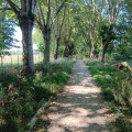
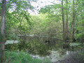
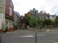
A walk on the outskirts of Nantes, mostly along wild and unspoilt nature trails, with a section through the old town of Bouguenais. You’ll follow the Étier de Bouguenais along the canoeists’ path, and the return route takes you through the Prés Boutinard.

Details

n°19125054
Creation:
Last update:
Last review:
  • Walking
    Activity: Walking
  • ↔
    Distance: 4.02 mi
  • ◔
    Average duration: 1h 55 
  • ▲
    Difficulty: Easy

  • ⚐
    Back to start: Yes
  • ↗
    Ascent: + 72 ft
  • ↘
    Descent: - 69 ft

  • ▲
    Highest point: 82 ft
  • ▼
    Lowest point: 10 ft
  • ⚐ Country: France
  • ⚐ City: Bouguenais (44340)
  • ⚑
    Start/End: N 47.186292° / W 1.633373°
  • ❏
    IGN map(s): Ref. 1223SB, 1224SB
  • Hour-by-hour weather

Description of the walk

Park in the car park at Port Lavigne.

(S/E) Head south-east along the Étier de Bouguenais. At the second footbridge, continue along the stream on the right.

(1) At the stone bridge, carry on straight ahead, still following the stream.

(2) Keep to your left without crossing the bridge, then, at the four-way junction, turn right.

(3) Head west along Rue de la Commune de Paris de 1871. Carry on straight ahead, passing the town hall on Rue Aristide Briand. At the church, carry on straight ahead; then, at the roundabout, continue straight on along Rue de Beauvoir.

(4) At the roundabout, turn left onto Rue Eugène Pottier for 30 metres, then turn right onto Rue Phileas Fogg. At the bottom of the slope, cross the stream and, at the junction, take the path on the right.

(5) Turn right. Cross Rue Manon Lescaut, then turn right onto Rue de la Gouretterie. After 50 metres, turn left onto the path between the houses. Turn right onto Rue de la Gratiole.

(6) Cross Rue de Beauvoir to take Chemin de la Sangle opposite. Turn right at the first junction onto Chemin de la Rinière.

(7) Turn left onto Rue du Port Lavigne. At the entrance to the village of Port Lavigne, veer right onto the small path that runs alongside the stream and join the (S/E).

Waypoints

  1. S/E : mi 0 - alt. 10 ft - Port Lavigne car park
  2. 1 : mi 0.91 - alt. 13 ft - The stone bridge
  3. 2 : mi 1.47 - alt. 10 ft - La Grande Vallée
  4. 3 : mi 1.66 - alt. 20 ft - La Bouvre
  5. 4 : mi 2.56 - alt. 69 ft - Roundabout
  6. 5 : mi 2.78 - alt. 33 ft - Former campsite
  7. 6 : mi 3.13 - alt. 30 ft - Rue de Beauvoir
  8. 7 : mi 3.51 - alt. 33 ft - La Rinière
  9. S/E : mi 4.02 - alt. 13 ft - Port Lavigne car park

Reviews and comments

5 / 5
Based on 1 review

Reliability of the description
5 / 5
Ease of following the route
5 / 5
Route interest
5 / 5
Quelfenec
Quelfenec

Overall rating : 5 / 5

Date of your route : May 25, 2023
Reliability of the description : ★★★★★ Very good
Ease of following the route : ★★★★★ Very good
Route interest : ★★★★★ Very good
Very busy route : No

A lovely walk with beautiful scenery; no difficulties

Machine-translated

Other walks in the area

For more walks, use our search engine .

The GPS track and description are the property of this route's author. Please do not copy them without permission.