The Tête de Barbalon

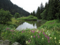
The Tête de Barbalon, starting from the hamlet of Le Pay, is a route very rarely taken by walkers. It is true that from the Cabane du Pay onwards, there are no longer any markings, apart from a few scattered cairns, nor any proper paths either – at most, a few faint tracks.
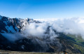
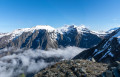
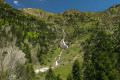
But the pleasure of encountering a somewhat rugged and wild natural landscape is very much there, and from the summit, the sweeping panorama of the surrounding mountains more than makes up for the effort involved.

Details

3828726
Creation:
Last update:
Last review:
  • Walking
    Activity: Walking
  • ↔
    Distance: 3.88 mi
  • ◔
    Average duration: 4h 35 
  • ▲
    Difficulty: Difficult

  • ⚐
    Back to start: Yes
  • ↗
    Ascent: + 3,255 ft
  • ↘
    Descent: - 3,255 ft

  • ▲
    Highest point: 7,746 ft
  • ▼
    Lowest point: 4,491 ft

Photos

Description of the walk

Access to the start: see important information in the ‘Practical Information’ section

(S/E) Follow the wide path for about 200 metres, heading north-west, to the first Fork in the road.

(1) Turn right onto the path that climbs through the fields to a crossroads at the edge of a wood. Ignore the path on the right heading south and follow the one on the left, which enters the forest known as the Fer à Cheval. You will soon come to another crossroads.

(2) Stay on the path on the right. Emerge onto the mountain pasture and head north up through open heathland to reach Rocher Roux, beneath which the Cabane du Pay is nestled.

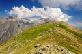
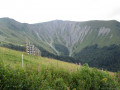
(3) Using the few paths that wind their way between blueberry bushes, rhododendrons and junipers, head up the grassy ridge towards the north-east, in the direction of the clearly visible pass that stretches between Roche Frette and the Tête de Barbalon.
After a steady climb, you’ll reach this wide, unnamed pass at an altitude of 2,202 m.

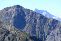
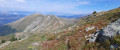
(4) Turn right, heading south-east, and follow a track through the scree that climbs up the broad ridge. You should then look out for and head towards a cairn on the right, perched on a rocky spur.

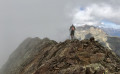
(5) Head up to the left, heading east, along a short couloir leading to a sort of small pass, which you reach after a few switchbacks. You will then emerge onto the short final slope that leads easily to the summit of the Tête de Barbalon, marked by a cairn.

(6) Return via the same route to get back to the car park (S/E).

Waypoints

  1. S/E : mi 0 - alt. 4,491 ft - Car park at the hamlet of Le Pay
  2. 1 : mi 0.06 - alt. 4,498 ft - Fork in the road
  3. 2 : mi 0.43 - alt. 4,754 ft - Junction
  4. 3 : mi 1.07 - alt. 5,653 ft - Cabane du Pay
  5. 4 : mi 1.7 - alt. 7,178 ft - Unnamed pass
  6. 5 : mi 1.85 - alt. 7,490 ft - Cairn on a rocky spur
  7. 6 : mi 1.94 - alt. 7,746 ft - Summit - Tête de Barbabon (2380m)
  8. S/E : mi 3.88 - alt. 4,491 ft - Car park at the hamlet of Le Pay

Notes

Access to the start from Grenoble: at the roundabout before La Mure, coming from Laffrey, head towards Nantes-en-Ratier, then cross the Col de Malissol and follow the signs for Lavaldens.
Please note: the road leading from Lavaldens to the hamlet of Le Pay (the starting point for this hike) has, since summer 2020, been subject to traffic restrictions and is now open only to local residents. This is to ensure the smooth flow of traffic (the road is very narrow) and to provide sufficient parking space (in Le Pay, there is parking for a maximum of 4 to 5 cars).
It is therefore recommended that you park your car in the car park in front of the Lavaldens community hall, very close to the church, and walk along the small road to the hamlet of Le Pay (3 km and an additional 411 m elevation gain).
For any information regarding traffic conditions on this road on the day of the walk, it is advisable to contact either Lavaldens Town Hall or the Alpe du Grand Serre Tourist Office.

The Pay shepherd’s hut can be reached without any particular difficulty via well-defined paths, marked from time to time by yellow lines (which are a little faded).
The rest of the route follows off-trail terrain with no markings, apart from a few intermittent paths and some cairns.
From the Pay hut to the pass, you’ll be walking across bushy slopes, and from the pass to the summit, over scree.
It is therefore advisable to undertake this hike only in clear, dry weather.

Worth a visit

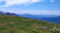
From the summit, you can enjoy a sweeping panorama of the surrounding mountains:
- to the north, the impressive south face of the Taillefer massif,
- to the south, the imposing Grand Armet massif, which partly obscures the Obiou massif,
- to the west, the gentler massifs of the Tabor and the Grand-Serre.
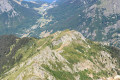
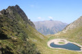
You can also enjoy a bird’s-eye view of the Roizonne valley.

Reviews and comments

4.7 / 5
Based on 2 reviews

Reliability of the description
4.5 / 5
Ease of following the route
4.5 / 5
Route interest
5 / 5
tchoumi
tchoumi

Thank you, Charlie 38, for your comments and the photos you’ve posted online

Machine-translated

Charlie 38
Charlie 38

Overall rating : 5 / 5

Date of your route : May 08, 2023
Reliability of the description : ★★★★★ Very good
Ease of following the route : ★★★★★ Very good
Route interest : ★★★★★ Very good
Very busy route : No

A really lovely walk, though it’s quite a challenging one.
It wasn’t too long as such – it took me 4 hours 30 minutes to complete it.

Saw about 20 chamois on the way up to the pass; superb view at the top of the Taillefer, right next to it.
Do be careful on the final climb, though – there are some loose and slippery rocks.

I’d recommend this to anyone who isn’t afraid of heights.

PS: The first hike where I didn’t come across a single person from start to finish!

Machine-translated

annapurna
annapurna

Overall rating : 4.3 / 5

Date of your route : Jun 13, 2021
Reliability of the description : ★★★★☆ Good
Ease of following the route : ★★★★☆ Good
Route interest : ★★★★★ Very good
Very busy route : No

The final ascent of the unnamed pass to the Tête de BARBALON is very steep, with stones constantly dislodging from under your feet. This route should only be attempted in small groups and by those who are not afraid of heights, as it is extremely steep with unstable terrain. The hike took place on 13 June, but there were still some patches of snow on the final slope.

Machine-translated

Other walks in the area

For more walks, use our search engine .

The GPS track and description are the property of this route's author. Please do not copy them without permission.