


tchoumi

 Visorando Member
 Premium user
 - Location: Saint-Nizier-du-Moucherotte (38250)
- Gender: man
Sign up:
Published route(s)
 The Gobert Trail from Font Froide to Combe Chaulange
 4.25 mi
 +1,368 ft
 -1,362 ft
 3h 10
3h 10
 Moderate
 Departure from Villard-de-Lans (Isère)
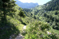
This hike will take you along the Sentier Gobert, famous for its rich flora, which is in full bloom during June and July.
This mountain trail also offers splendid views of the Lans-en-Vercors plain and Villard-de-Lans.
Mont Saint-Michel Chapel loop, starting from Curienne
 4.95 mi
+764 ft
-771 ft
2h 55
Moderate
Departure from Curienne (Savoie)
4.95 mi
+764 ft
-771 ft
2h 55
Moderate
Departure from Curienne (Savoie)
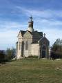
Admittedly, starting from Curienne, this route is not the shortest way to reach the Mont Saint-Michel Chapel! However, it offers the chance to (re)discover the very pleasant Chemin de la Paraie, the memorial stone and the Maquisards’ farm, as well as superb views over Chambéry and the surrounding mountains.Although technically straightforward and with little elevation gain, this hike is nevertheless classified as ‘moderate’ due to its length.
The Pic de la Sauge circular from Arvey
 7.10 mi
+3,235 ft
-3,222 ft
6h 05
Moderate
Departure from Puygros (Savoie)
7.10 mi
+3,235 ft
-3,222 ft
6h 05
Moderate
Departure from Puygros (Savoie)
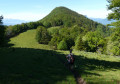
This hike is less popular than the nearby Pointe de la Galoppaz, an iconic peak in the Chambéry region.
However, it is just as interesting thanks to the variety of landscapes it crosses (forests, meadows, groves, rocks, etc.) and the superb panorama of the surrounding mountains (Mont Blanc, Belledonne, Beaufortain, Bauges, Chartreuse), the Chambéry cluse and Lake Thuile.
Les Grands Moulins via the normal route and return via the ridges
 7.03 mi
+3,284 ft
-3,274 ft
6h 05
7.03 mi
+3,284 ft
-3,274 ft
6h 05
 Difficult
Departure from Arvillard (Savoie)
Difficult
Departure from Arvillard (Savoie)
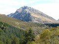
From Val Pelouse, the ascent of Les Grands Moulins (2,495 m) offers hikers a varied and magnificent route. This summit is the penultimate rocky bastion at the northern end of the Belledonne mountain range.
At the summit of Les Grands Moulins, the 360° panorama is breathtaking. To the south, Belledonne; to the west, Chartreuse and Vercors; to the north, the Chambéry cluse, Les Bauges and Les Aravis; to the east, Lauzière, Beaufortain, Vanoise and, in the background, the majestic Mont Blanc.
The Tête de Barbalon
 3.88 mi
+3,255 ft
-3,255 ft
4h 35
Difficult
Departure from Lavaldens (Isère)
3.88 mi
+3,255 ft
-3,255 ft
4h 35
Difficult
Departure from Lavaldens (Isère)
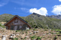
The Tête de Barbalon, starting from the hamlet of Le Pay, is a route very rarely taken by walkers. It is true that from the Cabane du Pay onwards, there are no longer any markings, apart from a few scattered cairns, nor any proper paths either – at most, a few faint tracks.
But the pleasure of encountering a somewhat rugged and wild natural landscape is very much there, and from the summit, the sweeping panorama of the surrounding mountains more than makes up for the effort involved.
Summit of La Cavale from Oris-en-Rattier
 5.41 mi
+3,724 ft
-3,724 ft
5h 45
Difficult
Departure from Oris-en-Rattier (Isère)
5.41 mi
+3,724 ft
-3,724 ft
5h 45
Difficult
Departure from Oris-en-Rattier (Isère)
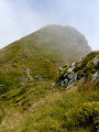
The Sommet de la Cavale does not claim to be on a par with its imposing neighbour, Le Coiro, which is 460 m higher. However, it remains a worthwhile destination, both for its wild and airy setting and for the beauty of the surrounding landscapes.
The fairly sustained climb up this long ridge is richly rewarded by the magnificent viewpoint offered by the summit, which provides breathtaking views of the Valbonnais, Dévoluy, Matheysine and Vercors massifs and the high peaks of the Écrins.
Lac des Bèches from Champhorent
 9.06 mi
+3,753 ft
-3,753 ft
7h 25
Difficult
Departure from Saint-Christophe-en-Oisans (Isère)
9.06 mi
+3,753 ft
-3,753 ft
7h 25
Difficult
Departure from Saint-Christophe-en-Oisans (Isère)
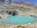
This hike will take you through the magnificent Lavey (or Muande) valley with its stone bridges and waterfalls, the Lavey refuge, a reminder of a bygone mountain farming life, and, in a wild and beautiful setting, the turquoise waters of Lac des Bèches, dominated by the Aiguille des Arias and its immense scree slopes.
From there, the panorama stretches from the Aiguille du Plat de la Selle and the Dibona to the north, to the Tête des Fétoules and the Aiguille de l'Olan to the south.
The Lautaret loop starting from Corrençon-en-Vercors
 3.44 mi
+410 ft
-407 ft
1h 55
3.44 mi
+410 ft
-407 ft
1h 55
 Easy
Departure from Corrençon-en-Vercors (Isère)
Easy
Departure from Corrençon-en-Vercors (Isère)
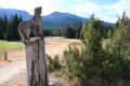
A pleasant, easy family walk through clearings and forests, at the gateway to the Hauts-Plateaux Nature Reserve. A renowned Nordic site, with an 18-hole golf course, a roller ski track, a professional shooting range and numerous marked trails, this area is a delight for hikers, golfers, biathletes, mountain bikers and runners alike.
Lac Noir and the Sentier des Charbonniers
 2.30 mi
+512 ft
-522 ft
1h 30
Easy
Departure from Chapareillan (Isère)
2.30 mi
+512 ft
-522 ft
1h 30
Easy
Departure from Chapareillan (Isère)
A pleasant walk through the woods, with no particular difficulties and very well signposted. It takes you to the small Lac Noir lake, dominated by the majestic Mont Granier, then along an educational trail to discover the work of the men who, during the Second World War, produced charcoal for gas generators.
The Col des Sept Laux from Rivier d'Allemont
 4.80 mi
+3,018 ft
-3,018 ft
4h 50
Difficult
Departure from Allemond (Isère)
4.80 mi
+3,018 ft
-3,018 ft
4h 50
Difficult
Departure from Allemond (Isère)
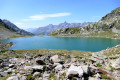
This hike will take you to four of the ten lakes known as the "Lacs des Sept Laux": Lac de la Sagne, Lac de la Corne, Lac Jeplan and Lac du Cos, the latter being located slightly below the Col des Sept Laux.
At times, the slope is quite steep and the route somewhat rugged, but your efforts will be richly rewarded when you discover these beautiful mountain lakes and the various surrounding mountain ranges.
Tour of the Sornin Plateau and the Dent du Loup, starting from La Molière
 7.36 mi
+1,066 ft
-1,076 ft
4h 20
Moderate
Departure from Engins (Isère)
7.36 mi
+1,066 ft
-1,076 ft
4h 20
Moderate
Departure from Engins (Isère)
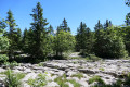
This route allows you to explore the wide pastures, small clearings, deep undergrowth and fields of sharp limestone pavements in the northern part of the Molière Plateau. The Sornin Plateau, meanwhile, after passing through its charming little hamlet, offers superb views of the mountain ranges surrounding the Grenoble basin. During the summer months, hundreds of sheep take over these meadows. From the Dent du Loup viewpoint, you can enjoy a remarkable view of the Isère valley and the Chartreuse massif.