Vaunoire – Combe Oursière Circular Loop

A superb circular walk in a corner of the countryside that’s still unspoilt. It allows you to admire the nearby Taillefer massif ‘from the bottom up’ and to enjoy the magnificent Vallon de Vaunoire, whilst avoiding the classic return route from Moulin Vieux.
A few tricky sections add an extra bit of excitement to the route.
The GPX track is essential for tackling this circular route.
There is no path between the waypoints (2) and (6).

Details

n°638574
Creation:
Last update:
Last review:
  • Walking
    Activity: Walking
  • ↔
    Distance: 5.78 mi
  • ◔
    Average duration: 6h 20 
  • ▲
    Difficulty: Difficult

  • ⚐
    Back to start: Yes
  • ↗
    Ascent: + 4,242 ft
  • ↘
    Descent: - 4,249 ft

  • ▲
    Highest point: 8,025 ft
  • ▼
    Lowest point: 3,996 ft

Photos

Description of the walk

From La Morte or Lavaldens: head east after Moulin Vieux and park at the end of the tarmac road, at an altitude of 1,223 metres.

(S/E) Walk eastwards at first, then quickly turn south onto the path that crosses the Ruisseau de Vaunoire and climbs steeply, due south, towards Combe Oursière.

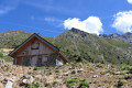
(1) At the fork, continue left towards the south-east and head for the Combe Oursière hut.

(2) Take care after the hut, as the path can sometimes be hard to follow, but the route south, then east along the Combe is fairly obvious.

(3) Head due east up the slope at the top of the valley towards the pass; there are a few rocky sections, which are no problem in dry, clear weather but may be trickier if wet. And the slope is steep here! Reach the Col de Combe Oursière.

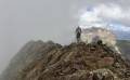
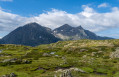
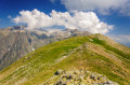
(4) From the pass, at an elevation of 2,446 metres, there’s a panoramic view of the Grand Armet, Taillefer, Grandes Rousses, Muzelle, and Plancol below, which serves as your target for the descent.
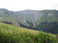
After the pass, the descent is quite steep, but it’s manageable as there are quite a few cairns, which point south-east towards what remains of the Grand Glacier, allowing you to weave your way between the ridges (elevation 2098).

(5) Then head north-east: do not descend between the two torrents (contour line 1950 on the IGN map), but instead stay well on the left bank… of the one on the left.
A different route is shown on the OSM base map.

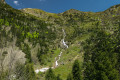
(6) Further down, there are picturesque landscapes along the Vaunoire, opposite Plancol.
Turn left after crossing the stream. Join a good path and follow it to the left. Cross the Ruisseau de Vaunoire and follow it along its banks. Further on, cross it again and turn due west, still following its course, to return to the starting point (S/E).

Waypoints

  1. S/E : mi 0 - alt. 4,003 ft - End of the road. Vaunoire Stream or - Roizonne (rivière)
  2. 1 : mi 0.88 - alt. 5,190 ft - Junction. Towards the Cabane de Combe Oursière
  3. 2 : mi 1.21 - alt. 5,702 ft - Combe Oursière hut
  4. 3 : mi 1.84 - alt. 6,598 ft - The valley
  5. 4 : mi 2.45 - alt. 8,025 ft - Col de Combe Oursière (2446m)
  6. 5 : mi 2.83 - alt. 6,962 ft - Beneath the Grand Glacier
  7. 6 : mi 3.65 - alt. 5,604 ft - Vaunoire Stream
  8. S/E : mi 5.78 - alt. 3,996 ft - End of the road

Notes

Take the warnings seriously: there are passages to find, and a GPX track is required.

Worth a visit

4 hours to climb up and… 5 hours to come down, including stops and a nap: at my age (61), you go faster uphill than downhill! (Bring walking poles to take the strain off your knees).
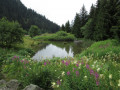
A short rest in the grass beside the idyllic Vaunoire Stream, with the water singing in the stillness of the mountains.

Reviews and comments

3.2 / 5
Based on 4 reviews

Reliability of the description
2.5 / 5
Ease of following the route
2.5 / 5
Route interest
4.5 / 5
User 27729876

Overall rating : 3.3 / 5

Date of your route : Sep 27, 2025
Reliability of the description : ★★☆☆☆ Disappointing
Ease of following the route : ★★★☆☆ Average
Route interest : ★★★★★ Very good
Very busy route : No

Magnificent hike

BUT

The climb up to the Combe Oursiere pass via the west face is dangerous: very steep grassy slope with clumps of earth overlooking small rocky outcrops. No false moves allowed. Descending via this side is strongly discouraged.

I think it would be more responsible to classify this hike as "very difficult" so as not to risk sending people who are not sure-footed and experienced.

Furthermore, 6 hours 20 minutes seems very underestimated to me.

Thank you to the author for the description and corrections, but these estimates of difficulty and duration really need to be corrected as they are not realistic (see other comments).

Machine-translated

otac baba
otac baba

I created this route and went back to walk it last autumn. I reviewed the route between points 5 and 6 – which is the trickiest section (between the Grand Glacier and Plancol) – and corrected the original instructions on the map and in the comments, as they were indeed incorrect for this section: you should not pass between them, but rather keep well to the left of the two streams and below the cliff, as indicated by the route.
Regarding the timing: the route is entirely off-track between points 2 and 6, and it’s best to allow for some leeway: the recording shows several back-and-forth sections along paths that aren’t immediately obvious… but on the recorded route, there’s always a passable section (no climbing or tricky manoeuvres: you stay on your feet…). And as far as I’m concerned, a nap and taking photos considerably extend the stated duration (another 10 hours this time, having set off at 6 am).
The rating is ‘difficult’ in terms of duration, elevation gain and route-finding, but could be ‘easy’ in terms of technical difficulty, as this is essentially just a good old-fashioned hike. Apologies to those who struggled because of the rough route description, but now that it’s up to date, don’t miss out on this little corner of unspoilt nature, so close to the big city (but set off early!).
Because it’s still just as beautiful (and deserted).

Machine-translated

Fampendeli
Fampendeli

Overall rating : 3.7 / 5

Date of your route : Aug 18, 2023
Reliability of the description : ★★★★☆ Good
Ease of following the route : ★★★☆☆ Average
Route interest : ★★★★☆ Good
Very busy route : No

We didn’t complete the whole walk, but we stopped at the Combe Oursière hut, then turned back and retraced our steps (1 hour 20 minutes’ actual ascent / 1 hour 30 minutes as indicated on the departmental signposts). On this section of the walk, the path is very easy to follow. It climbs quite steeply and steadily through the forest, so it’s in the shade (which is very welcome in summer, during a heatwave). The hut (very small) is on the edge of the forest, in a rather wild valley. It is open and clean, and fairly well-equipped (gas hob and gas, saucepans, wood-burning stove, mattresses for 2 or 3 people...)
Out of curiosity, we tried to follow the rest of the walk, but it was impossible to make out any sort of path. Perhaps we didn’t persevere enough in our search, but in any case, the route is much less obvious once you’ve passed the hut.
A pleasant and quiet walk, at least as far as the hut.

Machine-translated

AyDiV
AyDiV
• Edited:

Overall rating : 2 / 5

Date of your route : Oct 31, 2021
Reliability of the description : ★☆☆☆☆ Very disappointing
Ease of following the route : ★☆☆☆☆ Very disappointing
Route interest : ★★★★☆ Good
Very busy route : No

Please note: before you consider this walk.
Let me explain: we set off on this hike at 11 am and finished at 11 pm (late October).
We were a group of four students in good physical condition and kitted out for a hike (though perhaps not quite enough for this one).
We’d chosen this walk because it was supposed to take 6 hours, as stated in the description. However, as mentioned above, it took us nearly 12 hours.
The route is very poorly marked and the description is just as bad.
If you’re not an experienced hiker, you should definitely not attempt this walk.
The creator of this hike should redraw the route from scratch and should provide far more warnings about the difficulty of this ascent, as it is not just difficult, but very difficult, even extreme.
Nevertheless, and it must be said, there are some very beautiful landscapes and a stunning panorama.

Machine-translated

winnie
winnie

Overall rating : 3.7 / 5

Date of your route : Sep 24, 2021
Reliability of the description : ★★★☆☆ Average
Ease of following the route : ★★★☆☆ Average
Route interest : ★★★★★ Very good
Very busy route : No

A lovely walk in unspoilt countryside.
However, the GPX track isn’t very accurate. It looks more like a road. One might even wonder whether it corresponds to a route that has actually been walked. The descent from the Col de Combe Oursière proves to be very tricky, with rocky outcrops and scree. The description is too vague, merely mentioning the passage between the two streams.

Machine-translated

Other walks in the area

For more walks, use our search engine .

The GPS track and description are the property of this route's author. Please do not copy them without permission.