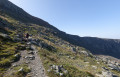
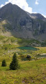
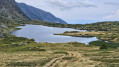
The Grand Serre ridge above La Morte

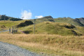
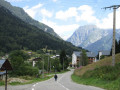
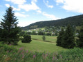
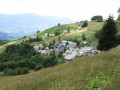
A leisurely walk through the ski area of Alpe du Grand Serre, climbing up to the ridges to enjoy a superb panoramic view, then descending via the hamlet of Le Désert.

Details

9283812
Creation:
Last update:
Last review:
  • Walking
    Activity: Walking
  • ↔
    Distance: 6.13 mi
  • ◔
    Average duration: 4h 20 
  • ▲
    Difficulty: Moderate

  • ⚐
    Back to start: Yes
  • ↗
    Ascent: + 1,745 ft
  • ↘
    Descent: - 1,736 ft

  • ▲
    Highest point: 6,155 ft
  • ▼
    Lowest point: 4,442 ft

Photos

Description of the walk

You can reach Alpe du Grand Serre from La Mure via Nantes-en-Ratier, La Valette and Lavaldens (a magnificent route through wide valleys), but the quickest and most direct route is to head up from Séchilienne.
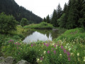
Head to the motorhome car park, opposite the Lac de la Morte (near the town hall on one side or the Col de la Morte on the other).

(S/E) Set off along the road towards the pass, passing the lake and then a sports shop.

(1) Just after the sports shop, turn right onto the Chemin de la Montagne du Grand Serre; at the entrance to this path there are yellow signposts indicating, amongst other things, the Crête du Grand Serre.
Just past the last house, this path becomes unpaved and gives way to a track that is partly suitable for vehicles. Continue until you come to another track.

(2) Turn right towards “Le Grand Serre” (signposted at the hamlet of Le Mollard), taking a forest track that passes through wooded areas and ski runs.

(3) At the sign for the hamlet of Blatonay, turn left towards “Le Grand Serre” and head up a lovely track which first crosses a woodland interspersed with ski runs, then winds through the wide open ski areas, crossing the route of the Serriou chairlift several times.

(4) In a wide left-hand bend uphill, leave the track on your right that climbs to the top of La Cochette hill and continue, passing under the Serriou chairlift one last time.
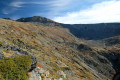
After a double hairpin bend followed by a wide left-hand bend, you’ll reach the pass on the ridge. On the right, you can see avalanche barriers and, about 300 m as the crow flies away, the top station of the Serriou chairlift.

(5) Head back down the same way to the signpost for the hamlet of ‘Blatonay’.

(3) Turn left opposite, heading towards “Pré du Clos”. This takes you round the north side of La Cochette hill, passing beneath the La Cochette ski lifts.
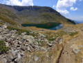
After passing under the ski lifts, the track joins another track heading south towards the large, ravined valley, overlooked by the summit of the Grand Serre.

(6) Turn right to reach the start of the ski lifts.

(7) At the ski lift base, you’ll find a car park and the road leading to Le Désert. Turn left and head for the hamlet of Le Désert.

(8) At the right-hand bend in the village is the start of the Chemin des Grangettes, which takes you round the left-hand side of the Souillets hill to reach La Morte at the lake. Continue through the village to the end.

(9) Retrace your steps and rejoin the Route du Désert, pass under the Cochette ski lift and continue towards the resort village, until you reach the lake.

(10) Enter the leisure centre and walk round the lake, then exit and follow the path back to the main road.
Turn left onto the main road and return to the car park where you started (S/E)


Waypoints

  1. S/E : mi 0 - alt. 4,449 ft - Motorhome car park
  2. 1 : mi 0.15 - alt. 4,465 ft - Montagne du Grand Serre Trail
  3. 2 : mi 0.58 - alt. 4,862 ft - Le Mollard
  4. 3 : mi 0.83 - alt. 5,003 ft - Blatonay
  5. 4 : mi 1.54 - alt. 5,554 ft - Turn left (La Cochette)
  6. 5 : mi 2.32 - alt. 6,155 ft - The Col des Crêtes du Grand Serre
  7. 6 : mi 4.3 - alt. 4,692 ft - Towards the Pré du Clos
  8. 7 : mi 4.48 - alt. 4,580 ft - La Cochette ski lift
  9. 8 : mi 4.74 - alt. 4,524 ft - Start of the Tour des Souillets
  10. 9 : mi 4.8 - alt. 4,544 ft - Hameau du Désert
  11. 10 : mi 5.73 - alt. 4,452 ft - The lake
  12. S/E : mi 6.13 - alt. 4,449 ft - Motorhome car park

Notes

We did this walk in early August 2016.

There are no difficulties on this walk. The paths and tracks are always very accessible and require no specialist equipment. Although the elevation gain is considerable (nearly 550 m), the climb is very easy.

As downhill mountain biking is becoming increasingly popular at Alpe du Grand Serre, as in other resorts in the Alps, please take care when crossing trails reserved for this sport: it is easier for us to anticipate their presence than it is for them to avoid a pedestrian.

Worth a visit

There are two possible routes for this route:
- Once you reach the point (6), head towards the bottom of the Grand Serre valley to see the gully formations for yourself. Return either via the same track or via a forest path that more or less follows the course of the Grand Rif stream.
- At the point (8) in the hamlet of Le Désert, take the Chemin des Grangettes and go round the Colline des Souillets on the left, following one of the cross-country ski trails.

Reviews and comments

4.4 / 5
Based on 3 reviews

Reliability of the description
4.3 / 5
Ease of following the route
4.7 / 5
Route interest
4.3 / 5
peliber
peliber

Overall rating : 4.3 / 5

Date of your route : Aug 17, 2026
Reliability of the description : ★★★★★ Very good
Ease of following the route : ★★★★☆ Good
Route interest : ★★★★☆ Good
Very busy route : No

No complaints – I’d definitely recommend it...

Machine-translated

ArcheoPat38
ArcheoPat38

Overall rating : 4.7 / 5

Date of your route : Aug 05, 2026
Reliability of the description : ★★★★★ Very good
Ease of following the route : ★★★★★ Very good
Route interest : ★★★★☆ Good
Very busy route : No

Hello.
I took a different route: I went up to the top of the Serriou chairlift following the very precise directions, then headed to the summit of the Grand Serre. Please note that, broadly speaking, from the chairlift’s top station you follow the paths trodden by sheep along the ridge; in some places I had to proceed with caution, but as I’m afraid of heights, the drop-off at the edge is quite daunting.
The return journey was the same.
5 hours 10 minutes including breaks, 13 km, 891 m elevation gain.

Machine-translated

stjo
stjo

@Deuxpattes, I’d just like to point out that my description of this walk only applies to the summer, as I did it in August.

Machine-translated

Deuxpattes
Deuxpattes

Overall rating : 4.3 / 5

Date of your route : Mar 03, 2022
Reliability of the description : ★★★☆☆ Average
Ease of following the route : ★★★★★ Very good
Route interest : ★★★★★ Very good
Very busy route : Yes

WARNING WARNING WARNING

This snowshoe hike, which follows only the ski runs, can only be undertaken outside school holidays and at weekends. Or if the runs are closed to skiers.
Although we saw three small signs supposedly guiding snowshoe walkers, no trail has been marked out (we couldn’t work out where they were directing us) and the slopes on either side of the ski runs are impassable in snowshoes.

Otherwise, it’s absolutely stunning!

Machine-translated

Other walks in the area

For more walks, use our search engine .

The GPS track and description are the property of this route's author. Please do not copy them without permission.