


Refine your search for walks in La Roche-en-Ardenne
La Roche-en-Ardenne walks


 La Cresse des Chevaux
 Visorando Member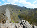
 10.23 mi
 +1,532 ft
 -1,532 ft
 6h 00
6h 00
 Difficult
 Departure from La Roche-en-Ardenne (Province de Luxembourg)
This walk is quite challenging, not so much because of its length or total elevation gain, but rather due to the number of obstacles encountered along the Ourthe: mud, water, rocks that are difficult to cross and fallen trees often force walkers to stray from the ‘official’ paths and wind their way both horizontally and vertically. Challenging, then, but well worth the trip. The more adventurous may want to take a short detour to the Cheslé site.
Borzée, or a beaver’s paradise
 10.21 mi
+1,490 ft
-1,463 ft
6h 00
10.21 mi
+1,490 ft
-1,463 ft
6h 00
 Moderate
Departure from La Roche-en-Ardenne (Province de Luxembourg)
Moderate
Departure from La Roche-en-Ardenne (Province de Luxembourg)
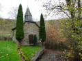
Borzée, the cul-de-sac hamlet in the woods halfway up between Maboge along the Ourthe and Samrée on the plateau, had become virtually deserted since the closure of its iconic Nature Centre. It has come back to life and will likely become even livelier once the final phases of the Anatura Ardenne project to build a holiday village are completed.Borzée, the stream which officially rises in the hamlet’s pond behind the chapel and flows into the Mer stream barely 1.5 km further down, is literally overrun by beavers, whose dams, driftwood and gnawed, fallen tree trunks can be seen on either side of the valley.
From Cheslé to Hérou
 6.28 mi
+981 ft
-981 ft
3h 45
Difficult
Departure from Houffalize (Province de Luxembourg)
6.28 mi
+981 ft
-981 ft
3h 45
Difficult
Departure from Houffalize (Province de Luxembourg)
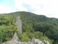
A challenging walk in the Upper Ourthe region, along the wildest and most picturesque section of the valley. Discover an ancient Celtic fortress and the Hérou panorama, rated 2 stars by Michelin.
Forest loop in the heart of the Ardennes via Samrée
 10.45 mi
+1,706 ft
-1,690 ft
6h 15
Moderate
Departure from La Roche-en-Ardenne (Province de Luxembourg)
10.45 mi
+1,706 ft
-1,690 ft
6h 15
Moderate
Departure from La Roche-en-Ardenne (Province de Luxembourg)
Set off to discover the authentic Ardennes forest, far from the hustle and bustle of the tourist centre of La Roche-en-Ardenne. In mid-August, apart from a few people on the outskirts of Borzée, you may not meet any other hikers. Peace and quiet guaranteed.
Circular Ardennes loop south of La Roche-en-Ardenne
 11.95 mi
+1,358 ft
-1,375 ft
6h 40
Moderate
Departure from La Roche-en-Ardenne (Province de Luxembourg)
11.95 mi
+1,358 ft
-1,375 ft
6h 40
Moderate
Departure from La Roche-en-Ardenne (Province de Luxembourg)
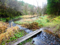
This circular route goes around a few villages south of La Roche-en-Ardenne, encroaching slightly on the territory of Tenneville.Although mainly forested, the route offers some beautiful panoramic views of the surrounding countryside and hills.
The two Ourthes rivers and the Nisramont Dam
4.71 mi
+850 ft
-846 ft
2h 55
Moderate
Departure from La Roche-en-Ardenne (Province de Luxembourg)
Superb walk, relatively difficult in its first part
Mer and Belle Meuse starting from Bérismenil
 9.75 mi
+1,175 ft
-1,145 ft
5h 30
Moderate
Departure from La Roche-en-Ardenne (Province de Luxembourg)
9.75 mi
+1,175 ft
-1,145 ft
5h 30
Moderate
Departure from La Roche-en-Ardenne (Province de Luxembourg)
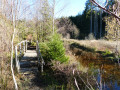
Mer or Mère … signposts and place-name signs use both spellings. This stream rises in the hills south of Samrée and flows gently from cascade to cascade as far as Maboge, where it joins the Ourthe.Further on, the other main stream on this walk is indeed called the Belle Meuse and has recently been colonised by beavers, judging by photos taken in 2017 – when there was virtually no sign of them and fording the stream posed no major problem – and in 2022, when crossing the path at km 14 is impossible without the small wooden bridges added at the side or without putting on waders. It, too, rises in the hills, at La Fange aux Mochettes to the north-east of Samrée, and flows southwards to join the Martin Moulin stream between Achouffe and Engreux.
A circular nature-filled loop starting from Cens
 11.38 mi
+1,070 ft
-1,073 ft
6h 10
Moderate
Departure from Tenneville (Province de Luxembourg)
11.38 mi
+1,070 ft
-1,073 ft
6h 10
Moderate
Departure from Tenneville (Province de Luxembourg)
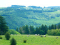
Here is a circular walking route within the Two Ourthes Nature Park, offering a lovely mix of countryside and woodland (alternating between coniferous and deciduous trees) with magnificent views of the Ardennes hills between La Roche-en-Ardenne and the Pays de Bastogne. The section along the River Ourthe is wonderfully wild, and progress is slower here than on the wide country lanes to the north of the route. It is likely that this route would be impassable without getting your feet wet in the event of heavy flooding.
Circular in the Heart of the Ardennes starting from La Roche
 11.00 mi
+945 ft
-945 ft
5h 55
Moderate
Departure from La Roche-en-Ardenne (Province de Luxembourg)
11.00 mi
+945 ft
-945 ft
5h 55
Moderate
Departure from La Roche-en-Ardenne (Province de Luxembourg)
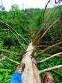
Starting from the Ronchamps pond, the walk begins by winding through the countryside before heading into the forest.Make sure you’re wearing suitable footwear, as the route follows a stream along a path overgrown with tall grass at the start and flooded with water towards the end. This valley is magnificent and wonderfully wild!The first climb of the route leads out into the countryside with a lovely view to the north over the hills of the Ourthe Valley.A short detour (off the route) to the centre of Beausaint allows you to admire its castle.From Beausaint to Vecmont, it’s (almost) straight ahead and through the countryside. There’s a small chapel and a picnic table between Ronchampay and Vecmont.Shortly after Vecmont, there is (unfortunately) a short kilometre of minor road before entering the woods, which the route leaves only briefly to cross the N89 again and finally return to the starting point.
An Ardennes getaway in the heart of the forest at Borzée
 10.66 mi
+1,358 ft
-1,385 ft
6h 05
Moderate
Departure from La Roche-en-Ardenne (Province de Luxembourg)
10.66 mi
+1,358 ft
-1,385 ft
6h 05
Moderate
Departure from La Roche-en-Ardenne (Province de Luxembourg)
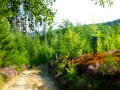
The forest completely surrounds Borzée. Borzée is a hamlet of La Roche-en-Ardenne. La Roche-en-Ardenne lies at the heart of the Ardennes. This circular tour takes you on a tour of the hamlet of Borzée and a section of the valleys of the Mer and Belle Meuse streams, two tributaries of the Ourthe.
Between two Ourthes
 8.59 mi
+1,191 ft
-1,191 ft
5h 00
Moderate
Departure from Houffalize (Province de Luxembourg)
8.59 mi
+1,191 ft
-1,191 ft
5h 00
Moderate
Departure from Houffalize (Province de Luxembourg)
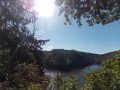
A waterside route passing several viewpoints, notably the confluence of the two Ourthes. The Nisramont Dam and two footbridges are essential for crossing from one bank to the other.Please note: this is a challenging walk (see practical information)
Ardennes circular starting from Champlon
 10.52 mi
+961 ft
-935 ft
5h 40
Moderate
Departure from Tenneville (Province de Luxembourg)
10.52 mi
+961 ft
-935 ft
5h 40
Moderate
Departure from Tenneville (Province de Luxembourg)
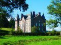
The hike takes you on a journey of discovery through the countryside and forests on the heights of the Deux Ourthes Natural Park. The balanced alternation between panoramic views and deciduous and coniferous forests provides all the ingredients for a beautiful and enjoyable outing in nature.
Saint-Thibaut Hermitage
 3.63 mi
+607 ft
-604 ft
2h 10
3.63 mi
+607 ft
-604 ft
2h 10
 Easy
Departure from Rendeux (Province de Luxembourg)
Easy
Departure from Rendeux (Province de Luxembourg)
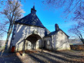
The Saint-Thibaut Hermitage trail and its panoramic view of the valley and the River Ourthe
From Chlorophylle to La Houssière
 11.04 mi
+1,237 ft
-1,220 ft
6h 10
Moderate
Departure from Manhay (Province de Luxembourg)
11.04 mi
+1,237 ft
-1,220 ft
6h 10
Moderate
Departure from Manhay (Province de Luxembourg)
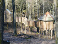
This hike, half in the forest and half in the countryside, starts at the car park of Chlorophylle Park, a forest theme park offering recreation, education and art. The path starts between the reception building, restaurant, terrace, toilets and souvenir shop, and the park itself.
Around the Aisne tourist tramway between Dochamps and Lamorménil
 11.05 mi
+1,119 ft
-1,129 ft
6h 05
Moderate
Departure from Manhay (Province de Luxembourg)
11.05 mi
+1,119 ft
-1,129 ft
6h 05
Moderate
Departure from Manhay (Province de Luxembourg)
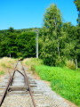
Since 1965, the Tramway Touristique de l'Aisne (TTA) has been operating an old Ardennes local railway line between Pont d'Érezée and Lamorménil. This long walk allows you to discover the last two (old) stations or stops.
Around the Basseille Stream
 10.57 mi
+1,043 ft
-1,027 ft
5h 45
Moderate
Departure from Tenneville (Province de Luxembourg)
10.57 mi
+1,043 ft
-1,027 ft
5h 45
Moderate
Departure from Tenneville (Province de Luxembourg)
The Ruisseau de Basseille has its source in the Fagne de la Borne near the Saint-Hubert Aerodrome and flows into the western Ourthe near Ortheuville. This walk follows its course more or less closely for about 6 km.
The Hermitage of St-Thibaut
 4.94 mi
+607 ft
-600 ft
2h 50
Moderate
Departure from Rendeux (Province de Luxembourg)
4.94 mi
+607 ft
-600 ft
2h 50
Moderate
Departure from Rendeux (Province de Luxembourg)
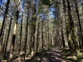
The hike starts at the end of Rue du Belvédère and crosses the woods to reach the village of Hodister. It then heads towards the site of St-Thibaut. Be sure to admire the view halfway along the route before returning to the starting point.
In the Two Ourthes Nature Park, starting from Compogne
 10.28 mi
+1,168 ft
-1,145 ft
5h 45
Moderate
Departure from Bertogne (Province de Luxembourg)
10.28 mi
+1,168 ft
-1,145 ft
5h 45
Moderate
Departure from Bertogne (Province de Luxembourg)
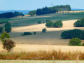
Alternating between countryside and woodland sections, this circular route starting from Compogne allows you to discover a small part of the magnificent landscapes of the Two Ourthes Nature Park. There’s no Ourthe here, just the Cornaille stream and two of its tributaries. To see both Ourthes at a glance, the easiest way is to head to Engreux and walk down to the Adeps Centre at their confluence.
Circular loop at the source of the Aisne
 10.00 mi
+715 ft
-715 ft
5h 15
Moderate
Departure from Manhay (Province de Luxembourg)
10.00 mi
+715 ft
-715 ft
5h 15
Moderate
Departure from Manhay (Province de Luxembourg)
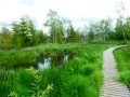
The Tailles plateau rises to an altitude of around 650 metres, where fagnes, fanges, pools and peat bogs are home to the sources of many of the Ourthe’s tributaries. Two of the best-known streams are the Henri Moulin, which flows southwards and joins the Eastern Ourthe just before the Nisramont dam, and the Aisne, which flows northwards and joins the Ourthe at Bomal.This walk explores the northern part of the Plateau des Tailles and the wetlands where the Aisne has its source. The boardwalks installed in recent years at the bottom of the Fagne de Pouhon will save you from the wet feet that were a certainty in previous years! While you’re unlikely to spot any beavers, a bit of careful observation is all it takes to discover their handiwork.
Around Rendeux
11.20 mi
+1,112 ft
-1,119 ft
6h 05
Moderate
Departure from Rendeux (Province de Luxembourg)
Start at Robert Lenoir Park in Rendeux and head towards Bois d'Arlogne. Once there, the hike passes through Marcouray. Then, from the village, head towards Cielle and descend towards La Boverie to finally follow the Ourthe to Rendeux via Jupille and Marcourt. A beautiful circular route to discover the villages of our municipality!
In search of a lost cross in Rendeux
 9.44 mi
+1,155 ft
-1,142 ft
5h 20
Moderate
Departure from Rendeux (Province de Luxembourg)
9.44 mi
+1,155 ft
-1,142 ft
5h 20
Moderate
Departure from Rendeux (Province de Luxembourg)
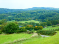
We went in search of the Croix Monseur-Kinet located near the Chapelle Saint-Thibaut. We didn't find it! But we found others. A mainly forestroute offering panoramic views of the Ourthe valley and its tributaries here and there.
More walks in La Roche-en-Ardenne
Select a point of interest below: