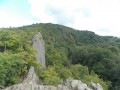
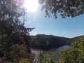
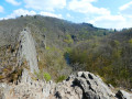
The two Ourthes rivers and the Nisramont Dam

Superb walk, relatively difficult in its first part

Fiche technique

71714816
Creation:
Last update:
Last review:
  • trace_mode_pedestrian
    Activité: trace_mode_pedestrian
  • ↔
    label_distance: 4.71 mi
  • ◔
    Durée calculée: 2h 55 
  • ▲
    Difficulte: Moyenne

  • ⚐
    Retour point de depart: Oui
  • ↗
    label_elevation_gain: + 850 ft
  • ↘
    label_elevation_loss: - 846 ft

  • ▲
    label_highest_point: 1,286 ft
  • ▼
    label_lowest_point: 869 ft

Points de passages

  1. D/A : mi 0 - alt. 876 ft - Ourthe (rivière) - Belgique
  2. 1 : mi 1.65 - alt. 942 ft - Ourthe occidentale (rivière) - Affluent de l'Ourthe
  3. 2 : mi 2.35 - alt. 955 ft - Ourthe orientale (rivière) - Affluent de l'Ourthe
  4. D/A : mi 4.71 - alt. 879 ft

Reviews and comments

4.5 / 5
Based on 1 review

Facilité à suivre l'itinéraire
4 / 5
Intérêt du circuit de randonnée
5 / 5
lucvertongen
lucvertongen

Note globale : 4.5 / 5

Date de la randonnée : Sep 28, 2025
Facilité à suivre l'itinéraire : ★★★★☆ Bien
Intérêt du circuit de randonnée : ★★★★★ Tres bien
Circuit très fréquenté : Oui

A very beautiful walk that follows the lake for the first 4 kilometres, which are quite demanding!
The rest of the walk, which takes you back to the start, is easier. However, between km 5 and km 6, you walk through woods via firebreaks or paths marked "private property". This is a little confusing!

translation_auto

Other walks in the area

For more walks, use our search engine .

Les descriptions et la trace GPS de ce circuit restent la propriété de leur auteur. Ne pas les copier sans son autorisation.