The Plaine des Faverges and the Chapel of La Beunaz

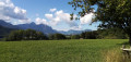
A short, relatively easy walk through the countryside, offering superb views of the surrounding peaks. The two chapels at Les Faverges and La Beunaz add a lovely touch of heritage.

This walk is part of a multi-day hike: Itinérances en Pays de Gavot

Details

3854335
Creation:
Last update:
Last review:
  • Walking
    Activity: Walking
  • ↔
    Distance: 3.43 mi
  • ◔
    Average duration: 1h 55 
  • ▲
    Difficulty: Easy

  • ⚐
    Back to start: Yes
  • ↗
    Ascent: + 361 ft
  • ↘
    Descent: - 361 ft

  • ▲
    Highest point: 3,225 ft
  • ▼
    Lowest point: 2,851 ft

Photos

Description of the walk

Start at the hamlet of Place. Park next to the recycling bins, along Rue de Place. There is space for three vehicles between the bins and the fence of a private property. Please do not obstruct any collection of the bins or their contents.

Signposts are located at major junctions, as well as signposts with yellow arrows at various points along the route.

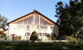
(S/E) Head eastwards; immediately ignore the road on the right leading to the Créto industrial estate and follow the Route de la Fin Franche. Carry on straight ahead (eastwards), keeping the summits of the Mémises and the Dent d’Oche in your sights, and ignore any roads running perpendicular to the main route. Enter the hamlet of Les Faverges, pass a few houses and then a tiny school, and you will arrive at the chapel.

(1) Turn left at the back of the chapel and walk past a farm. After about a hundred metres, leave the road and turn left onto the Chemin des Longeraies. Immediately ignore a turn-off on the left and carry straight on. Turn right with the path, then left at number 250. A little further on, take a hairpin bend to the right and climb gently between two hedges (a well-shaded stretch). Then continue, keeping a large meadow on your left. You’ll come out onto the road you left earlier and follow it to the left.

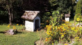
(2) When the road bends sharply to the right (small chapel on the left), carry on straight ahead between two large houses towards the Chapelle de La Beunaz. The tarmac soon gives way to a path that climbs steeply. Join the road again and follow it to the left, still uphill but more gently.

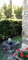
(3) At the Stop sign, turn right onto the Way of the Cross, which runs parallel to the D52 and is separated from it by a crash barrier and a hedge. This will take you to the Chapel of La Beunaz.

(4) Retrace your steps along the Way of the Cross.

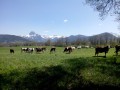
(3) Back at the crossroads, carry on straight ahead towards the Champ du Bois, along the D52 (take care, as it is a busy road). After about fifty metres, turn left onto the Chemin du Champ du Bois. Stay on this small road and ignore any dead ends or side paths. Head downhill through a beautiful beech forest. Leave the woods and walk alongside a meadow on your left (lovely view of Mont Billiat).

(5) At Champ du Bois (a large, isolated house), turn left towards Chez Bochet. Head downhill and stay on the main path, which is mostly shaded, ignoring any tracks off to the sides. Continue through the meadows until you reach a crossroads (house at no. 412).

(6) Then turn left towards numbers 500 to 503. Pass number 503 and continue along a path that leads downhill. You’ll come out onto a road at the hamlet of Chez Bochet (cross) and follow it to the left. At the crossroads, turn left towards Les Faverges. Cross the hamlet of Place, passing farms on your way, and you’ll soon reach the starting point (S/E).

Waypoints

  1. S/E : mi 0 - alt. 2,864 ft - Waste bins at the hamlet of Place
  2. 1 : mi 0.84 - alt. 2,953 ft - Chapelle des Faverges (Saint-Paul-en-Chablais)
  3. 2 : mi 1.43 - alt. 3,038 ft - Frênay
  4. 3 : mi 1.67 - alt. 3,186 ft - Crossroads – D52 road
  5. 4 : mi 1.78 - alt. 3,225 ft - Chapelle Notre-Dame-des-Sept-Douleurs (Saint-Paul-en-Chablais)
  6. 5 : mi 2.35 - alt. 3,130 ft - Le Champ du Bois
  7. 6 : mi 2.81 - alt. 3,035 ft - Crossroads
  8. S/E : mi 3.43 - alt. 2,864 ft - Waste bins at the hamlet of Place

Notes

In dry weather, good trainers or low-cut walking boots are sufficient for this route, which follows well-maintained paths and quiet country lanes.

There is a water source at Les Faverges, a few metres beyond the chapel (1), and at a place called Chez Bochet, between the cross and the junction leading to Les Faverges.

Parking is the main challenge on this walk and, to my knowledge, the suggested starting car park is the only one available without obstructing traffic.

The author has completed this walk half a dozen times, taking various routes, most recently on 18 August 2020.

This route passes through a protected area, which may be subject to special regulations:

Worth a visit

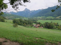
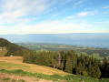
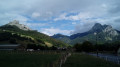
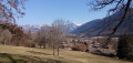
- Superb views of the peaks of the Mémises-Oche massif to the east, and of Mont Billiat and the Montagne des Soeurs to the west.
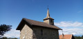
- Faverges Chapel (1846) (1).
- La Beunaz Chapel (1840) (4).

Reviews and comments

4.8 / 5
Based on 2 reviews

Reliability of the description
5 / 5
Ease of following the route
5 / 5
Route interest
4.5 / 5
Penmarch77
Penmarch77

Overall rating : 4.7 / 5

Date of your route : May 02, 2022
Reliability of the description : ★★★★★ Very good
Ease of following the route : ★★★★★ Very good
Route interest : ★★★★☆ Good
Very busy route : No

An interesting route, even if the start involves a long stretch along the road, which is less pleasant. The description is clear and precise – thank you and well done!
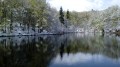
For those who want to extend this walk, you can take a detour via Lac de la Beunaz and Lac Noir. At point 3, opposite the stop sign, there’s a signposted path that takes you there. Allow an hour to walk around these two lakes.

Machine-translated

Laurenger
Laurenger

Overall rating : 5 / 5

Date of your route : Dec 31, 2021
Reliability of the description : ★★★★★ Very good
Ease of following the route : ★★★★★ Very good
Route interest : ★★★★★ Very good
Very busy route : No

A lovely walk that we were lucky enough to enjoy in the sunshine at the start of January. The final stretch of the route is quite open, which is very pleasant at this time of year when it’s important to make the most of the sunshine. The Way of the Cross, just before reaching the Chapel of La Beunaz, was very interesting and unexpected – well worth a visit
I’d like to commend the very detailed description – excellent work

Machine-translated

Other walks in the area

For more walks, use our search engine .

The GPS track and description are the property of this route's author. Please do not copy them without permission.