Country:

 City:
City:


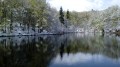
Start from the Lac de la Beunaz car park. Access from Saint-Paul-en-Chablais or Bernex: follow the signs for ‘Plage de la Beunaz’.
Signposts are present at a few junctions.
(S/E) On leaving the car park, follow the road to the left uphill. Pass Les Champs Mottay on the left, walk alongside Lac de la Beunaz (fenced off) on your right and continue uphill.
(1) At the “La Gottetaz” signpost, go straight on (with the wayside shrine on your right). Cross the Chemin de la Gottetaz on your right and climb slightly. At a three-way junction near house number 1516, take the Chemin de la Corne on the left (yellow arrow). Climb steeply, ignoring all turn-offs to the right, and pass a small reservoir. The tarmac gives way to a stony track which soon leads to a crossroads (signpost ‘Fin des Combes’).
(2) Turn left here and walk alongside a spruce forest on your right. Climb up to a telecoms mast situated just before a hairpin bend to the right.
(3) At the start of the bend, leave the wide track and take a narrower path on the left which descends into the forest. Ignore a path branching off to the left and continue on roughly level ground. At a fork in the road, take the poorly marked, winding path on the right. The forest is particularly dark in this area. Cross a few small gullies and stay on the path, heading north-east.
(4) Turn left onto the path, which then descends into a small ravine (the path shown as a dotted line on the IGN map has disappeared). At a fork in the road, keep to the left.
(5) At the next fork in the road, turn right and continue downwards (take care to spot this turn-off). You’ll soon reach another path; follow it to the right on roughly level ground. Further on, the descent becomes steep (take care if the ground is wet). Pass by the foot of a metal post and head straight through a dark section of woodland.
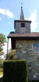
(6) You’ll emerge onto a stony track; follow it to the left, heading downhill. At the Fork in the road shortly afterwards, take the track on the right, still heading downhill. Leave the forest and you’ll soon reach the Chapelle de Laprau.
(7) Follow a small road to the left. When this bends right at the corner of a large building (metal cross), take a stony path on the left and walk uphill for a few dozen metres to a farm building. Then turn right onto a grassy path, leaving the building on your left. This will take you to the hamlet of Roseires d’Aval (fountain, wayside shrine).
(8) Turn left and head steeply uphill through the hamlet. Turn right with the road and continue uphill more gently (lovely view of Lake Geneva on the right). At a T-junction, veer right and immediately pass the Roseires d’Amont Oratory. Stay on the small, shaded road and note, on the left-hand side, an oratory carved into the trunk of a large beech tree. Pass a few houses and arrive at a junction with a stony path.
(9) Then turn left onto the road. At the next junction, turn left onto the Route de la Plage. Head uphill and you’ll soon reach the Lac de la Beunaz car park (S/E).

 Visorando Member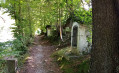
 Easy
Easy 
 Very difficult