The Villiers plain

A short route across the plain, to spot Montagu’s harriers and skylarks.

Details

n°60883
Creation:
Last update:
Last review:
  • Walking
    Activity: Walking
  • ↔
    Distance: 7.56 mi
  • ◔
    Average duration: 3h 30 
  • ▲
    Difficulty: Easy

  • ⚐
    Back to start: Yes
  • ↗
    Ascent: + 69 ft
  • ↘
    Descent: - 75 ft

  • ▲
    Highest point: 207 ft
  • ▼
    Lowest point: 105 ft

Photos

Description of the walk

Park in the car park at Villiers-en-Plaine Castle (Town Hall).
(S/E) Follow the D744 towards Coulonges. Continue to the Prieuré crossroads.

(1) Turn right towards Faye-sur-Ardin. After the industrial estate, take the farm tracks, alternating between right and left turns (3 right, 2 left) to reach Coursay.

(2) On leaving Coursay, take the road on the left which joins the D126.
At the stop sign, turn right (D126); after about 100 metres, turn right onto the “Vieux Chemin de Niort”.

(3) Before reaching La Couture, take the dirt track on the right. At the end of this track, turn left to reach Plaisance.

(4) Head straight on towards Trotte-Baril (pronounced Troutte Barail). Continue along the track called Fontarabie, join the D744 and then the car park where you started (S/E).

Waypoints

  1. S/E : mi 0 - alt. 138 ft - Château de Villiers car park
  2. 1 : mi 0.31 - alt. 135 ft - The Priory
  3. 2 : mi 3.25 - alt. 200 ft - Coursay
  4. 3 : mi 4.56 - alt. 144 ft - Old Niort Road
  5. 4 : mi 5.89 - alt. 108 ft - Trotte-Baril
  6. S/E : mi 7.56 - alt. 131 ft - Château de Villiers car park

Notes

Almost the entire route is on tarmac roads.

Worth a visit

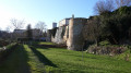
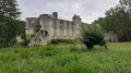
Villiers-en-Plaine Castle and its grounds.
From spring to late summer, you’ll have the chance to spot harriers in the plain. Don’t forget your binoculars.

Reviews and comments

3.5 / 5
Based on 2 reviews

Reliability of the description
3 / 5
Ease of following the route
4.5 / 5
Route interest
3 / 5
Sneg
Sneg
• Edited:

Overall rating : 5 / 5

Date of your route : Apr 18, 2023
Reliability of the description : Not used / Not applicable
Ease of following the route : ★★★★★ Very good
Route interest : ★★★★★ Very good
Very busy route : No

A very pleasant morning in the Villiers plain (back around 1.30 pm). Greenery and pastel colours (sky, rooftops, fields...). We made our way along wide, loosely tarmacked tracks, with a few sections on very narrow tarmacked roads. Very little traffic: peace and quiet and social distancing guaranteed. Also striking: the monotony that sometimes characterises our paths and countryside.

Machine-translated

damsi
damsi

Hello, Yannick.
I do find your comments rather harsh, mainly because there aren’t many of us Visorandonneurs who post walks in our area. Admittedly, there are no signposts on this route, because if there were, it would mean it could be found in guidebooks or leaflets sold at the tourist office or in bookshops; therefore, I wouldn’t have bothered to describe it on this website.
Finally, I’ve pointed out that the main attraction of this route is the chance to spot Montagu’s harriers in season (from April to August), which is a rare and protected species. Birdwatchers registered on Visorando will appreciate this!
Finally, the starting village is called Villiers-en-Plaine, so as for the scenery… QED!
Thank you for your understanding, and I wish you some lovely walks!

Machine-translated

gazok54
gazok54 ★

Thank you, yannickhrp1952.
As for the markup, I won’t go into detail here, but I’d encourage you to read this:
https://www.visorando.com/forum-randonnee...
But given the type of terrain you’ll be encountering, do you really need signposting?

The appeal of a hike is very subjective. In this case, it’s undeniable that a flat area is likely to be less appealing than the mountains. That said, hiking is also about seeking a sense of well-being through walking, and in that respect, any type of terrain meets the criteria.

Machine-translated

yannickhrp1952
yannickhrp1952

Overall rating : 2.7 / 5

Date of your route : Feb 28, 2016
Reliability of the description : ★★★☆☆ Average
Ease of following the route : ★★★★☆ Good
Route interest : ★☆☆☆☆ Very disappointing

This route has no signposting and is of absolutely no interest: it runs entirely across flat countryside (which was to be expected, really… in the middle of wheat fields – not exactly thrilling at this time of year), especially as there aren’t any bushes to shelter from the wind. A very dreary landscape, then; the only vertical features are the electricity pylons and wind turbines – visually, one would expect better! The only interesting spot is the starting (and finishing) point: the castle grounds, which house the town hall. In short, a route best forgotten as it’s completely rubbish as it stands.

Machine-translated

Other walks in the area

For more walks, use our search engine .

The GPS track and description are the property of this route's author. Please do not copy them without permission.