The La Roche Viaduct

A walk through plains and hills with beautiful scenery and a view of a viaduct over the Autise.

Details

1998583
Creation:
Last update:
Last review:
  • Walking
    Activity: Walking
  • ↔
    Distance: 8.08 mi
  • ◔
    Average duration: 4h 05 
  • ▲
    Difficulty: Moderate

  • ⚐
    Back to start: Yes
  • ↗
    Ascent: + 433 ft
  • ↘
    Descent: - 440 ft

  • ▲
    Highest point: 207 ft
  • ▼
    Lowest point: 95 ft

Photos

Description of the walk

We’ll meet at ETA Poussard on Route d’Epannes, which is visible from a distance; that’s where we’ll park.

(S/E) We’ll set off along the D168 to reach the junction with the D744.

(1) We’ll turn right onto this road, and we’ll soon leave the tarmac road behind, following a path on the left that crosses a small rest area. Once we reach the hamlet of Babillon, we’ll take the path on the right (PR® marked in yellow with a cross), cross the D744 again and turn left towards the hamlet of La Moulinotte.

(2) At La Moulinotte, cross the D744 again by taking a path almost directly opposite, which will lead you to Le Colombier.

(3) Follow the yellowPR® signpost to the right as far as La Roche.

(4) From there, you can admire the magnificent viaduct. In the middle of the hamlet, take a path on the left to reach a junction at the edge of a wide track.

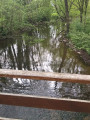
(5) Turn right to cross the viaduct and admire the River Autise. Just after the viaduct, you’ll find a small path on the right, marked in yellow (Val d’Autize trail), which takes you down to the banks of the River Autise. Once at the bottom, head right towards Saint-Pompain.

(6) At this junction, turn left and you’ll see a sign for ‘Retour Saint-Pompain’ heading towards the Moulin de Dray.

(7) Take the path on the left, which takes you across the Autize via four small bridges. Continue on until you reach the outskirts of Saint-Pompain.

(8) Be careful not to follow the path; you’ll need to turn left towards Chaillot – the signpost is facing the other way. In the village, turn left onto the yellowPR® trail to return to La Roche

(4) At La Roche, turn right (an uphill path you’ve taken before) and, once at the top of the hill, this time turn left towards the hamlet of Grolet.

(9) Once in Grolet, leave the path to the left (tarmac road), then turn left again towards Les Alleuds, then Le Colombier.

(3) We’ll follow the path we took earlier to return to the D744

(2) When you reach the D744, turn left, then right. There is a path just behind the last house; this is thePR® marked in yellow.

(10) At this point, we’ll turn right onto the tarmac road, then immediately left onto a path that cuts through the fields.

(11) When you reach the small copse, turn right, then cross the D168 to continue along the track and turn right at the next junction (tarmac road).

(12) At the stop sign, head straight ahead to pass through the hamlet of Monzais, then turn left (a long downhill stretch) and right (Chemin du Petit Logis). At the top of the track, at the stop sign, turn right to return to the starting point (S/E).

Waypoints

  1. S/E : mi 0 - alt. 180 ft - Poussard company car park, Route d’Epannes
  2. 1 : mi 0.18 - alt. 197 ft - Junction with the D744.
  3. 2 : mi 0.85 - alt. 118 ft - La Moulinotte
  4. 3 : mi 1.19 - alt. 174 ft - Le Colombier
  5. 4 : mi 1.71 - alt. 128 ft - View of the viaduct at La Roche
  6. 5 : mi 1.84 - alt. 184 ft - Heading towards the viaduct
  7. 6 : mi 2.02 - alt. 105 ft - Heading towards Moulin Dray, after the - Autise (rivière)
  8. 7 : mi 2.68 - alt. 105 ft - Dray Mill
  9. 8 : mi 3.22 - alt. 157 ft - Heading towards Chaillot
  10. 9 : mi 4.44 - alt. 200 ft - Grolet
  11. 10 : mi 6.5 - alt. 190 ft - Crossing the Ardin road
  12. 11 : mi 6.9 - alt. 171 ft - The little wood
  13. 12 : mi 7.36 - alt. 187 ft - Monzais
  14. S/E : mi 8.08 - alt. 180 ft - Poussard company car park, Route d’Epannes

Notes

A short walk which, in my view, can be done in all seasons.
No particular recommendations; for my part, I took the opportunity to do some ‘plogging’: picking up plastic and metal rubbish.
For the first time, I used the track feature on the Visorando app to map out the walk; for this reason, it may look a bit haphazard on the map – I’ll take more care next time. The route I took sometimes follows a ‘Petite Randonnée’ trail marked in yellow; I’ll make this clear in the description.

Always be cautious and plan ahead when you're outdoors. Visorando and the author of this route cannot be held responsible for any accidents occurring on this route.

The GR® and PR® markings are the intellectual property of the Fédération Française de Randonnée Pédestre.

Reviews and comments

4 / 5
Based on 3 reviews

Reliability of the description
4.3 / 5
Ease of following the route
3.7 / 5
Route interest
4 / 5
Reisende
Reisende

Overall rating : 3.7 / 5

Date of your route : Dec 17, 2023
Reliability of the description : ★★★★☆ Good
Ease of following the route : ★★★☆☆ Average
Route interest : ★★★★☆ Good
Very busy route : No

Hello. I’m pleased with the walk, which can be done in full or in half-sections on either side of the D744 road. The best starting point is the car park along the D744 as you leave Champbertrand towards Villiers-en-Plaine, rather than the car park at a business (under construction in December 2023). Note: The section of the small woodland near Monzais, between point 11 on the suggested map and the D168, can be difficult to navigate in heavy rain due to a stream crossing the path. In any case, well done to the person who created this interesting route, which alternates between small woodland, open countryside and a valley. Enjoy your walk.

Machine-translated

TINO1779
TINO1779

Overall rating : 4.3 / 5

Date of your route : Apr 27, 2022
Reliability of the description : ★★★★★ Very good
Ease of following the route : ★★★★☆ Good
Route interest : ★★★★☆ Good
Very busy route : No

First of all, well done on the description of this walk, which isn’t easy to follow. The description is brilliant, and that’s just as well, because between the various signposts and the crossroads… You need to check the guide at every junction to make sure you don’t go the wrong way.
Apart from the viaduct, there’s also a lovely view of St Pompain’s Church at point (8)....

Machine-translated

Picton79
Picton79

Overall rating : 4 / 5

Date of your route : Nov 16, 2021
Reliability of the description : ★★★★☆ Good
Ease of following the route : ★★★★☆ Good
Route interest : ★★★★☆ Good
Very busy route : No

It would be much better to set off from the lay-by on the D 744 than from a company car park.

Machine-translated

Other walks in the area

For more walks, use our search engine .

The GPS track and description are the property of this route's author. Please do not copy them without permission.