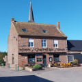
La Plaine au Bois, starting from Ledringhem

A walk starting from Ledringhem and leading to the Mémorial de la Plaine au Bois. This memorial commemorates the atrocities that took place there in May 1940, during Operation Dynamo.
The return journey follows the banks of the Peene before it joins the Yser.
Most of the paths on this walk are tarmac-surfaced, but there is very little traffic.

Details

n°3607132
Creation:
Last update:
Last review:
  • Walking
    Activity: Walking
  • ↔
    Distance: 7.77 mi
  • ◔
    Average duration: 3h 35 
  • ▲
    Difficulty: Moderate

  • ⚐
    Back to start: Yes
  • ↗
    Ascent: + 33 ft
  • ↘
    Descent: - 33 ft

  • ▲
    Highest point: 79 ft
  • ▼
    Lowest point: 36 ft
  • ⚐ Country: France
  • ⚐ City: Ledringhem (59470)
  • ⚑
    Start/End: N 50.853886° / E 2.439817°
  • ❏
    IGN map(s): Ref. 2303E
  • Hour-by-hour weather

Description of the walk

Park in the car park by Ledringhem church.

(S/E) Walk to the village centre, go round the town hall, then turn left onto Chemin d’Esquelbecq. Continue along Petit Chemin d’Esquelbecq.

(1) Then take the Chemin de Rubrouck on the right towards Wormhout and continue left along Rue des Dunkirk’s Veterans to reach the junction withthe GR®130.

(2) Turn left onto it, then quickly turn right off it to reach the Mémorial de la Plaine au Bois.

(3) Return to theGR® junction at Rue de Rubrouck.

(2) Carry on to the left until you reach the entrance to Wormhout.

(4) Turn right onto Rue Louis Patoor; here, leave the red and whiteGR® markings. Turn left into Rue de Ledringhem, then immediately right onto the pedestrian path, Allée du Llandudno, and at the end, continue along the road opposite.

(5) At the next junction, turn right onto Rue de la Taillanderie, then take the grassy path on the left to reach and follow the banks of the River Peene. You will reach the D 916.

(6) Cross it carefully and continue along the path opposite. Turn right at the next junction. Cross the D 916 carefully once more and reach the start of Chemin Denhout on the right.

(7) Follow this path, cross the bridge over the River Peene and reach a cross-path.

(8) Continue left along Chemin Denhout towards the village of Ledringhem.

(9) Turn left onto Chemin de Wormhout to reach the church car park in the centre of the village (S/E).

Waypoints

  1. S/E : mi 0 - alt. 69 ft - Ledringhem church car park
  2. 1 : mi 1.43 - alt. 72 ft - Chemin de Rubrouck
  3. 2 : mi 1.94 - alt. 72 ft - GR junction
  4. 3 : mi 2.34 - alt. 66 ft - La Plaine au Bois Memorial
  5. 4 : mi 3.48 - alt. 66 ft - Entrance to Wormhout.
  6. 5 : mi 3.83 - alt. 49 ft - Rue de la Taillanderie. Towards the banks of the - Peene Becque (rivière)
  7. 6 : mi 5.26 - alt. 52 ft - D916
  8. 7 : mi 6.07 - alt. 59 ft - Chemin Denhout
  9. 8 : mi 6.56 - alt. 62 ft - Junction: Chemin Denhout / Chemin de Steenvoorde
  10. 9 : mi 7.52 - alt. 62 ft - Chemin de Wormhout
  11. S/E : mi 7.77 - alt. 69 ft - Ledringhem church car park

Worth a visit

(S/E) Note the option for refreshments in Ledringhem: a hiking café called ‘Au Trou Flamand’ is situated in the centre of the village.

Always be cautious and plan ahead when you're outdoors. Visorando and the author of this route cannot be held responsible for any accidents occurring on this route.

The GR® and PR® markings are the intellectual property of the Fédération Française de Randonnée Pédestre.

Reviews and comments

4.2 / 5
Based on 2 reviews

Reliability of the description
3.5 / 5
Ease of following the route
4.5 / 5
Route interest
4.5 / 5
marie59640
marie59640

we did the Wormhoudt Plaine aux Bois hike, which is shorter but very well marked

Machine-translated

delph_d2312
delph_d2312

Overall rating : 4 / 5

Date of your route : Oct 25, 2021
Reliability of the description : ★★★☆☆ Average
Ease of following the route : ★★★★☆ Good
Route interest : ★★★★★ Very good
Very busy route : No

A lovely walk, but with many signs missing (including the names of the paths), it can sometimes be difficult to find your way. The description is lacking in details.
We had to check Google Maps several times because we’d lost our way.

Machine-translated

adav59
adav59

Overall rating : 4.3 / 5

Date of your route : Dec 07, 2020
Reliability of the description : ★★★★☆ Good
Ease of following the route : ★★★★★ Very good
Route interest : ★★★★☆ Good
Very busy route : No

A lovely walk combining grassy paths and pavements through the village.

Machine-translated

Other walks in the area

For more walks, use our search engine .

The GPS track and description are the property of this route's author. Please do not copy them without permission.