


Refine your search for walks in Col du Haut de Fouchure (798m)
Col du Haut de Fouchure (798m) walks


 Maquis de la Piquante Pierre
 Visorando Member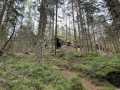
 5.45 mi
 +974 ft
 -965 ft
 3h 20
3h 20
 Easy
Easy
 Departure from Basse-sur-le-Rupt (Vosges)
Immerse yourself in the historic setting of a maquis, a symbol of the Resistance, visible throughout the route.
A family hike (suitable for children over 6 years old) featuring natural landmarks (Piquante Pierre, Roches Saint Jacques, Tourbière, viewpoints) and panoramic views of the Vosges mountains
La Piquante Pierre and the Haut du Roc as seen from the Saut du Bouchot
 17.73 mi
+3,681 ft
-3,711 ft
11h 20
17.73 mi
+3,681 ft
-3,711 ft
11h 20
 Very difficult
Departure from Gerbamont (Vosges)
Very difficult
Departure from Gerbamont (Vosges)
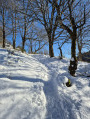
This part of the Vosges is less well known than the area of the high peaks. However, a few peaks rise above 1,000 m, including the Haut du Roc and the Piquante Pierre. This walk offers stunning panoramic views of the surrounding area, stretching as far as the Ballon d’Alsace and the Ballon de Servance. Starting from the Saut du Bouchot, which offers a refreshing break, the climb is steady all the way to the Piquante Pierre. The section leading to the Haut du Roc involves a long descent before climbing again. Finally, for the rest of the route, it is simply a series of ascents and descents, although the path descends much more than it climbs.
La Piquante Pierre at the start of the Col du Haut de Fouchure
 3.78 mi
+787 ft
-804 ft
2h 20
Easy
Departure from Basse-sur-le-Rupt (Vosges)
3.78 mi
+787 ft
-804 ft
2h 20
Easy
Departure from Basse-sur-le-Rupt (Vosges)
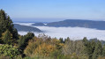
An easy and very pleasant walk along trails offering magnificent panoramic views throughout. At the summit of the Piquante Pierre, at an altitude of 1,008 metres, there is a magnificent view of part of the Vosges foothills and the lower Moselotte valley, as well as the surrounding high mountains. The descent takes you through the picturesque Plateaux valley, where the views are once again stunning. One last viewpoint and you will reach the Col du Haut de Fouchure, enchanted by the scenery.
Walks near Col du Haut de Fouchure (798m)
From the Chalet de Rouge Mousse to the Cabane des Champis
 6.55 mi
+1,732 ft
-968 ft
4h 30
6.55 mi
+1,732 ft
-968 ft
4h 30
 Moderate
Departure from La Bresse (Vosges)
Moderate
Departure from La Bresse (Vosges)
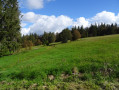
Starting from the Chalet de Rouge Mousse, the route takes you to Lac des Corbeaux, then via the GR®533 to La Roche Beauty (viewpoint), and on to Mont Moyenmont (alt. 969 m) to reach La Chaume des Champis and its hut.
From the Cabane des Champis to Lac de Blanchemer
 8.77 mi
+1,627 ft
-2,201 ft
5h 25
Moderate
Departure from La Bresse (Vosges)
8.77 mi
+1,627 ft
-2,201 ft
5h 25
Moderate
Departure from La Bresse (Vosges)
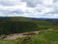
Starting from Les Champis, the route passes through the Marécage Rouge Feigne, the Col de Thiaville (alt. 1,112 m), the Hohneck (alt. 1,363 m) and the Col du Wormspel (alt. 1,277 m) before descending towards Lac de Blanchemer.
Gérardmer – Honneck – Sotré
 12.06 mi
+1,220 ft
-2,782 ft
6h 35
12.06 mi
+1,220 ft
-2,782 ft
6h 35
 Difficult
Departure from La Bresse (Vosges)
Difficult
Departure from La Bresse (Vosges)
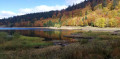
This second stage of the Gérardmer Mini-Trek links the Chalet des Champis to Petit Xonrupt, passing through some of the most beautiful landscapes of the Hautes-Vosges. After a descent into the Vologne valley, the route climbs back up to the heights of La Bresse-Hohneck, before reaching Lac de la Lande, the Schmargult farmhouse inn and the famous Route des Crêtes. The walk continues with a long descent past the Sotré mountain refuge, Lake Retournemer and the shores of Lake Longemer, before reaching the centre of Xonrupt-Longemer. A varied stage combining forests, high-altitude scree slopes, glacial lakes and remarkable panoramic views.
Remiremont - Méloménil
 19.59 mi
+1,608 ft
-1,883 ft
10 hrs
Very difficult
Departure from Remiremont (Vosges)
19.59 mi
+1,608 ft
-1,883 ft
10 hrs
Very difficult
Departure from Remiremont (Vosges)
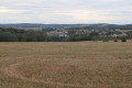
The path leaves the Moselle valley and heads towards the Canal des Vosges. This mainly wooded walk is enhanced by traditional Lorraine farmhouses.
Gérardmer - Les Champis
7.48 mi
+2,480 ft
-915 ft
5h 35
Moderate
Departure from Xonrupt-Longemer (Vosges)
First stage of the Gérardmer Mini-Trek. On this first day, you will discover the aerial landscapes of Le Poli and the heights of Lispach, as well as the isolated stubble fields above the Vologne Valley. This stage allows you to make steady progress towards the Chalet des Champis, where you will spend the night. It is also an opportunity to spend a night in an unguarded cabin that has (almost) everything to please: isolated and at least a 30-minute walk from any built-up area, in the middle of the thatched cottages, accessible to all and all year round...It is a must-see in the area.
Ballon de Servance
 12.46 mi
+1,982 ft
-2,228 ft
7h 25
Moderate
Departure from Le Thillot (Vosges)
12.46 mi
+1,982 ft
-2,228 ft
7h 25
Moderate
Departure from Le Thillot (Vosges)
Hike to Ballon de Servance.Please note that for this hike, you will need two vehicles, one at (S) at the Col des Croix andthe other at the Sources de Presles reservoir (E). The path leading directly up to the Ballon is a quiet zone and is closed from 15 December to 14 July. See notices
From Lac de Blanchemer to the Chalet de Rouge Mousse
 7.13 mi
+1,880 ft
-2,054 ft
4h 55
Moderate
Departure from La Bresse (Vosges)
7.13 mi
+1,880 ft
-2,054 ft
4h 55
Moderate
Departure from La Bresse (Vosges)
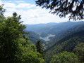
Starting from Lac de Blanchemer, the route follows theGR®531, taking you via the Rainkopf (alt. 1,305 m), before descending towards the Tourbière de Machais, the Col de Bramont and the Étang de Sèchemer to reach the Chalet de Rouge Mousse.
From Lac de Blanchemer to Lac de Longemer
 6.46 mi
+738 ft
-1,532 ft
3h 35
Moderate
Departure from La Bresse (Vosges)
6.46 mi
+738 ft
-1,532 ft
3h 35
Moderate
Departure from La Bresse (Vosges)
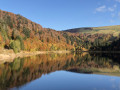
Second stage of this hike with bivouac. This time, Lac Lalande, Lac de Retournemer, Cascade Charlemagne and Cascade de Retournemer will be on your route, allowing you to discover magnificent colours.
From Lake Longemer to Lake Blanchemer
 11.03 mi
+2,979 ft
-2,169 ft
7h 40
Difficult
Departure from Xonrupt-Longemer (Vosges)
11.03 mi
+2,979 ft
-2,169 ft
7h 40
Difficult
Departure from Xonrupt-Longemer (Vosges)
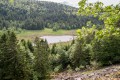
The first stage of a two-day bivouac hike with an overnight stay at Lac de Blanchemer, passing by Lac du Lispach, which is reminiscent of a Canadian landscape, and the Machais peat bog.
Difficulty and beautiful views sum up this first stage.
Hahnenbrunnen Pass and Uff Rain from Langenwasen
 9.32 mi
+2,182 ft
-2,146 ft
6h 10
Difficult
Departure from Metzeral (Haut-Rhin)
9.32 mi
+2,182 ft
-2,146 ft
6h 10
Difficult
Departure from Metzeral (Haut-Rhin)
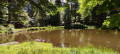
A lovely climb towards the Vosges ridge along the River Pfahlrunz, with a stop at a charming little lake (unnamed). Lots of remarkable trees. Then an easy walk along theGR®5along the ridge before heading towards the farm inns at Salzbach and Uff Rain, with panoramic views of the Vosges peaks.